


39 Hiking Trails in Yosemite National Park, California
first prev 1 2 next lastShowing Hiking Trails in Yosemite National Park, California, USA City, Zip, or Address

Mist Trail
Yosemite National Park
9.2 miles S of Yosemite National ParkThe mist trail is a small breakoff from the John Muir Trail through Yosemite National Park. It's called the mist trail because of the heavy amount of mist that hikers walk through as Vernal and...
Backpack, Hike 1.7 mi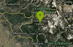
Mono Meadow
Yosemite West, Yosemite National Park
5.1 miles S of Yosemite West, Yosemite National ParkThe hike through Mono Meadow is the best way to get a view of Mt. Starr King, Clarke Range, and Half Dome all at once. It's about a three mile round trip hike towards Yosemite backcountry. It...
Hike 4.6 mi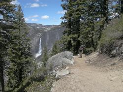
Four Mile Trail
Yosemite National Park
9.5 miles S of Yosemite National ParkFour Mile Trail is a moderate hike that offers the best views of some of Yosemite's most famous landmarks, including Yosemite Falls, Half Dome, Clouds Rest, North Dome, El Capitan, and the Royal...
Hike 1.9 mi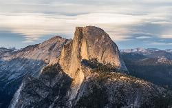
Half Dome
Yosemite Valley, Yosemite National Park
4.4 miles E of Yosemite Valley, Yosemite National ParkHalf Dome is the most popular and difficult hike in Yosemite Valley. The trail is about 14 miles long with an elevation gain of 4800 feet. There are cables to help you scale up to the summit once you...
Hike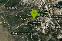
Harden Lake
Big Oak Flat, Yosemite National Park
13.2 miles E of Big Oak Flat, Yosemite National ParkThe hike to Harden Lake at Yosemite is essentially a long walk. Much of the trail is walking down Tioga Road, an old gravel street that has been part of Yosemite since its foundation. The trail is...
Backpack, Hike 0.7 mi
Lukens Lake
Tuolumne Meadows, Yosemite National Park
13.9 miles W of Tuolumne Meadows, Yosemite National ParkLukens Lake is a small lake in the White Wolf area of Yosemite National Park. The hike is a short, 1.6 mile walk through a forest to the secluded lake surrounded by trees and a small...
Hike, Swim 1.2-1.6 mi
May Lake
Yosemite Valley, Yosemite National Park
8.9 miles NE of Yosemite Valley, Yosemite National ParkMay lake is a relatively small lake that rests at the base of Mt. Hoffman in Yosemite National Park. One of the park's most scenic lakes, May lake not only gets up close and personal with...
Hike, Swim 4.0 mi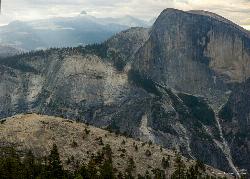
North Dome
Yosemite Valley, Yosemite National Park
2.0 miles NE of Yosemite Valley, Yosemite National ParkNorth Dome is a strenuous 10.4 mile hike that gives visitors a close up view straight at Half Dome from across the valley. It also has a unique view of Clouds Rest peak. Because the hike...
Backpack, Hike 5.7 mi
Ten Lakes
Tuolumne Meadows, Yosemite National Park
8.8 miles W of Tuolumne Meadows, Yosemite National ParkA 6.4 mile hike will lead you to three of the Ten Lakes at Ten Lakes Basin. There are three possible trails to take to see this phenomenon. The shortest begins at Yosemite Creek. The other two...
Backpack, Camp, Hike 0.5 mi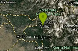
McGurk Meadow
Yosemite National Park
14.3 miles S of Yosemite National ParkMcGurk Meadow is a short, 0.8 mile hike through one of Yosemite's wildflower meadows. The trail is fairly flat, about 100 feet of elevation gain, and it doesn't require too much effort,...
Hike 1.2 mi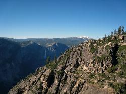
Taft Point
Yosemite Valley, Yosemite National Park
2.3 miles S of Yosemite Valley, Yosemite National ParkThe hike to Taft Point is often paired with the hike to Sentinel Dome. There is a 5 mile loop that connects the two and offers breathtaking views of the valley along the south rim. The trailhead...
Hike 2.1 mi
Snow Creek Falls
Yosemite Valley, Yosemite National Park
3.5 miles NE of Yosemite Valley, Yosemite National ParkSnow Creek is one of the more difficult waterfalls to find in the valley, but in the spring and summer months, the elusive waterfall can be seen from the Mirror Lake Trail, a 5 mile loop around...
Backpack, Hike 5.5 mi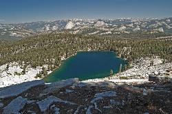
Ostrander Lake
Wawona, California
8.4 miles NE of Wawona, CaliforniaOstrander Lake is a long, 11.4 mile hike just behind Sentinel Dome. Unlike most of Yosemite's summer hikes, the trail to Ostrander Lake is open during the winter for people to ski through....
Hike, Swim 3.6 mi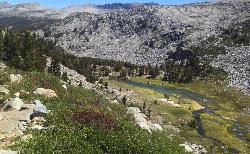
Lyell Canyon
Wawona, California
29.8 miles NE of Wawona, CaliforniaLyell Canyon is a breezy, 8 mile hike through the Tuloumne Meadows of Yosemite. While it is a little bit of a longer hike, the total elevation gain is about 200 feet, making it pretty flat and...
Hike
Elizabeth Lake
Wawona, California
26.4 miles NE of Wawona, CaliforniaElizabeth Lake is a gorgeous lake tucked underneath the High Sierras in Yosemite. It's about a 4.8 mile hike to reach it, with an elevation gain of 1000 feet. Even though it's not super long,...
Hike, Swim 1.8 mi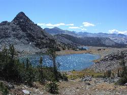
Gaylor Lakes
Yosemite Valley, CA
21.2 miles NE of Yosemite Valley, CAGaylor Lakes is one of Yosemite's most underrated hikes. It's a 2 mile trail with views the entire way. At various points along the trail, you can see Dana Meadows and the mountains...
Hike, Swim 0.9-3.2 mi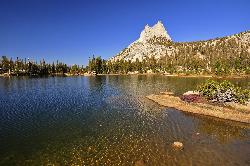
Cathedral Lakes
Wawona, California
24.8 miles NE of Wawona, CaliforniaOne of the busiest trails in the Tuloumne Meadows area, the hike to Cathedral Lakes is a gorgeous 7 mile walk to the perfect place to rest and recuperate. While there are several High Sierra...
Hike, Swim 4.0 mi
Mono Pass
Yosemite Valley, CA
20.7 miles NE of Yosemite Valley, CAAt an elevation of 10,600 feet, the hike through Mono Pass is an 8 mile journey that takes you across the High Sierras, through several meadows, and stops at a few different lakes along the...
Hike, Swim 6.0 mi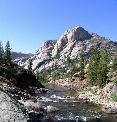
Glen Aulin
Wawona, California
28.8 miles NE of Wawona, CaliforniaThis is an 11 mile hike along the Tuolumne River to Glen Aulin. There is a view to take in at every turn on this hike, whether it's the Tuolumne River, Tuolumne Fall, Soda Springs,...
Backpack, Camp, Hike 0.8-4.1 mi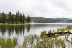
Dog Lake and Lembert Dome
Yosemite Valley, CA
17.2 miles NE of Yosemite Valley, CAThe hike to Dog Lake is often paired with the hike to Lembert Dome, because the two are so close in proximity. Each hike by itself is 2.8 miles round trip, but Lembert Dome has an elevation gain of...
Hike, Swim


