


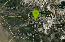
Harden Lake
Big Oak Flat, Yosemite National Park
| Address: | White Wolf Rd, California, USA |
| GPS: |
37°52'11.6"N 119°38'56.1"W Maps | Directions |
| State: | California |
| Trail Length: | 5.80 miles |
| Trail Type: | Out & Back |
| Hike Difficulty: | Beginner |
| Elevation Gain: | 355 feet |
Lakes Trails Rocks Wildflowers National Park
Backpack and Hike
The hike to Harden Lake at Yosemite is essentially a long walk. Much of the trail is walking down Tioga Road, an old gravel street that has been part of Yosemite since its foundation. The trail is wide, and there isn't much of an elevation gain. The only reason it isn't one of the easiest hikes in the valley is because of its length. Harden Lake is about 5.8 miles from the trailhead, which is longer than most beginners are comfortable with.
About two miles into the hike, you'll reach the Middle Fork of the Tuolumne River. Follow the signs that lead to the lake. Along the trail, there are small granite domes, a red fir forest, and lodgepole pines.
The lake itself, although not one of the most popular in the park, offers a quiet and serene place to finish the hike and take in the scenery. There are tons of rocks and trees surrounding the lake, as well as a meadow of wildflowers.
For those who want to continue hiking, there is a trail just beyond the lake that will lead to the Grand Canyon of the Tuolumne River. This makes the hike a total of 8.3 miles roundtrip, with an elevation gain of 1000 ft on the return trip.
More Information
Be courteous, informed, and prepared. Read trailhead guidelines, stay on the trail, and don't feed the wildlife.
Read More- Plan Ahead and Prepare
- Travel & camp on durable surfaces
- Dispose of waste properly
- Leave what you find
- Minimize campfire impacts
- Respect wildlife
- Be considerate of other visitors
Directions
From Big Oak Flat, Yosemite National Park
- Head southwest on CA-120 E toward Tuolumne Grove RdToll road(7.7 mi)
- Turn left to stay on CA-120 EToll roadMay be closed at certain times or days(14.5 mi)
- Turn left onto White Wolf RdToll road(1.1 mi)

Other Hiking Trails and Backpacking Trails Nearby

Lukens Lake
Tuolumne Meadows, Yosemite National Park
2.3 miles SELukens Lake is a small lake in the White Wolf area of Yosemite National Park. The hike is a short, 1.6 mile walk through a forest to the secluded lake surrounded by trees and a small...
Hike, Swim 5.7 mi
Ten Lakes
Tuolumne Meadows, Yosemite National Park
7.3 miles EA 6.4 mile hike will lead you to three of the Ten Lakes at Ten Lakes Basin. There are three possible trails to take to see this phenomenon. The shortest begins at Yosemite Creek. The other two...
Backpack, Camp, Hike 1.2-1.6 mi
May Lake
Yosemite Valley, Yosemite National Park
8.6 miles EMay lake is a relatively small lake that rests at the base of Mt. Hoffman in Yosemite National Park. One of the park's most scenic lakes, May lake not only gets up close and personal with...
Hike, Swim 2.9 mi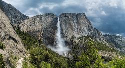
Upper Yosemite Falls
Yosemite Valley, Yosemite National Park
8.7 miles SEYosemite Falls is the tallest waterfall in North America, standing at 2,425 feet. It's made up of Upper Yosemite Falls, Lower Yosemite Falls, and the middle cascades. Lower Yosemite Falls...
Hike 0.8 mi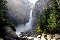
Lower Yosemite Falls
Yosemite Valley, Yosemite National Park
9.0 miles SYosemite Falls is 3,967 feet high, making it twice as tall as the Empire State building, ten times as tall as Niagara Falls, and one of Yosemite Valley's biggest attractions. Lower...
Hike 0.7 mi
Cook's Meadow Loop
Yosemite Valley, Yosemite National Park
9.1 miles SCook's Meadow Loop is a shorter, smaller hike inside Sentinel Meadow. Cook's Meadow Loop is just under a mile and takes about 45 minutes to complete, depending on how long you stop at each...
Hike 4.0 mi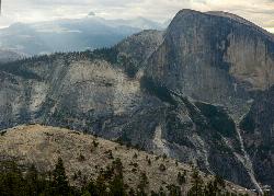
North Dome
Yosemite Valley, Yosemite National Park
9.2 miles SENorth Dome is a strenuous 10.4 mile hike that gives visitors a close up view straight at Half Dome from across the valley. It also has a unique view of Clouds Rest peak. Because the hike...
Backpack, Hike 4.7 mi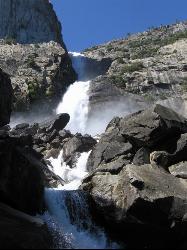
Wapama Falls
Groveland, California
9.2 miles NWA 5 mile hike along the shoreline of the Hetch Hetchy reservoir will take you to one of Yosemite's famous waterfalls. The hike to the fall is moderate, takes about 2.5-5 hours to...
Backpack, Hike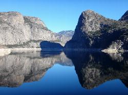
Hetch Hetchy Reservoir
Groveland, California
9.2 miles NWLocated thirty minutes outside Yosemite Valley, Hetch Hetchy has the longest hiking season in the park. It's home to the O'Shaughnessy Dam and Wapama Falls. Since...
Backpack, Hike 15.9 mi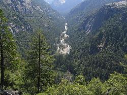
Valley Loop Trail
Yosemite Valley, Yosemite National Park
9.4 miles SThe Valley Loop trail at the heart of Yosemite is one of the best ways to discover the park. The entire loop is 11.5 miles long, and there are several places to enter and exit the trail...
Hike 2.1 mi
Snow Creek Falls
Yosemite Valley, Yosemite National Park
9.5 miles SESnow Creek is one of the more difficult waterfalls to find in the valley, but in the spring and summer months, the elusive waterfall can be seen from the Mirror Lake Trail, a 5 mile loop around...
Backpack, Hike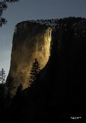
Horsetail Falls
Yosemite Valley, Yosemite National Park
9.8 miles SHorsetail Falls is located near El Capitan Valley in Yosemite. Around mid to late February, the fall gains popularity due to the way the orange glow of the sunset radiates off of it. In order to...
Hike 4.6 mi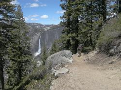
Four Mile Trail
Yosemite National Park
10.0 miles SFour Mile Trail is a moderate hike that offers the best views of some of Yosemite's most famous landmarks, including Yosemite Falls, Half Dome, Clouds Rest, North Dome, El Capitan, and the Royal...
Hike
Mirror Lake
Yosemite Valley, Yosemite National Park
10.0 miles SEMirror Lake is a seasonal lake situated in a secluded corner of the beautiful Yosemite Valley. The lake sits at the base of Half Dome and allows a different perspective of the famous monolith....
Backpack, Hike, Swim 0.2 mi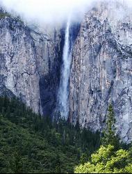
Ribbon Falls
Yosemite Valley, Yosemite National Park
10.0 miles SStanding at 1612 ft tall, Ribbon Falls is one of the tallest waterfalls in Yosemite Valley and the longest single-drop waterfall in North America. It's visible from El Capitan road as you...
Hike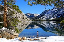
Tenaya Lake
Yosemite Valley, Yosemite National Park
10.4 miles ETenaya Lake is one of the most visited destinations in Yosemite National Park. The lake is easily accessed by Highway 120/Tioga Pass road which runs along the north shore of the lake. On the east...
Canoe, Hike, Kayak, Swim 0.2 mi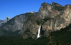
Bridalveil Falls
Yosemite Valley, Yosemite National Park
10.6 miles SKnown for being the focal point for one of Ansel Adams' most famous photographs, Bridalveil Falls is one of the first waterfalls you see as you enter Yosemite. The path to get there...
Hike 0.3 mi
Glacier Point
Yosemite National Park
10.6 miles SLocated in Yosemite National Park, Glacier Point gives a birds-eye-view of the park you can't find anywhere else. It can be accessed by both hiking and driving through the park, though the roads...
Hike 1.9-2.9 mi
Mist Trail
Yosemite National Park
10.7 miles SEThe mist trail is a small breakoff from the John Muir Trail through Yosemite National Park. It's called the mist trail because of the heavy amount of mist that hikers walk through as Vernal and...
Backpack, Hike 1.2 mi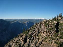
Taft Point
Yosemite Valley, Yosemite National Park
11.1 miles SThe hike to Taft Point is often paired with the hike to Sentinel Dome. There is a 5 mile loop that connects the two and offers breathtaking views of the valley along the south rim. The trailhead...
HikeNearby Campsites
Ten Lakes
Tuolumne Meadows, Yosemite National Park
7.3 miles EA 6.4 mile hike will lead you to three of the Ten Lakes at Ten Lakes Basin. There are three possible trails to take to see this phenomenon. The shortest begins at Yosemite Creek. The other two...
Backpack, Camp, Hike
Merced River
Yosemite Valley, Yosemite National Park
9.6 miles SThe main fork of Merced River at Yosemite National Park is a perfect place to fish, swim, raft, and even pan for gold. The river circles around the center of Yosemite Valley, and almost every...
Camp, Swim, Whitewater
Crane Flat
Big Oak Flat, Yosemite National Park
11.8 miles SWCrane Flat Campground is a meadow and forest between Tuolumne and Merced Groves of Giant Sequoias. The campground is 30 minutes outside Yosemite Valley, has restrooms and picnic...
Backpack, Camp, Hike, Snowshoe 6.0 mi
Glen Aulin
Wawona, California
12.8 miles EThis is an 11 mile hike along the Tuolumne River to Glen Aulin. There is a view to take in at every turn on this hike, whether it's the Tuolumne River, Tuolumne Fall, Soda Springs,...
Backpack, Camp, Hike
Glen Aulin
Glen Aulin, California
12.8 miles EThis trail is a popular route to take in the Yosemite High Country because it is a good introductory hike into the backcountry. At the end of the hike there are several waterfalls as well as a...
Backpack, Camp, Hike, Swim
Tuolumne Meadows
Tuolumne County, California
16.5 miles EA beautiful alpine meadow found in the upper Sierra Nevada Mountains. Open during the summer, this meadow offers excellent views of nearby granite domes and mountains. There is a roadway through...
Camp, Hike 4.0 mi
Saddlebag Lake
Lee Vining, California
21.6 miles EA man-made lake found in the Inyo forest, resting at about 10,008 feet above sea level, Saddlebag Lake is located just outside the Tioga Pass entrance to Yosemite National Park. This lake has some of...
Camp, Canoe, Hike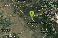
Briceburg Recreation Area
Midpines, California
26.3 miles SWCamp, Kayak, and Swim near Midpines, California
Camp, Kayak, Swim
Crystal Lake
Mammoth Lakes, California
39.5 miles SEUnlike many hikes in the Sierra's, Crystal lake can be done as a day hike and as the perfect way to get away for a bit. As hikers make their way to the lake, they will see the monolith Crystal...
Camp, Hike


