


Glen Aulin
Wawona, California
| Address: | Yosemite National Park, California, USA |
| GPS: |
37°54'33.5"N 119°25'8.7"W Maps | Directions |
| State: | California |
| Trail Length: | 11.00 miles |
| Trail Type: | Out & Back |
| Hike Difficulty: | Intermediate |
| Elevation Gain: | 800 feet |
| Trails/Routes: | 6.1 mi |
Lakes Rivers Waterfalls Streams Trails Rocks Wildflowers National Park
Backpack, Camp, and Hike
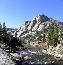
This is an 11 mile hike along the Tuolumne River to Glen Aulin. There is a view to take in at every turn on this hike, whether it's the Tuolumne River, Tuolumne Fall, Soda Springs, Parsons Memorial Lodge, or White Cascade. There are also several wildflower meadows along the way, especially towards the beginning of the hike.
The total elevation gain is 800 feet, which is pretty low considering the distance, which is upwards of 11 miles. If you can last the 6-8 miles it will take to reach Glen Aulin, then you'll be able to soak in some of the best parts of Yosemite's backcountry without doing too much climbing.
Once you reach Glen Aulin, there are several places to camp, including the Backpackers Campground, which provides tents, or the High Sierra Camp. If you plan on staying in Glen Aulin for a few days, you might consider hiking to to Waterwheel Falls and the Grand Canyon of the Tuolumne, two popular attractions in the Tuolumne Meadows area.
The hike is available as long as Tioga Road is open, which is typically June to November, but it would be more enjoyable the earlier in the season you go due to the snow melting and feeding into the waterfalls.
More Information
Yosemite National Park Itinerary
This Yosemite National Park Itinerary will help you get started as you plan your vacation to Yosemite National Park.
https://www.justgotravelstudios.com/collections/national-park-itineraries/products/yosemite-national-park-itinerary?ref=9zpxis0diinBe courteous, informed, and prepared. Read trailhead guidelines, stay on the trail, and don't feed the wildlife.
Read More
- Plan Ahead and Prepare
- Travel & camp on durable surfaces
- Dispose of waste properly
- Leave what you find
- Minimize campfire impacts
- Respect wildlife
- Be considerate of other visitors
Directions
From Wawona, California
- Head south on Chowchilla Mountain Rd toward Wawona RdToll road(377 ft)
- Turn right onto Wawona RdToll road(21.6 mi)
- Slight right onto Southside DrPartial toll road(1.4 mi)
- Turn left onto El Capitan DrToll road(0.4 mi)
- Merge onto Northside DrToll road(2.0 mi)
- Continue onto El Portal RdToll road(0.9 mi)
- Turn right onto Big Oak Flat Road (signs for CA-120/Tioga Rd/Manteca)Toll road(9.5 mi)
- Continue onto Old Yosemite Coulterville RdToll road(344 ft)
- Turn right onto CA-120 EToll roadMay be closed at certain times or days(36.6 mi)
You will have to park along the road

Other Hiking Trails and Backpacking Trails Nearby
Glen Aulin
Glen Aulin, California
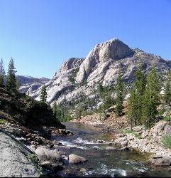
0.0 miles NEA popular introductory Yosemite High Country backcountry hike following the Tuolumne River to a High Sierra Camp beside the White Cascade waterfall, with further options to Waterwheel Falls.
Backpack, Camp, Hike, Swim 0.9-3.2 mi
Cathedral Lakes
Wawona, California
4.4 miles SA gorgeous 7-mile High Sierra hike along the John Muir Trail to twin lakes at 10,000 feet, framed by Cathedral, Echo, and Tressider Peaks with sweeping views of Tenaya Lake from a rock shelf.
Hike, Swim 0.8-4.1 mi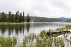
Dog Lake and Lembert Dome
Yosemite Valley, CA
4.5 miles EA 4-mile round-trip hike through Tuolumne Meadows wildflowers to a serene evergreen lake and a granite dome with sweeping views — doable in 1.5 to 3 hours.
Hike, Swim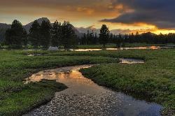
Tuolumne Meadows
Tuolumne County, California
4.6 miles SEA stunning alpine meadow in the high Sierra with granite domes and mountain views, the meandering Tuolumne River, and access to Yosemite backcountry — open summer only when the park road is clear.
Camp, Hike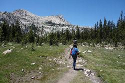
Elizabeth Lake
Wawona, California
5.2 miles SEA 4.8-mile hike with a 1,000-foot gain to a quiet alpine lake tucked between Cockscomb, Unicorn Peak, and Johnson's Peak in Yosemite's Tuolumne Meadows backcountry.
Hike, Swim 5.7 mi
Ten Lakes
Tuolumne Meadows, Yosemite National Park
5.6 miles WA 6.4-mile hike from Yosemite Creek to three of the Ten Lakes Basin's seven lakes, through wildflower meadows, forests, and past the Grand Canyon of the Tuolumne, gaining 2,200 feet.
Backpack, Camp, Hike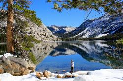
Tenaya Lake
Yosemite Valley, Yosemite National Park
5.8 miles SWTenaya Lake's glacier-carved granite shoreline offers a spacious east-beach for swimming, canoeing, and kayaking with stunning Yosemite dome views all around.
Canoe, Hike, Kayak, Swim 1.3-1.6 mi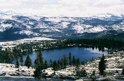
May Lake
Yosemite Valley, Yosemite National Park
5.9 miles SWA 2.5-mile roundtrip hike to a scenic 9,270-foot lake at the base of Mt. Hoffmann — with views of Clouds Rest, Half Dome, and Teyana Lake, plus the option to summit the peak for even grander panoramas.
Hike, Swim 3.6 mi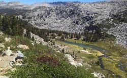
Lyell Canyon
Wawona, California
7.1 miles SEAn 8-mile, nearly flat hike through Yosemite's Tuolumne Meadows along the Lyell Fork river, with creek crossings, Kuna Creek cascades, and backcountry quiet far from the crowds.
Hike 1.8 mi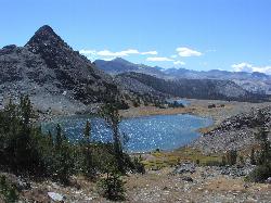
Gaylor Lakes
Yosemite Valley, CA
8.2 miles EA 2-mile Yosemite hike with views the entire way — Dana Meadows, mountain peaks, and a high valley holding five separate lakes, with a mostly flat valley to wander once you top the pass.
Hike, Swim 4.0 mi
Mono Pass
Yosemite Valley, CA
8.6 miles EAn 8-mile high-Sierra hike at 10,600 feet crossing meadows and several lakes, climbing through Bloody Canyon to sweeping views of Mono Valley and Mono Lake.
Hike, Swim 4.0 mi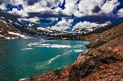
Saddlebag Lake
Lee Vining, California
8.9 miles NEAt 10,008 ft, this Eastern Sierra alpine lake offers exceptional trout fishing, a scenic four-mile loop, and a water taxi into the heart of the Twenty Lakes Basin.
Camp, Canoe, Hike 0.7 mi
Lukens Lake
Tuolumne Meadows, Yosemite National Park
11.4 miles WA short 1.6-mile forest walk to a secluded lake famous for the luminescent shooting stars visible while you swim, plus a wildflower meadow that peaks in July.
Hike, Swim 1.1 mi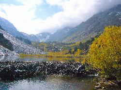
Lundy Canyon
Bridgeport, California
11.6 miles NEA 3-mile canyon hike past twin 70-foot waterfalls and beaver ponds into the Hoover Wilderness, with options to climb 2,000 feet to Burro Lake or explore wildflower meadows and multiple cascades.
Hike 2.1 mi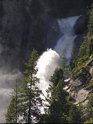
Snow Creek Falls
Yosemite Valley, Yosemite National Park
11.8 miles SWA 2,140-foot, seven-drop cascade tucked deep in Tenaya Canyon — best spotted from the Mirror Lake Loop, where you can also take a swim before hunting for the falls from the Snow Creek Trail junction.
Backpack, Hike 1.9 mi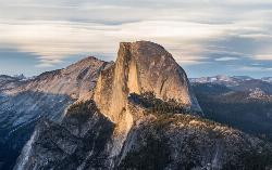
Half Dome
Yosemite Valley, Yosemite National Park
12.5 miles SWA grueling 14-mile round-trip hike with 4,800 feet of gain to the summit of Half Dome, including a cable section in the final 400 feet — a permit is required and a sunrise start is essential.
Hike
Harden Lake
Big Oak Flat, Yosemite National Park
12.8 miles WA long but gentle 5.8-mile walk down old Tioga Road through granite domes and red fir forest to a serene lake ringed by wildflowers — with optional extension to the Grand Canyon of the Tuolumne.
Backpack, Hike 4.1 mi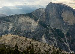
North Dome
Yosemite Valley, Yosemite National Park
13.0 miles SWA strenuous 10.4-mile hike through Yosemite forest to North Dome, rewarding hikers with the best straight-on view of Half Dome from 7,450 feet — plus a 0.6-mile detour to a 15-foot granite arch.
Backpack, Hike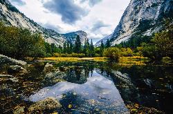
Mirror Lake
Yosemite Valley, Yosemite National Park
13.2 miles SWA paved, car-free trail winds to this seasonal lake at the base of Half Dome, offering a still mirror reflection and a popular summer swimming hole.
Backpack, Hike, Swim 2.9 mi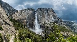
Upper Yosemite Falls
Yosemite Valley, Yosemite National Park
13.9 miles SWThe tallest waterfall in North America at 2,425 feet — a 7.2-mile, 2,600-ft-gain hike to the top of Upper Yosemite Falls with stunning valley views along the way.
HikeNearby Campsites
Glen Aulin
Glen Aulin, California
0.0 miles NEA popular introductory Yosemite High Country backcountry hike following the Tuolumne River to a High Sierra Camp beside the White Cascade waterfall, with further options to Waterwheel Falls.
Backpack, Camp, Hike, Swim
Tuolumne Meadows
Tuolumne County, California
4.6 miles SEA stunning alpine meadow in the high Sierra with granite domes and mountain views, the meandering Tuolumne River, and access to Yosemite backcountry — open summer only when the park road is clear.
Camp, Hike 5.7 mi
Ten Lakes
Tuolumne Meadows, Yosemite National Park
5.6 miles WA 6.4-mile hike from Yosemite Creek to three of the Ten Lakes Basin's seven lakes, through wildflower meadows, forests, and past the Grand Canyon of the Tuolumne, gaining 2,200 feet.
Backpack, Camp, Hike 4.0 mi
Saddlebag Lake
Lee Vining, California
8.9 miles NEAt 10,008 ft, this Eastern Sierra alpine lake offers exceptional trout fishing, a scenic four-mile loop, and a water taxi into the heart of the Twenty Lakes Basin.
Camp, Canoe, Hike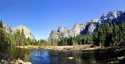
Merced River
Yosemite Valley, Yosemite National Park
14.6 miles SWThe Merced River circles Yosemite Valley with whitewater, swimming holes, gold-panning spots, and unbeatable views of Yosemite Falls and Glacier Point at every bend.
Camp, Swim, Whitewater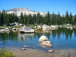
Crane Flat
Big Oak Flat, Yosemite National Park
23.6 miles SWFramed between two giant sequoia groves, Crane Flat meadow is a quiet Yosemite base camp for birding, stargazing, and seasonal hikes to Lukens and Harden Lake.
Backpack, Camp, Hike, Snowshoe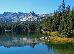
Crystal Lake
Mammoth Lakes, California
30.7 miles SEA 3.2-mile roundtrip Sierra day hike past Lake George, Lake Marie, and Lake Mamie, ending at Crystal Lake beneath the monolith Crystal Crag — shaded trail with room to swim, fish, or picnic lakeside.
Camp, Hike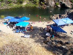
Briceburg Recreation Area
Midpines, California
37.7 miles SWBriceburg is where State Route 140 drops out of the Sierra foothills and meets the Wild and Scenic Merced River, twelve miles east of Mariposa on the road to Yosemite, and it's one of the best public...
Camp, Kayak, Swim
Wild Willy's Hot Spring
Mammoth Lakes, California
39.5 miles SEA soaking hot spring in Long Valley's open sagebrush plain — pools range from 95°F to 105°F, with a larger deeper pool and smaller, hotter pools, reached by a 0.2-mile wooden boardwalk from the parking area.
Camp, Hot Springs
Bass Lake Recreation Area
Oakhurst, California
40.1 miles SWarm Sierra reservoir at 3,400 feet with Forest Service beaches and campgrounds, a waterfall trail at the north end, and Yosemite's south gate twenty miles up the road.
Camp, Canoe, Hike, Kayak, Swim
Crowley Lake Campground
Crowley Lake, California
42.6 miles SENestled in the stunning Eastern Sierra near Crowley Lake, this BLM campground offers first-come, first-served sites for tents, RVs, and trailers with breathtaking high-desert views.
Camp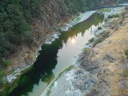
Standish Hickey Area
Lakeshore, California
45.9 miles SEA two-mile stretch of the south fork of the Eel River inside a redwood canyon 180 miles from San Francisco — swim, kayak, fish, or hike, then camp near the 1,200-year-old Captain Miles Standish Tree.
Backpack, Camp, Hike, Kayak, Swim


