


137 Hiking Trails near Arrowhead Point Trail
first prev 1 2 3 4 5 6 7 next lastShowing Hiking Trails within 50 miles Distance miles of 5461-5499 W Pinnacle Peak Rd, Glendale, AZ 85310, USA City, Zip, or Address

Scarlett Canyon
Phoenix, Arizona
8.1 miles EScarlett Canyon trail (not officially named) is an unmarked trail adjacent to the Scarlett Canyon residential neighborhood. This is a 3 mile loop trail considered to be easy to...
Hike, Horseback, Mountain Bike, Rock Climb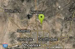
Apache Wash Trail
Phoenix, Arizona
8.7 miles NEStart west on Ocitillo to Ridgeback north till you get to the crossing of Sidewinder then head west. Keep on Sidewinder toil you come to the crossing of Octillio and head east back to...
Hike
Discovery Trail
Peoria, Arizona
8.7 miles WDiscovery Trail is a path within Peoria, Arizona for residents of Vistancia. This concrete paved, 3.5 mile path meant for walking, running, and biking. Yoga, stargazing, and picnicking are...
Hike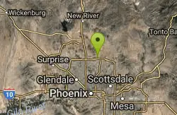
Reach 11 Trail
Phoenix, Arizona
8.8 miles EHike near Phoenix, Arizona
Hike
Sidewinder-Ocotillo-West Loop
Phoenix, Arizona
8.9 miles NEThis loop starts at Carefree Hwy and 7th Ave, be aware there is limited parking at the trailhead. The Ocotillo part of the trail is relatively flat and the Sidewinder part has some good...
Hike, Horseback, Mountain Bike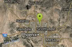
Lookout Mountain Circumference Trail
Phoenix, Arizona
8.9 miles SEHike near Phoenix, Arizona
Hike
Tower Road - Sonoran Preserve
Phoenix, Arizona
8.9 miles NEShort and steep (.6 mile each way) out and back asphalt road to the radio tower.
Hike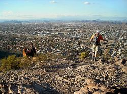
Lookout Mountain Summit Trail
Phoenix, Arizona
8.9 miles SELookout Mountain Summit Trail is a short, 1 mile trail in Phoenix, Arizona. The trail is steep, especially towards the summit, but it's manageable, and well worth the...
Hike
Sidewinder, Apache Vista, Ocotillo Loop Trail
Phoenix, Arizona
9.0 miles NEThis is an excellent loop that is very well maintained, well sign posted and if you include the vista summit trail, a moderate work out. Massive Car Park, good restrooms, and plenty of...
Hike, Horseback, Mountain Bike
Ocotillo/Ridgeback/Sidewinder Loop Trail
Phoenix, Arizona
9.1 miles NEGreat moderate loop which includes a summit, great views and Classic Sonoran Desert scenery. Multiple access points and other connecting trails allows for the loop to be changed if...
Hike, Horseback, Mountain Bike
Shaw Butte and Charles M Christiansen Loop Trail
Phoenix, Arizona
9.4 miles SEWhen you say "North Mountain," I think most Arizonans know where it is or can find it. When you say "Shaw Butte," it seems like you get a lot more questioning glances and "huh?". Shaw...
Hike, Mountain Bike
Maxine Lakin Nature Trail
Phoenix, Arizona
9.9 miles SEHike near Phoenix, Arizona
Hike
North Mountain National Trail
Phoenix, Arizona
9.9 miles SENorth Mountain National Trail is a 2.3 mile moderate, loop trail near Phoenix. It's easy to travel on if you go up the paved sections. The inclines are steep in parts, making it a real...
Hike
Shadow Mountain Trail
Phoenix, Arizona
10.3 miles SEThis particular route trailhead starts at 23rd place and Sweetwater rd it's a great wildlife trail.
Hike 1.3 mi

Dreamy Draw Loop Trail
Phoenix, Arizona
12.6 miles SEThe Dreamy Draw Nature Trail is a short multi-access loop trail that provides a true Sonoran Desert experience. The trail crosses a number of desert washes and, at times, becomes somewhat rocky....
Hike, Horseback, Mountain Bike
Clay Mine Trail
Cave Creek, Arizona
12.8 miles NEClay Mine Trail is a 1.6 mile out-and-back, beginner friendly trail in Cave Creek Regional Park. This is a trail that is very close to the Visitor Center. It's not too difficult but there...
Hike 4.6 mi
Perl Charles Memorial Trail (#1A)
Phoenix, Arizona
13.3 miles SEThis is a technical singletrack loop with some very steep up and down sections located in the Phoenix Mountain Preserves. This trail is for advanced riders who like to bleed and leave their skin on...
Hike, Horseback, Mountain Bike
L.V. Yates to "Two Bit" Peak Loop
Phoenix, Arizona
13.7 miles SEWell this time of the year there really was not a lot of wild life to see, just to hot. Starting from the 40st trailhead gave me a different view of the preserve. I really enjoyed...
Hike, Horseback 2.6 mi
L.V. Yates Trail (#8)
Phoenix, Arizona
13.8 miles SEThe trail is strewn with large rocks and gulleys from recent torrential rains. Not impassable on foot, but definitely some hike-a-bike areas. Keep in mind there's no ridge hiking...
Hike, Horseback, Mountain Bike 5.8 mi
Go John Trail
Cave Creek, Arizona
13.8 miles NEThe Go John Trail is a 5.8 mile loop trail outside of Cave Creek, Arizona, that is moderately trafficked, used by both hikers and mountain bikers. It is an excellent opportunity to view the desert...
Hike, Horseback, Mountain Bike


