


137 Hiking Trails near Arrowhead Point Trail
first prev 1 2 3 4 5 6 7 next lastShowing Hiking Trails within 50 miles Distance miles of 5461-5499 W Pinnacle Peak Rd, Glendale, AZ 85310, USA City, Zip, or Address
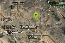
Dixie Mine
Fountain Hills, Arizona
23.9 miles EMcDowell Mountain Regional Park 16300 McDowell Mountain Park Dr. MMRP Arizona 85255 Ph: 480-471-0173 Fax: 602-372-8507 mcdowellpark@mail.maricopa.gov Mailing...
Hike
Sonoran Trail Fountain Hills
Fountain Hills, Arizona
23.9 miles EHike near Fountain Hills, Arizona
Hike 8.3 mi
Estrella Mountains Competitive Track
Tolleson, Arizona
24.2 miles SThe third competitive track in the Maricopa County Regional Park system, located in Estrella Mountain Regional Park, was completed in February 2000. The track consists of two loops totaling 13 miles....
Hike, Horseback, Mountain Bike 1.2 mi
Ma-Ha-Tauk Trail
Phoenix, Arizona
24.4 miles SMa-Ha-Tauk Trail can be found in South Mountain Park in Phoenix. This is a 2.5 mile, out-and-back trail. Aside from a short section of steeper incline in the first part of the hike, this is an...
Hike, Horseback 2.3 mi
Hidden Valley Trail Via Mormon Trail
Phoenix, Arizona
24.4 miles SHidden Valley Trail via Mormon Trail is a 2-4 mile hike, depending on the route you choose to take and how much additional exploring you do. This hike offers a natural rock tunnel, petroglyphs,...
Hike, Mountain Bike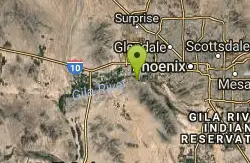
Baseline Trail
Goodyear, Arizona
24.5 miles SWThe Baseline trail is a 2.6 mile loop at Estrella Mountain Regional Park. This listing is based on access from a spur trail (33.378981, -112.371072) off of the Gila trail. Access is...
Hike
Max Delta
Phoenix, Arizona
24.5 miles SThis trails follows close to San Juan Rd. Part of the trail is rocky while other parts are well just dirt. Max Delta Trail is a 2.7 mile trail within Phoenix, Arizona on the South Mountain...
Hike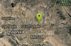
Sunrise Peak via Sunrise Trail
Scottsdale, Arizona
24.6 miles EHike near Scottsdale, Arizona
Hike 4.8 mi
Lost Creek Petroglyph Trail
Buckeye, Arizona
24.6 miles SWStarting at Verrado's trailhead, the trail heads a short ways to a petroglyph site. While a little rocky at times, the trail is easy. To deter vandals, a very necessary fence with barbed-wire has...
Hike, Mountain Bike 0.2-5.0 mi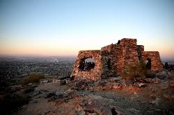
Holbert Trail to Dobbins Lookout
Phoenix, Arizona
24.7 miles SStart out at the main entrance to South Mountain and make a left past the vistor's center. Go to the end of the road to the beginning of Holbert Trail. Get to the top and make a right to Dobbins...
Hike
Holbert-Hidden Valley-Mormon Trail Shuttle
Phoenix, Arizona
24.7 miles SHolbert- Hidden Valley- Mormon Trail is a combination trail hike on the north side of South Mountain near Phoenix, Arizona. This trail is approximately 6.5 miles long, and is suitable for...
Hike, Mountain Bike 1.0 mi
Quail Trail
Goodyear, Arizona
24.7 miles SWQuail Trail is the access trail from the Nature Center to the main trail system. It is a pretty steep climb, but smooth and steady. Quail Trail is a spur trail in the Estrella Mountain...
Hike, Horseback, Mountain Bike 1.9 mi
Javelina Trail
Phoenix, Arizona
24.9 miles SEComing down Javelina is fast and fun no doubt. It sure beats the crowded Pima Canyon trail back to the Pima lot if you parked there. Javelina is just one more sweet trail on South Mountain. Not a...
Hike, Horseback, Mountain Bike 1.8 mi
Javelina-Beverly Canyon Loop Trail
Phoenix, Arizona
24.9 miles SEJavelina Canyon Trail does have some beautiful hills and valleys to wander through and it feels down right remote at times. I’ve found Javelina to have less traffic that Beverly as...
Hike, Horseback, Mountain Bike 13.8 mi
Butterfield to Gadsen Loop Trail
Goodyear, Arizona
25.1 miles SWAs with other trails in Estrella, the trail is wide and the surface tends to be rather benign, varying from mostly smooth, to occasionally strewn with small rocks, sandy in the washes. Butterfield...
Hike, Horseback, Mountain Bike 2.9 mi
Coldwater Trail
Goodyear, Arizona
25.1 miles SWThe Cold Water Trail #27 is a seldom visited, remote backcountry destination along the backdrop of the rugged Verde Rim with healthy mixed vegetation and unique geology. The trail was originally used...
Hike, Horseback, Mountain Bike
Rainbow Valley to Toothaker Loop Trail
Goodyear, Arizona
25.2 miles SWEstrella Mountain Regional Park has many trails within it, a great beginner to intermediate friendly trail is the Rainbow Valley to Toothaker Loop Trail. This 6.6 mile hike is mostly flat with a few...
Hike, Horseback, Mountain Bike
Dysart Trail
Goodyear, Arizona
25.2 miles SW$6 entry fee per car.
Hike, Horseback, Mountain Bike 3.6 mi
Toothaker Trail
Goodyear, Arizona
25.2 miles SWToothaker is an easy roller coaster of a trail. It crosses numerous washes ranging from small to large and can be a tad loose and/or rocky in some sections. The end reward is a nice view of Rainbow...
Hike, Horseback, Mountain Bike 0.8-1.0 mi

Kiwanis Trail to Telegraph Pass Lookout
Phoenix, Arizona
25.3 miles SAn ideal hike to take children on as the distance is short and the elevation gain is not extreme. Avid hikers have opportunities to embark on longer hikes into South Mountain. ... This short hike is...
Hike, Mountain Bike


