


137 Hiking Trails near Arrowhead Point Trail
first prev 1 2 3 4 5 6 7 next lastShowing Hiking Trails within 50 miles Distance miles of 5461-5499 W Pinnacle Peak Rd, Glendale, AZ 85310, USA City, Zip, or Address

National Trail
Phoenix, Arizona
25.4 miles SNational Trail is the gem of South Mountain and home to the infamous Waterfall. It’s a local favorite as well as a destination trail for MTB snowbirds. Like most trails in the Sonoran...
Hike, Mountain Bike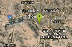
Alta Trail And Bajada Trail
Phoenix, Arizona
25.5 miles SHike near Phoenix, Arizona
Hike
South Mountain Trails (Desert Classic Trail)
Phoenix, Arizona
25.6 miles SEHike and Mountain Bike near Phoenix, Arizona
Hike, Mountain Bike 1.5 mi
Desert Classic
Phoenix, Arizona
25.6 miles SEThe Desert Classic trail is just that, a classic at the South Mountain Park area. Because it is such a classic, the trail is well marked and well worn by high traffic flow of riders and hikers....
Hike, Mountain Bike
Pima Wash Trail to West Loop
Phoenix, Arizona
25.6 miles SEHike near Phoenix, Arizona
Hike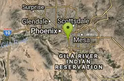
National to Hidden Valley to Mormon Loop
Phoenix, Arizona
25.6 miles SEHike near Phoenix, Arizona
Hike 2.1 mi
Marcos de Niza & Pima
Phoenix, Arizona
25.6 miles SEIf you're looking to: get off the tourist highway trail, enjoy killer South Mountain views, take a rollercoaster for a hike with an easy stroll or jog back to the start - this is a loop you...
Hike
Desert Classic - Goat Trail
Phoenix, Arizona
25.6 miles SEHike and Mountain Bike near Phoenix, Arizona
Hike, Mountain Bike
South Mountain National Trail
Phoenix, Arizona
25.6 miles SEThe National Trail crosses South Mountain Park from the east to the west ends and intersects with most of the other trails in the park. A very scenic hike with moderate ups and downs...
Hike, Mountain Bike
Wagner-Granite-Bluff Trails
Scottsdale, Arizona
25.7 miles EHike and Mountain Bike near Scottsdale, Arizona
Hike, Mountain Bike 2.5 mi
Hidden Valley from Buena Vista Trail
Phoenix, Arizona
25.7 miles SFor an easily accessible trail, butting right up against Phoenix’s southern border, it is truly surprising how special, quiet and natural the hike through Hidden Valley is! The path...
Hike, Mountain Bike
Wagner Trail
Scottsdale, Arizona
25.7 miles EWagner Trail is a 2.2 mile, beginner to intermediate loop trail located in the McDowell Sonoran Preserve. The trail is well-marked and easy to follow; this wide, but rugged...
Hike, Horseback, Mountain Bike
Tortoise and Hilltop Trails
Fort McDowell, Arizona
25.8 miles EBe on the lookout for wildlife like jackrabbits and lizards on the initial stretch of trail (Tortoise Trail) and for mountain bikers as this trail joins the Pemberton Trail for a bit as...
Hike 3.9 mi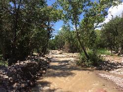
Cave Creek Swimming Hole
Cave Creek, Arizona
26.1 miles NEHidden along Cave Creek Trail #4 is a swimming hole deep enough to refresh from the summer heat. It takes almost four miles of hiking in Arizona desert to reach the swimming hole, but the water is...
Hike, Swim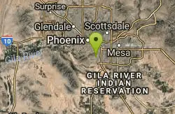
Old Man Trail
Phoenix, Arizona
26.6 miles SRanger Office Phone: (602) 262-7393 Hours for all trailhead areas and entrances: 5 a.m. to 7 p.m. (entrance gates close). Trails remain open until 11 p.m.
Hike
Telegraph Pass Trail
Phoenix, Arizona
27.0 miles STelegraph Pass Trail is a 2.3 mile beginner friendly, out-and-back trail in South Mountain Park in Phoenix. The first third or so of Telegraph Trail is paved, making it wheelchair...
Hike 6.1 mi
Goat Hill via Telegraph Pass Trail
Phoenix, Arizona
27.0 miles SThe views from the top of Goat Hill are awesome on a clear day as you can enjoy a 360 view. Telegraph Trail is kind of a sidewalk part of the after that a little bit rocky until you reach the summit...
Hike
Corona Loop
Phoenix, Arizona
27.2 miles SThis is a good hike, take plenty of water and a map or gps would be a very good ideal. I went up the day after we got over a inch of rain so lot of places were washed out. i looked like...
Hike
Fountain Park Trail
Fountain Hills, Arizona
27.4 miles EFountain views, Four Peaks view, desert vegetation, close to coffee! The trail is well groomed and well marked. It parallels some house as you begin to go up the first hill. About 15...
Hike, Mountain Bike
Corona de Loma Trail
Phoenix, Arizona
27.5 miles Squick climb to the top of Buena Vista lookout. Great view of the east vally
Hike


