


137 Hiking Trails near L.V. Yates to "Two Bit" Peak Loop
first prev 1 2 3 4 5 6 7 next lastShowing Hiking Trails within 50 miles Distance miles of 9202 N 40th St, Phoenix, AZ 85028, USA City, Zip, or Address

Scarlett Canyon
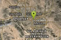
Phoenix, Arizona
7.9 miles NScarlett Canyon trail (not officially named) is an unmarked trail adjacent to the Scarlett Canyon residential neighborhood. This is a 3 mile loop trail considered to be easy to...
Hike, Horseback, Mountain Bike, Rock Climb
Reach 11 Trail
Phoenix, Arizona
8.0 miles NHike near Phoenix, Arizona
Hike
Double Butte Loop Trail
Phoenix, Arizona
8.2 miles SDouble Butte Loop Trail is one of the trails within Papago Park in Phoenix, Arizona. The Double Butte Loop Trail is a natural trail that traverses the circumference of both the small butte...
Hike, Mountain Bike 23.0 mi
Grand Canal Trail
Phoenix, Arizona
8.6 miles SWThe Grand Canal Trail is a 23-mile long system of paved and unpaved trails located in Glendale, Phoenix and Tempe that travels through...
Hike
Crosscut Canal Trail
Tempe, Arizona
9.0 miles SCrosscut Canal Trail is a concrete, sidewalk multi-use trail for walking, biking, wheelchairs, scooters, and skateboards. This two mile long path follows a canal and links Tempe Town Lake to...
Hike 4.9 mi
Tempe Town Lake Trail
Tempe, Arizona
9.6 miles SOn the lake's south side, the trail connects Arizona State University's main Tempe campus with Tempe Beach Park, as well as the Tempe Marketplace retail mecca. A newer extension on the...
Hike 2.0 mi
Loma and Canal Trails
Tempe, Arizona
9.6 miles STrails open to mountain biking and hiking that wind through the Papago Park in Tempe, Arizona. The Loma Trail winds around lots of uphill and downhill paths, and leads to a park with a small lake and...
Hike, Mountain Bike
Saguaro Loop and Nature Trail
Scottsdale, Arizona
9.7 miles NEHike near Scottsdale, Arizona
Hike
Tom's Thumb Trail South
Scottsdale, Arizona
9.7 miles NEHike near Scottsdale, Arizona
Hike
Tom's Thumb to Bell Pass
Scottsdale, Arizona
9.7 miles NEHike and Mountain Bike near Scottsdale, Arizona
Hike, Mountain Bike
Horseshoe Loop Hike
Scottsdale, Arizona
9.7 miles NEHike near Scottsdale, Arizona
Hike
Gateway and Tom's Thumb Loop Trail
Scottsdale, Arizona
9.7 miles NEStarting at the 104th St trailhead, head toward the Gateway loop trail. Turn right at the Gateway loop. Next take the Bell pass trail and be prepared for a steep climb. Once you hit...
Hike, Horseback, Mountain Bike
Gatewa-Prospector-Thompson Peak Road Trail
Scottsdale, Arizona
9.7 miles NEHike near Scottsdale, Arizona
Hike
Inspiration Point
Scottsdale, Arizona
9.7 miles NEInspiration Point is a 5.7, moderate hike located on the McDowell Sonoran Preserve near Scottsdale, Arizona. You'll begin your hike at the Gateway area, where you can find a parking lot...
Hike, Mountain Bike 0.6 mi
Horseshoe Trail
Scottsdale, Arizona
10.0 miles NEHorseshoe trail is a short, fun singletrack with a lot of quick turns created by wash areas and rocks. It's a nice warm-up heading to Gateway Loop Trail. In some areas there are a lot of cactus,...
Hike, Horseback, Mountain Bike
Hayden Butte And Tempe Town Lake Trail
Tempe, Arizona
10.2 miles SHike near Tempe, Arizona
Hike
'A' Mountain at Hayden Butte
Tempe, Arizona
10.5 miles S'A' Mountain aka Hayden Butte, is a popular hike in downtown in Tempe, Arizona. This hike located partially on Arizona State University's campus, is a short, easy walk, though it's...
Hike
Rio Salado Habitat Restoration Area
Phoenix, Arizona
10.9 miles SWHike near Phoenix, Arizona
Hike
Glendale Canal
Glendale, Arizona
11.6 miles WHike, Horseback, and Mountain Bike near Glendale, Arizona
Hike, Horseback, Mountain Bike
Hawk's Nest Trail and Dixie Mountain Loop
Phoenix, Arizona
13.3 miles NWModerate Trail providing access from the Car Park to all other trails. Directly links to Desert Tortoise Trail and Dixie Mountain Loop. Good hiking shoes/boots recommended....
Hike, Horseback, Mountain Bike


