


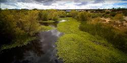
Rio Salado Habitat Restoration Area
Phoenix, Arizona
| Address: | Rio Salado Habitat Restoration Area, 641 W Lower Buckeye Rd, Phoenix, AZ 85003, USA |
| GPS: |
33°25'26.6"N 112°4'19.8"W Maps | Directions |
| State: | Arizona |
Waterfalls Streams Trails Rocks Wildflowers Ponds Glaciers National Park State Park
Hike
More Information
Add ResourceBe courteous, informed, and prepared. Read trailhead guidelines, stay on the trail, and don't feed the wildlife.
Read More- Plan Ahead and Prepare
- Travel & camp on durable surfaces
- Dispose of waste properly
- Leave what you find
- Minimize campfire impacts
- Respect wildlife
- Be considerate of other visitors
Directions
From Phoenix, Arizona
- Head west on W Washington St toward 1st Ave (315 ft)
- Turn left onto S 1st Ave (0.6 mi)
- S 1st Ave turns slightly right and becomes S Central Ave (1.0 mi)
- Turn leftDestination will be on the right(417 ft)
There's a parking lot with signs to show where the trails go.
leahmia
4/13/17 11:52 am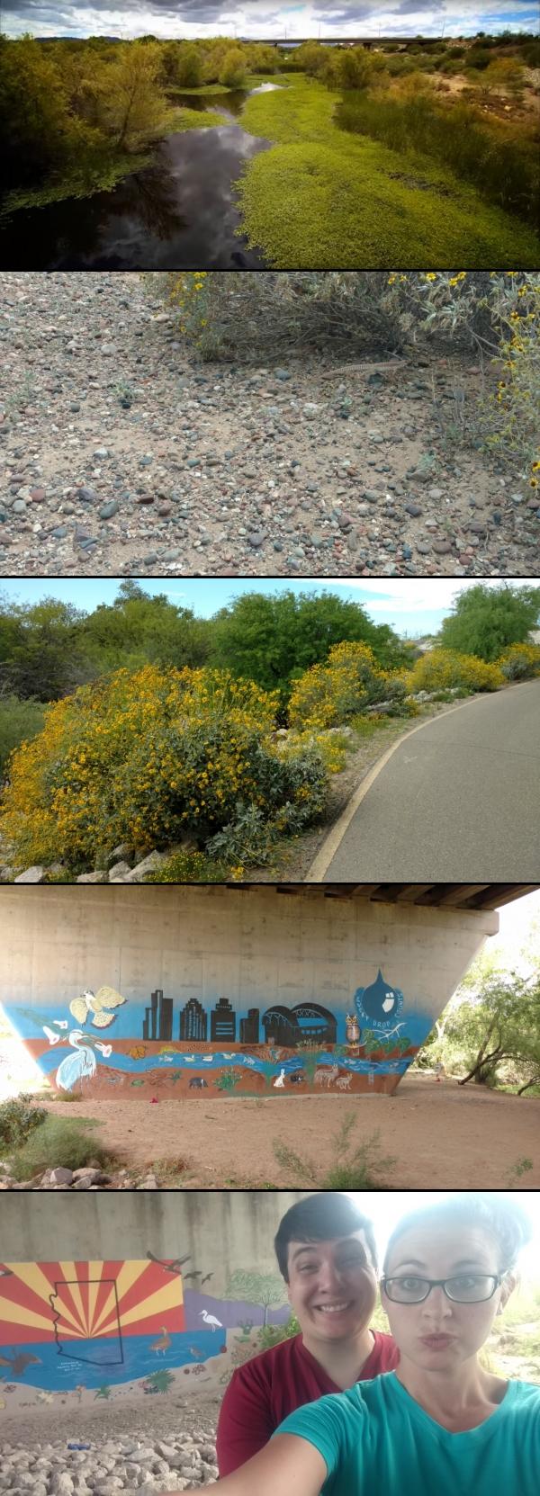


Other Hiking Trails Nearby

Hidden Valley Trail Via Mormon Trail
Phoenix, Arizona
4.6 miles SEHidden Valley Trail via Mormon Trail is a 2-4 mile hike, depending on the route you choose to take and how much additional exploring you do. This hike offers a natural rock tunnel, petroglyphs,...
Hike, Mountain Bike
Max Delta
Phoenix, Arizona
4.9 miles SThis trails follows close to San Juan Rd. Part of the trail is rocky while other parts are well just dirt. Max Delta Trail is a 2.7 mile trail within Phoenix, Arizona on the South Mountain...
Hike
Holbert-Hidden Valley-Mormon Trail Shuttle
Phoenix, Arizona
5.0 miles SHolbert- Hidden Valley- Mormon Trail is a combination trail hike on the north side of South Mountain near Phoenix, Arizona. This trail is approximately 6.5 miles long, and is suitable for...
Hike, Mountain Bike 0.2-5.0 mi
Holbert Trail to Dobbins Lookout
Phoenix, Arizona
5.0 miles SStart out at the main entrance to South Mountain and make a left past the vistor's center. Go to the end of the road to the beginning of Holbert Trail. Get to the top and make a right to Dobbins...
Hike 23.0 mi
Grand Canal Trail
Phoenix, Arizona
5.1 miles NWThe Grand Canal Trail is a 23-mile long system of paved and unpaved trails located in Glendale, Phoenix and Tempe that travels through...
Hike 1.2 mi
Ma-Ha-Tauk Trail
Phoenix, Arizona
5.3 miles SMa-Ha-Tauk Trail can be found in South Mountain Park in Phoenix. This is a 2.5 mile, out-and-back trail. Aside from a short section of steeper incline in the first part of the hike, this is an...
Hike, Horseback 0.8-1.0 mi
Kiwanis Trail to Telegraph Pass Lookout
Phoenix, Arizona
5.8 miles SAn ideal hike to take children on as the distance is short and the elevation gain is not extreme. Avid hikers have opportunities to embark on longer hikes into South Mountain. ... This short hike is...
Hike, Mountain Bike 2.5 mi
Hidden Valley from Buena Vista Trail
Phoenix, Arizona
5.8 miles SFor an easily accessible trail, butting right up against Phoenix’s southern border, it is truly surprising how special, quiet and natural the hike through Hidden Valley is! The path...
Hike, Mountain Bike 1.9 mi
Javelina Trail
Phoenix, Arizona
6.1 miles SEComing down Javelina is fast and fun no doubt. It sure beats the crowded Pima Canyon trail back to the Pima lot if you parked there. Javelina is just one more sweet trail on South Mountain. Not a...
Hike, Horseback, Mountain Bike 1.8 mi
Javelina-Beverly Canyon Loop Trail
Phoenix, Arizona
6.1 miles SEJavelina Canyon Trail does have some beautiful hills and valleys to wander through and it feels down right remote at times. I’ve found Javelina to have less traffic that Beverly as...
Hike, Horseback, Mountain Bike
South Mountain Trails (Desert Classic Trail)
Phoenix, Arizona
6.5 miles SEHike and Mountain Bike near Phoenix, Arizona
Hike, Mountain Bike 2.1 mi
Marcos de Niza & Pima
Phoenix, Arizona
6.5 miles SEIf you're looking to: get off the tourist highway trail, enjoy killer South Mountain views, take a rollercoaster for a hike with an easy stroll or jog back to the start - this is a loop you...
Hike
Pima Wash Trail to West Loop
Phoenix, Arizona
6.5 miles SEHike near Phoenix, Arizona
Hike 1.5 mi
Desert Classic
Phoenix, Arizona
6.5 miles SEThe Desert Classic trail is just that, a classic at the South Mountain Park area. Because it is such a classic, the trail is well marked and well worn by high traffic flow of riders and hikers....
Hike, Mountain Bike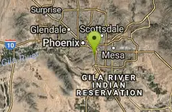
National to Hidden Valley to Mormon Loop
Phoenix, Arizona
6.5 miles SEHike near Phoenix, Arizona
Hike
Desert Classic - Goat Trail
Phoenix, Arizona
6.5 miles SEHike and Mountain Bike near Phoenix, Arizona
Hike, Mountain Bike
South Mountain National Trail
Phoenix, Arizona
6.5 miles SEThe National Trail crosses South Mountain Park from the east to the west ends and intersects with most of the other trails in the park. A very scenic hike with moderate ups and downs...
Hike, Mountain Bike
Papago to Tempe Town Lake
Phoenix, Arizona
6.5 miles NEThere are many paths that interconnect within Papago park and the nearby Tempe Town Lake. Any of these in combination provide a good walk or bike riding experience with a variety of views. Papago...
Hike
Old Man Trail
Phoenix, Arizona
6.8 miles SERanger Office Phone: (602) 262-7393 Hours for all trailhead areas and entrances: 5 a.m. to 7 p.m. (entrance gates close). Trails remain open until 11 p.m.
Hike
Double Butte Loop Trail
Phoenix, Arizona
7.1 miles EDouble Butte Loop Trail is one of the trails within Papago Park in Phoenix, Arizona. The Double Butte Loop Trail is a natural trail that traverses the circumference of both the small butte...
Hike, Mountain BikeNearby Campsites

Lower Salt River Nature Trail
Fort McDowell, Arizona
25.1 miles EThe Lower Salt River Nature Trail is a scenic walk to take at the Tonto National Forest. This trail provides stunning views as you walk alongside the Salt River. This rustic trail is older and less...
Camp, Hike
Buckhorn Campground Nature Trail
Apache Junction, Arizona
26.3 miles ECamp and Hike near Apache Junction, Arizona
Camp, Hike


