


Grand Canal Trail
Phoenix, Arizona
| Address: | ~3524 N Black Canyon Hwy, Phoenix, AZ 85017, USA |
| GPS: |
33°29'22.9"N 112°6'47.7"W Maps | Directions |
| State: | Arizona |
| Trail Length: | 23.50 miles |
| Trail Type: | Out & Back |
| Hike Difficulty: | Intermediate |
| Elevation Gain: | 98 feet |
| Trails/Routes: | 23.0 mi |
Pet Friendly
Hike
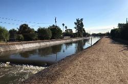
The Grand Canal Trail is a 23-mile long system of paved and unpaved trails located in Glendale, Phoenix and Tempe that travels through the middle of the metropolitan area. For most of the way, the trail follows alongside the Grand Canal through residential and business districts. The trail is open for bike riding, walking and running. The route of the trail reduces the number of roadway intersections, but It does have numerous roadway crossings at street level. The trail has gaps at some of the major highways, such as Highway 60 and Interstate 17, but there are underpasses for the Piestewa Freeway, the Red Mountain Freeway and Route 143.Courtesy of walkrideusa.com
The Grand Canal Trail goes past the following points of interest:
University of Phoenix Stadium Alhambra Traditional School Grand Canal Linear Park Steele Indian School Park Glendale Heroes Regional Park Phoenix Advantage Charter School Heatherbrae Elementary School William Machan Elementary School Westland School Creighton Elementary School Maryvale High School Davy Crockett Elementary School Marivue Pool 44th Street & Washington Station Maryvale Stadium Phoenix Sky Harbor International Airport St. Vincent De Paul Catholic School Pueblo Grande Museum & Archaeological Park Glen L. Downs Elementary School Washington Street & Center Parkway Station Justine Spitalny Elementary School The Grand at Papago Park Center Pueblo Del Sol School Tempe Public Park
More Information
Add ResourceBe courteous, informed, and prepared. Read trailhead guidelines, stay on the trail, and don't feed the wildlife.
Read More
- Plan Ahead and Prepare
- Travel & camp on durable surfaces
- Dispose of waste properly
- Leave what you find
- Minimize campfire impacts
- Respect wildlife
- Be considerate of other visitors
Directions
From Phoenix, Arizona
- Head west on W Washington St toward 1st Ave (1.2 mi)
- Continue onto W Adams St (0.8 mi)
- Turn right onto N Black Canyon Hwy (75 ft)
- Take the ramp on the left onto I-17 N/US-60 WContinue to follow I-17 N(2.9 mi)
- Take exit 202 toward Indian School Rd (0.1 mi)
- Merge onto N Black Canyon Hwy (0.1 mi)
- Turn left onto W Indian School Rd (348 ft)
- Turn left at the 1st cross street onto N Black Canyon Hwy (signs for I-17 S/I-10/Tucson) (0.1 mi)
- Keep right to stay on N Black Canyon HwyDestination will be on the left(0.3 mi)


Other Hiking Trails Nearby
Rio Salado Habitat Restoration Area
Phoenix, Arizona
5.1 miles SEThe Rio Salado Habitat Restoration Area is a remarkable urban oasis just south of downtown Phoenix, where the historic Salt River, once a year-round river before it was diverted and drained, has been...
Hike 4.6 mi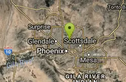
Perl Charles Memorial Trail (#1A)
Phoenix, Arizona
5.5 miles NEA technical, skin-on-rocks singletrack loop in the Phoenix Mountain Preserves — a 4.8-mile advanced loop with great Sonoran Desert views from the Dreamy Draw area.
Hike, Horseback, Mountain Bike 
Arizona Canal Trail
Phoenix, Arizona
5.6 miles NEMulti-purpose paved canal trails stretching from the Pima Indian Reservation to Glendale, tucked away from city traffic with underpasses, architecture, and space to bike, jog, walk, or ride horses.
Hike, Horseback 3.9 mi
Freedom Loop Trail (#302)
Phoenix, Arizona
6.2 miles NEA 3.8-mile loop around Piestewa Peak with great views of Phoenix and a quieter feel than the crowded summit route — rocky but manageable, with saguaros all around.
Hike 1.1 mi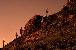
Piestewa Peak Summit Trail #300
Phoenix, Arizona
6.2 miles NEA steep, jagged, internationally recognized 1-mile climb to a 360-degree view of the entire Phoenix metro area — carved steps, two handrail sections, and water at the trailhead.
Hike 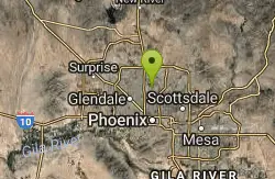
Maxine Lakin Nature Trail
Phoenix, Arizona
6.4 miles NHike near Phoenix, Arizona
Hike 1.4 mi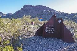
Mohave Trail (#200)
Phoenix, Arizona
6.5 miles NEA swift 0.6-mile one-way hike with a 300-foot elevation gain up switchbacks to a private summit view in Phoenix's Mountain Preserve — a quick escape from the crowds near Piestewa Peak.
Hike, Horseback 1.7 mi
Quartz Ridge Trail
Phoenix, Arizona
6.5 miles NEA short but strenuous hike through the Phoenix Mountain Preserve past towering Saguaro Cacti to great views of the city — a classic southwest desert trail.
Hike, Mountain Bike 1.3 mi
Dreamy Draw Loop Trail
Phoenix, Arizona
7.1 miles NEA short desert loop through a Sonoran Desert wash with native plants, resident coyotes and rabbits, spring wildflowers, and Piestewa Peak views — restrooms at the trailhead.
Hike, Horseback, Mountain Bike 0.9 mi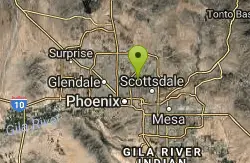
Ruth Hamilton Trail
Phoenix, Arizona
7.2 miles NEThe Ruth Hamilton Trail (#8B) is a short, rocky climb in the Phoenix Mountains Preserve with big skyline views from a ridgeline bench.
Hike, Mountain Bike 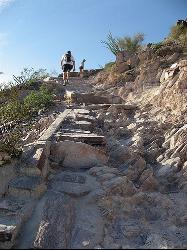
North Mountain National Trail
Phoenix, Arizona
7.4 miles NA 2.3-mile moderate loop with steep inclines, beautiful surrounding views, and two route options — it can get crowded at the parking lot but the panoramic Phoenix views are worth it.
Hike 
Shaw Butte and Charles M Christiansen Loop Trail
Phoenix, Arizona
8.0 miles NA popular but lesser-known Phoenix trail climbing past radio towers and an old burned restaurant ruin, with city views from the top and an easy flat return on the backside.
Hike, Mountain Bike 1.0-1.2 mi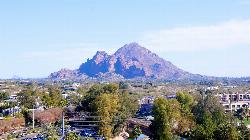
Camelback Mountain
Phoenix, Arizona
8.3 miles ETwo summit trails at Camelback Mountain — the steep 1.23-mile Echo Canyon Trail and the slightly easier 1.4-mile Cholla Trail — both with fantastic valley views.
Hike, Rock Climb 
Papago to Tempe Town Lake
Phoenix, Arizona
8.6 miles EA scenic urban walk or bike ride linking Papago Park's red buttes and Hole-in-the-Rock to the waterfront paths of Tempe Town Lake.
Hike 
L.V. Yates to "Two Bit" Peak Loop
Phoenix, Arizona
8.6 miles NEAn unmarked Phoenix preserve loop where some trails require navigation skills — best in spring after rainfall, with beautiful surrounding scenery and no water or shade on route.
Hike, Horseback 2.6 mi
L.V. Yates Trail (#8)
Phoenix, Arizona
8.6 miles NEA rocky, technical trail near Phoenix with large rocks and gullies from torrential rains — two ravines separated by saddles with no ridge hiking, some hike-a-bike sections.
Hike, Horseback, Mountain Bike 7.1 mi
Trail 100
Phoenix, Arizona
9.3 miles NEA 14-mile out-and-back hike and MTB trail through Phoenix Mountain Preserve with 1,570 feet of elevation, easy-to-follow markers, cacti, wildflowers, and several side paths to explore.
Hike, Mountain Bike 3.6 mi
Charles M. Christiansen Memorial Trail
Phoenix, Arizona
9.4 miles NEA 10.7-mile wilderness trail through the Phoenix Mountain Preserve with great valley views, gentle climbs, nice singletrack, and only 200 feet of elevation gain — very beginner friendly.
Hike, Horseback, Mountain Bike 
Double Butte Loop Trail
Phoenix, Arizona
9.5 miles EA beginner-friendly 2.3-mile flat loop trail in Papago Park through Sonoran Desert vegetation — cholla, saguaro, and desert wildlife — with plenty of parking at the West Park lot.
Hike, Mountain Bike 1.2 mi
Ma-Ha-Tauk Trail
Phoenix, Arizona
9.6 miles SA mostly easy 2.5-mile out-and-back trail in South Mountain Park connecting to many other trails, with views of downtown Phoenix and the Estrella Mountains — dogs welcome on leash.
Hike, HorsebackNearby Campsites

Lower Salt River Nature Trail
Fort McDowell, Arizona
26.3 miles EA 2-mile beginner loop alongside the Salt River in Tonto National Forest, with worn markers that keep things adventurous — watch for wild horses and spring cactus blooms.
Camp, Hike 
Buckhorn Campground Nature Trail
Apache Junction, Arizona
28.5 miles ECamp and Hike near Apache Junction, Arizona
Camp, Hike


