


65 Hiking Trails near Mormon Flats
first prev 1 2 3 4 next lastShowing Hiking Trails within 50 miles Distance miles of UT-65, Salt Lake City, UT 84108, USA City, Zip, or Address
Grandeur Peak
Salt Lake City, Utah
6.2 miles SWThe most accessible major peak on the Salt Lake City skyline, offering great valley views and year-round access for hikers of all abilities.
Hike 2.6 mi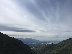
Salt Lake Valley Scenic Overlook
Salt Lake City, Utah
6.9 miles SWA 2-mile uphill hike through Millcreek Canyon switchbacks rewards you with a breathtaking overlook of the Salt Lake Valley from high above downtown's skyline.
Hike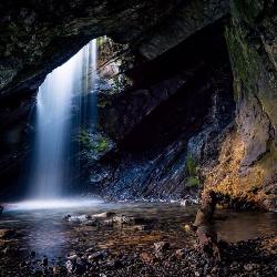
Donut Falls
Salt Lake City, Utah
9.1 miles SA waterfall that pours through a hole in a cave ceiling — earning the 'donut' name — on a family-friendly 3-mile round-trip hike through Big Cottonwood Canyon.
Hike, Swim
Mueller Park Trail
Bountiful, Utah
9.7 miles NWSmooth buff singletrack climbs gradually for 6.5 miles through Mueller Park before rewarding mountain bikers with fast, flowy descents all the way back down.
Cross-country Ski, Hike, Mountain Bike 4.7 mi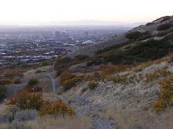
Bonneville Shoreline Trail
Salt Lake City, Utah
10.0 miles WA multi-use trail stretching from North Salt Lake to Parley's Canyon that follows the ancient shoreline of Lake Bonneville — perfect for hiking, biking, and trail running.
Hike, Mountain Bike
Hidden Falls
Salt Lake City, Utah
10.1 miles SA popular roadside waterfall in Big Cottonwood Canyon that's just a short stroll from the parking lot — a quick 15-minute detour with a big payoff.
Hike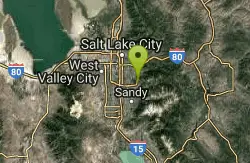
Pete's Rock
Salt Lake City, Utah
10.6 miles SWA large roadside rock next to the Mount Olympus trailhead — a local favorite for casual rock climbing, with the 9,026-ft summit offering some of the best views in the Salt Lake Valley.
Hike, Rock Climb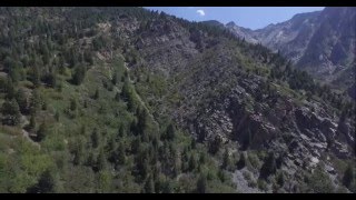
Storm Mountain
Salt Lake City, Utah
11.1 miles SA compact Wasatch peak just 3 miles up Big Cottonwood Canyon, with rock climbing routes, hiking, biking, and Big Cottonwood Creek running right alongside the day-use area.
Hike, Mountain Bike, Rock Climb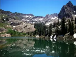
Lake Blanche
Salt Lake City, Utah
11.9 miles SA popular 3-mile one-way hike in the Wasatch Mountains to three alpine lakes — Blanche, Florence, and Lillian — with plenty of water along the trail and about 2.5 hours to the top.
Hike
Ferguson Canyon
Cottonwood Heights, Utah
12.7 miles SWA popular climbing destination tucked between Big and Little Cottonwood Canyons, where you can hike into a shaded canyon with a stream or push on to a rocky summit for sweeping views.
Hike, Mountain Bike, Rock Climb
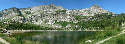
Silver Lake (Big Cottonwood)
Brighton, Utah
13.3 miles SEA Wasatch Mountains trail passing three alpine lakes, abundant wildlife from chipmunks to moose, shady forest, and sweeping views — with the option to hike counter-clockwise for a gentler climb.
Hike, Mountain Bike
Parrish Canyon Trail
Centerville, Utah
13.6 miles NWA Wasatch foothills trail connecting to Barnard Creek with views of Salt Lake City from the summit, wildlife to spot, pictographs on rocks in spring and summer, and a bridge as an easy turnaround for young hikers.
Hike, Mountain Bike
Wasatch Crest
Salt Lake City, Utah
13.8 miles SEWidely regarded as one of the best singletrack trails in Utah — start from Millcreek Canyon's Big Water Trailhead for the full out-and-back experience on the Wasatch Crest.
Hike, Mountain Bike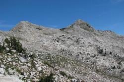
Pfeiferhorn Peak
Provo, Utah
14.0 miles SAn easily accessible Wasatch peak east of Salt Lake City with alpine lakes below and mountain goats spotted regularly above — breathtaking views of the Salt Lake valley from one of the range's highest points.
Backpack, Hike
Lisa Falls
Sandy, Utah
14.3 miles SA shaded granite climbing area in Little Cottonwood Canyon with polished friction faces, clean cracks, juggy overhangs, and a roaring waterfall that keeps the atmosphere cool and energizing.
Hike, Rock Climb 0.7 mi
Great White Icicle
Sandy, Utah
14.6 miles SAn ice climb in winter and a waterfall rappel in summer just outside Salt Lake City — the Great White Icicle in Little Cottonwood Canyon offers four shelves of ice and a bucket-list 4-to-5-hour ascent for all seasons.
Hike, Rock Climb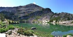
Cecret (Secret) Lake
Alta, Utah
14.8 miles SA short, easy alpine hike through Albion Basin meadows in Little Cottonwood Canyon leads to a beautiful mountain lake everyone can enjoy.
Hike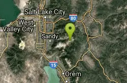
Sugarloaf Peak
Alta, Utah
15.1 miles SAn easily reached 11,000-foot Wasatch summit overlooking Albion Basin, Secret Lake, and Alta ski resort — one of the easiest of the Wasatch 11ers with a high trailhead and gentle terrain.
Hike
American Fork Twin Peaks
Provo, Utah
15.8 miles SA high-elevation, intermediate-friendly peak scramble that doubles as a gateway to multi-summit ridge traverses — offering sweeping views over Snowbird ski resort from the alpine ridge.
Hike 1.1-4.7 mi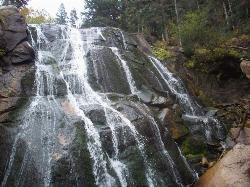
Bells Canyon
Sandy, Utah
15.9 miles SA 4.5-mile moderate hike up to a canyon waterfall through gorgeous fall foliage, meadows, wildflowers, and a creekside trail — the last 1.2 miles involve serious climbing over large rocks.
Backpack, Hike, Mountain Bike, Snowshoe


