


136 Hiking Trails near Shadow Mountain Trail
first prev 1 2 3 4 5 6 7 next lastShowing Hiking Trails within 50 miles Distance miles of 2601 E Acoma Dr, Phoenix, AZ 85032, USA City, Zip, or Address
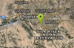
Corona Loop
Phoenix, Arizona
20.1 miles SThis is a good hike, take plenty of water and a map or gps would be a very good ideal. I went up the day after we got over a inch of rain so lot of places were washed out. i looked like...
Hike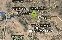
Corona de Loma Trail
Phoenix, Arizona
20.4 miles Squick climb to the top of Buena Vista lookout. Great view of the east vally
Hike
Telegraph Pass Trail
Phoenix, Arizona
20.9 miles STelegraph Pass Trail is a 2.3 mile beginner friendly, out-and-back trail in South Mountain Park in Phoenix. The first third or so of Telegraph Trail is paved, making it wheelchair...
Hike 6.1 mi
Goat Hill via Telegraph Pass Trail
Phoenix, Arizona
20.9 miles SThe views from the top of Goat Hill are awesome on a clear day as you can enjoy a 360 view. Telegraph Trail is kind of a sidewalk part of the after that a little bit rocky until you reach the summit...
Hike 12.6 mi
National Trail
Phoenix, Arizona
21.0 miles SNational Trail is the gem of South Mountain and home to the infamous Waterfall. It’s a local favorite as well as a destination trail for MTB snowbirds. Like most trails in the Sonoran...
Hike, Mountain Bike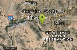
Alta Trail And Bajada Trail
Phoenix, Arizona
21.1 miles SHike near Phoenix, Arizona
Hike 1.5 mi
The Saddle
Mesa, Arizona
21.2 miles ESaddle trail is an intermediate mountain biking trail that connects to the greater Hawes trail network. The trail is 1.5-2mi long and it offers beautiful views of the neighboring Salt River and Red...
Hike, Mountain Bike 7.5 mi
Hawe's Loop
Mesa, Arizona
21.2 miles EMost of the trails in the Phoenix metropolitan area were originally built by mountain bikers, and the Hawe's loop trail system and trail are no exeptions. This trail features fantastic...
Hike, Mountain Bike
Desert Trails Bike Park
Mesa, Arizona
21.4 miles SEHike and Mountain Bike near Mesa, Arizona
Hike, Mountain Bike 2.1 mi

Lower Salt River Nature Trail
Fort McDowell, Arizona
21.7 miles EThe Lower Salt River Nature Trail is a scenic walk to take at the Tonto National Forest. This trail provides stunning views as you walk alongside the Salt River. This rustic trail is older and less...
Camp, Hike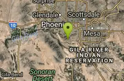
South Mountain Pyramid Trail
Phoenix, Arizona
22.2 miles SHike near Phoenix, Arizona
Hike
Pyramid Trail
Phoenix, Arizona
22.2 miles SHike near Phoenix, Arizona
Hike 8.3 mi
Estrella Mountains Competitive Track
Tolleson, Arizona
24.1 miles SWThe third competitive track in the Maricopa County Regional Park system, located in Estrella Mountain Regional Park, was completed in February 2000. The track consists of two loops totaling 13 miles....
Hike, Horseback, Mountain Bike
Riparian Preserve at Water Ranch Trail
Gilbert, Arizona
24.3 miles SEThe Riparian Preserve is an urban park with a series of loop trails surrounding seven ponds stocked with fish and birds. It is located at 2757 E. Guadalupe Road, Gilbert AZ. Several...
Canoe, Hike
Buckhorn Campground Nature Trail
Apache Junction, Arizona
25.5 miles SECamp and Hike near Apache Junction, Arizona
Camp, Hike
Baseline Trail
Goodyear, Arizona
25.7 miles SWThe Baseline trail is a 2.6 mile loop at Estrella Mountain Regional Park. This listing is based on access from a spur trail (33.378981, -112.371072) off of the Gila trail. Access is...
Hike 1.5 mi
Moon Rock Loop
Apache Junction, Arizona
26.0 miles SELocated within the larger Usery Mountain Regional Park, the Moon Rock loop is a fast and smooth trail that adds 1.3 miles to the more famous Blevins Trail. Although the Moon Rock loop is not known as...
Hike, Horseback, Mountain Bike 1.7 mi
Levee Trail
Mesa, Arizona
26.1 miles SELocated within the Usery Mountain Regional Park, the Levee trail is named so because it mostly follows the top of levee, running parallel to a large section of the channel trail and a Phoenix...
Hike, Horseback, Mountain Bike 3.9 mi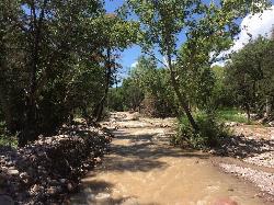
Cave Creek Swimming Hole
Cave Creek, Arizona
26.1 miles NHidden along Cave Creek Trail #4 is a swimming hole deep enough to refresh from the summer heat. It takes almost four miles of hiking in Arizona desert to reach the swimming hole, but the water is...
Hike, Swim 13.8 mi
Butterfield to Gadsen Loop Trail
Goodyear, Arizona
26.2 miles SWAs with other trails in Estrella, the trail is wide and the surface tends to be rather benign, varying from mostly smooth, to occasionally strewn with small rocks, sandy in the washes. Butterfield...
Hike, Horseback, Mountain Bike


