


69 Hiking Trails near South Bass Trail
first prev 1 2 3 4 next lastShowing Hiking Trails within 50 miles Distance miles of South Bass Trail near Supai, Arizona City, Zip, or Address

North Bass Trail
North Rim, Arizona
10.6 miles NA remote North Rim backcountry trail reached via a network of forest service roads, descending to Swamp Point on the Powell Plateau in Grand Canyon NP.
Backpack, Camp, Hike 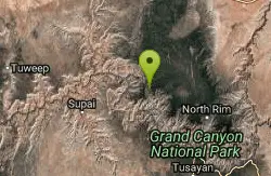
Powell Plateau Trail
North Rim, Arizona
10.6 miles NA rewarding plateau-top day hike or backpack to a remote North Rim plateau, where hikers with enough water can wander for days visiting rim overlooks and hidden draws.
Backpack, Camp, Hike 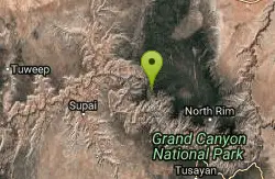
North Bass Trail to Muav Cabin
North Rim, Arizona
10.6 miles NA backcountry hike to Muav Cabin on the North Bass Trail in the Grand Canyon's remote North Rim.
Backpack, Hike 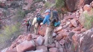
Hermit Trail
Grand Canyon Village, Arizona
12.5 miles SEA strenuous, less-crowded Grand Canyon backpacking trail with 2,000 feet of descent in the first 2.5 miles, Cathedral stairs, Redwall cliffs, and fossilized animal tracks.
Backpack, Camp, Hike 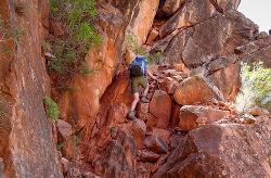
Boucher Trail
Grand Canyon Village, Arizona
12.5 miles SEA remote 17.7-mile out-and-back trail to the Colorado River at the base of the Grand Canyon — recommended for very experienced adventurers only, best March through October.
Backpack, Hike 
Hermit's Rest Viewpoint to Santa Maria Spring
Grand Canyon Village, Arizona
12.5 miles SEThe Hermit Trail to Santa Maria Spring is a rugged, uncrowded Grand Canyon South Rim hike with steep switchbacks and huge views.
Backpack, Hike 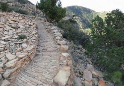
Hermit's Rest Viewpoint to Tonto Trail to Bright Angel Trail
Grand Canyon Village, Arizona
12.5 miles SEA multi-day Grand Canyon backpacking route crossing the Tonto Trail from Hermit's Rest to Bright Angel — spectacular inner canyon views with limited water sources and 3,000-foot rim access by foot only.
Backpack, Camp, Hike 
Hermits Rest Viewpoint to Dripping Springs Trail
Grand Canyon Village, Arizona
12.5 miles SEThe hike to Dripping Springs via the Hermit Trail is a rugged, uncrowded Grand Canyon South Rim trek to a fern-fringed spring overhang.
Backpack, Hike 7.7 mi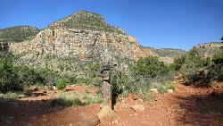
Waldron Trail
Grand Canyon Village, Arizona
12.5 miles SEA short but demanding 4.9-mile Grand Canyon hike branching off Hermit Trail, packed with views and adventure — bring a water treatment kit and prepare for dehydration, flash flooding, and overexertion.
Hike 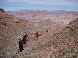
Boucher Trail to Hermit Trail Loop
Grand Canyon Village, Arizona
12.5 miles SEA demanding 3–4 day backpacking loop on the Grand Canyon's South Rim — even seasoned hikers consider the Boucher Trail the most difficult and hazardous South Rim route.
Backpack, Camp, Hike 
Rainbow Rim Trail - North Rim of the Grand Canyon
North Rim, Arizona
13.8 miles NSweet Grand Canyon singletrack through ponderosa and aspen forest with great views — doable for almost any rider on this North Rim gem.
Hike, Mountain Bike 8.4 mi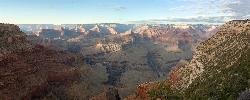
Grand Canyon Rim Village to Hermits Rest
Grand Canyon Village, Arizona
15.6 miles SEA bus-accessible, kid-friendly trail from the Grand Canyon Rim Village to the historic 1914 Hermits Rest cabin — featuring stunning river views, wildflowers, wildlife, and a gift shop and snack bar at the end.
Backpack, Hike 4.9 mi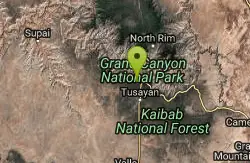
Bright Angel Trail to Tonto Trail
Grand Canyon Village, Arizona
15.6 miles SEA rugged 12.4-mile point-to-point through Grand Canyon's inner gorge on the South Kaibab–Tonto Trail corridor, with over 3,000 feet of elevation gain — advanced hikers only.
Backpack, Camp, Hike 1.5-9.8 mi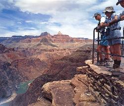
The Bright Angel Trails
Grand Canyon Village, Arizona
15.6 miles SEMultiple Bright Angel Trail routes range from a 5.4-mile out-and-back to the Three-Mile Resthouse to a 19-mile trek to the river, with the 12.4-mile South Kaibab–Tonto–Bright Angel point-to-point offering over 3,000 feet of Grand Canyon grandeur.
Backpack, Camp, Hike, Horseback 4.5 mi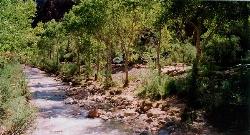
Bright Angel Trail to Bright Angel Campground and River Trail
Grand Canyon Village, Arizona
15.7 miles SEThe Bright Angel Trail is the Grand Canyon's most storied hike — South Rim to the Colorado River past tunnels, pictographs, Havasupai Gardens, and the Devil's Corkscrew.
Backpack, Camp, Hike, Rock Climb 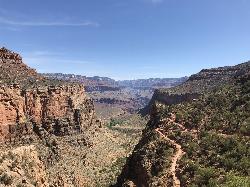
Bright Angel Trail to Three-Mile Rest house
Grand Canyon Village, Arizona
15.7 miles SEA steep 5.4-mile out-and-back trail descending into the Grand Canyon with 360-degree canyon views and extreme switchbacks — water and pit toilets at the Three-Mile Resthouse turnaround point.
Backpack, Camp, Hike 
South Rim Visitor Center Trail
Grand Canyon Village, Arizona
16.4 miles SEA short, well-marked connector trail near the South Rim Visitor Center of Grand Canyon National Park, leading to a nearby restaurant with rock and geological timeline markers along the way — great for kids.
Hike 
Bill Hall Trail
North Rim, Arizona
17.2 miles NBill Hall Trail offers a rugged North Rim descent into the Grand Canyon — a serious route for experienced hikers seeking solitude on the Arizona strip side.
Hike 0.6 mi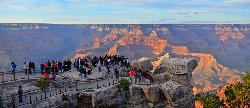
Mather Campground Trail
Grand Canyon Village, Arizona
17.3 miles SEA 1-mile connector trail adjacent to Mather Campground on the Grand Canyon South Rim — flat and easy for biking, running, or walking with pets on leash; campground has RV options nearby.
Camp, Hike, Mountain Bike 
Widforss Trail - Short Option
North Rim, Arizona
17.6 miles EA short option on the Widforss Trail at the Grand Canyon's North Rim — a scenic rim hike with views into the canyon.
Hike


