


7 Hiking Trails near Stockton Skatepark
first prev 1 next lastShowing Hiking Trails within 50 miles Distance miles of Stockton Skatepark near Stockton, California City, Zip, or Address
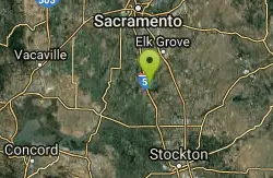
Cosumnes River Preserve
Galt, California
19.1 miles NA 45,859-acre wildlife habitat and agricultural preserve centered on the Cosumnes River near Galt — supporting Pacific Flyway migrating birds and varied riparian habitats.
Canoe, Hike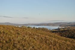
New Hogan Lake
Valley Springs, California
29.3 miles NENew Hogan Lake is a 4,400-acre reservoir tucked into the golden Sierra Nevada foothills of Calaveras County, California, about 30 miles northeast of Stockton near the little town of Valley Springs....
Backpack, Camp, Hike, Swim
Paradise Beach
Sacramento
40.1 miles NA free sandy beach on an oxbow bend of the American River in Sacramento's River Park neighborhood, reached on foot over the levee from Glenn Hall Park and open sunrise to sunset.
Hike, Swim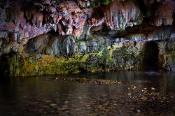
Natural Bridges
Sonora, California
45.7 miles EA free 250-foot limestone cavern on Coyote Creek near Sonora where you can float or swim through deep pools in summer — just avoid touching the limestone walls.
Hike, Swim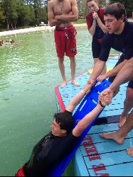
Cull Canyon Swim Complex
Castro Valley
45.8 miles SWA fenced, lifeguarded 1.5-acre chlorinated swim lagoon with a sand beach in Cull Canyon Regional Recreation Area, Castro Valley. Seasonal, with a $5 adult fee and early capacity limits on weekends.
Hike, Swim 3.8 mi
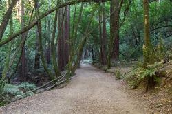
East Ridge Trail
Oakland, California
47.8 miles WA wide, gentle ridge trail weaving through Oakland's redwood-covered hills to a waterfall — accessible all year with ladder bug clusters in the trees each winter.
Hike
Quarry Lakes Regional Recreation Area (Niles Beach)
Fremont, California
48.4 miles SWLifeguarded sand beach on Horseshoe Lake at Quarry Lakes Regional Recreation Area in Fremont, a 471-acre East Bay park of former gravel pits turned swimming and fishing lakes.
Hike, Kayak, Mountain Bike, Swim


