


Paradise Beach
Sacramento

Hike and Swim
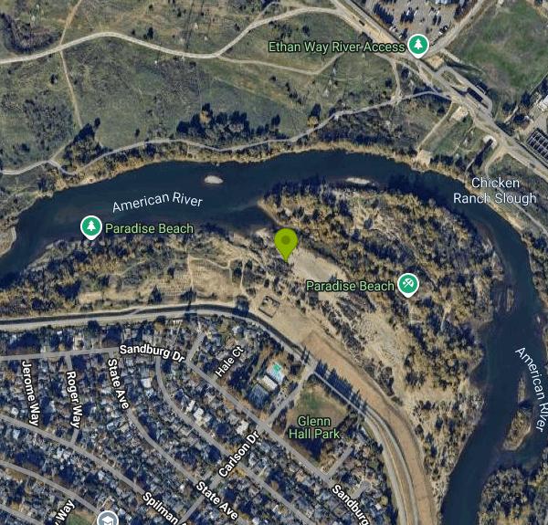
Paradise Beach is a sandy river beach on the lower American River in Sacramento's River Park neighborhood, a short distance downstream of the Sacramento State campus. It is one of the river access sites of the American River Parkway and is run by Sacramento County Regional Parks, which describes it as a cove formed where the river swings through an oxbow bend. The land itself came to the City of Sacramento in 1950, when the developers of River Park sold the riverbank outside the levee to the city for public use, and the beach has drawn swimmers, families and dog owners ever since.
The beach sits on the river side of the levee behind Glenn Hall Park, a 7.08-acre City of Sacramento park at 5415 Sandburg Drive. From U.S. 50, take the Howe Avenue exit north, turn left on Fair Oaks Boulevard, then right on Carlson Drive; the county gives the access point as the corner of Carlson and Sandburg Drives. Park in the Glenn Hall Park lot or on the neighborhood streets, walk over the levee and down to the sand. Entry is on foot only and there is no fee. The county lists the beach as open every day of the year from sunrise to sunset.
The swim area is the sandy inside of the bend, where the water near shore is calmer than the main channel. Swimming happens at your own risk: there are no lifeguards on the river, and the county points people who want supervised swimming to the city-run Glenn Hall Pool next door. The American River here carries water released from Folsom and Nimbus dams upstream, so it runs cold and its speed and depth change with the release schedule. Stay close to shore unless you are a strong swimmer, and expect the beach to be partly or fully under water after heavy rain or high spring flows. Alcohol is prohibited at Paradise Beach all year.
Children under 13 are required by city and county ordinance to wear a life preserver in public waterways. The county keeps a Kids Don't Float loaner station at Paradise Beach stocked with children's life vests that can be borrowed for free and returned on the way out. Dogs are a common sight on the sand, but they must be leashed on the parkway.
Glenn Hall Park, on the other side of the levee, has the restrooms, a fenced playground, picnic tables with a barbecue, tennis courts, ball fields and the public pool. Trails run along the riverbank from the beach, and the paved Jedediah Smith Memorial Trail passes nearby on its way between Folsom Lake and Discovery Park. Outside the swim season, anglers fish from the shore for striped bass, salmon and trout under state fishing rules, and birders work the cottonwoods and willows along the bank. Levee work by the U.S. Army Corps of Engineers has removed many trees along this stretch of riverbank, so the shoreline is more open than it once was.
More Information
American River Parkway
The American River Parkway Plan contains:
https://regionalparks.saccounty.gov/content/regionalparks/us/en/parks/american-river-parkway.htmlAmerican River Parkway - Wikipedia
38°37′N 121°18′W / 38.62°N 121.3°W
https://en.wikipedia.org/wiki/American_River_ParkwayGlenn Hall Park
A local park for recreation, get-togethers, and other activities.
https://www.cityofsacramento.gov/ypce/parks/park-directory/g-h/glenn-hall-parkGlenn Hall Park & Pool
Glenn Hall Park Take advantage of the wonderful facilities of Glenn Hall Park, right here in our neighborhood! The park offers swimming, two lighted tennis courts, a baseball field, two full size s…
https://riverparksacramento.org/community/glen-hall-park-pool/Life Preserver FAQs
All too often, safety officials have reported that many near accidents and fatalities along the rivers in the Sacramento area could have been avoided if the victim had been wearing a life preserver. This ordinance is intended to bring about a higher level of public awareness and that personal flotation devices, when used properly, save lives. This law is intended to motivate adults to be more diligent in protecting children while in public waterway recreation areas and swimming areas in general.
https://regionalparks.saccounty.gov/content/regionalparks/us/en/rangers/life-preserver-faqs.htmlParadise Beach
Paradise Beach is located near California State University, Sacramento, on a oxbow bend in the river which creates a cove where cautious swimmers and skimmers can play. The park is a popular destination for swimming families and young adults.
https://regionalparks.saccounty.gov/content/regionalparks/us/en/parks/american-river-parkway/paradise-beach.htmlRiver Park, Sacramento, California - Wikipedia
River Park is a neighborhood in Sacramento, California about four miles east of downtown bounded to the north and east by a sweeping bend in the American River and to the west and south by a historic railroad line and H Street. The neighborhood is essentially a large cul-de-sac, two miles deep, with just two entrances one block apart on H Street.
https://en.wikipedia.org/wiki/River_Park,_Sacramento,_CaliforniaSacramento’s Locally Loved Little Beach Is A Sandy Cove To Swim, Fish, And Picnic - Islands
To escape the city, Sacramento locals head to this sandy beach to lounge in the sun and cast a line, away from the crowds on California’s coast.
https://www.islands.com/2124837/sacramento-california-local-loved-paradise-beach-sandy-cove-swim-fish-picnic/Water Safety
Summer is here and the river is calling your name. It’s time to grab your friends and head out to the water. Visiting Sacramento County public waterways, rivers and lakes is such an excellent way to cool off and enjoy the outdoors.
https://regionalparks.saccounty.gov/content/regionalparks/us/en/rangers/water-safety.htmlBe courteous, informed, and prepared. Read trailhead guidelines, stay on the trail, and don't feed the wildlife.
Read More
- Plan Ahead and Prepare
- Travel & camp on durable surfaces
- Dispose of waste properly
- Leave what you find
- Minimize campfire impacts
- Respect wildlife
- Be considerate of other visitors
Directions
From Sacramento
- Head north on 10th St toward Kayak Alley (0.2 mi)
- Turn right onto J St (1.6 mi)
- Turn left onto Alhambra Blvd (0.2 mi)
- Turn right onto H St (2.0 mi)
- Turn left onto Carlson Dr (1.0 mi)
- Turn left onto Sandburg Dr (449 ft)
- Turn right onto Hale Ct (328 ft)


Other Swimming Holes and Hiking Trails Nearby
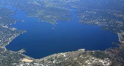
Granite Bay Main Beach
Granite Bay, California
19.3 miles NEThe largest sand beach on Folsom Lake, guarded in summer, twenty five minutes from downtown Sacramento at the end of Douglas Boulevard.
Canoe, Hike, Kayak, Swim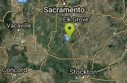
Cosumnes River Preserve
Galt, California
21.9 miles SA 45,859-acre wildlife habitat and agricultural preserve centered on the Cosumnes River near Galt — supporting Pacific Flyway migrating birds and varied riparian habitats.
Canoe, Hike
American River Confluence
Auburn, California
31.1 miles NEThe Confluence — where the North and Middle Forks of the American River meet below Foresthill Bridge — is Auburn's favorite swimming and rafting hub.
Hike, Horseback, Kayak, Rock Climb, Swim, Whitewater 1.2-2.7 mi
Lake Clementine Trail Loop
Auburn, California
31.2 miles NEFour connected trails loop around Lake Clementine on the North Fork American River — wheelchair accessible, pet friendly, and great for fishing, camping, and family summer outings.
Camp, Canoe, Hike, Kayak, Mountain Bike, Swim 5.6 mi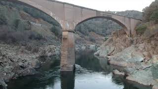
Quarry Trail
Cool, California
31.6 miles NEA riverside hike along an old limestone railway line to a dramatic amphitheater quarry — wildflowers peak April through June, and the historic railway story (scrap metal for WWII) adds a fascinating layer.
Hike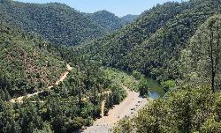
Upper Lake Clementine
Auburn
36.0 miles NEA cobble beach at the head of Lake Clementine in Auburn State Recreation Area, reached by a steep dirt road off Foresthill Road. $10 per vehicle, open mid-April to mid-October, with weekend reservations required in summer.
Canoe, Kayak, Swim
Sutter National Wildlife Refuge
Meridian, California
39.0 miles NWA 2,600-acre Sacramento Valley wildlife refuge 50 miles north of Sacramento, managing wetland impoundments and riparian habitat as critical wintering grounds for waterfowl.
Hike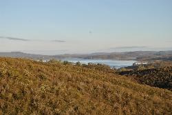
New Hogan Lake
Valley Springs, California
43.5 miles SENew Hogan Lake is a 4,400-acre reservoir tucked into the golden Sierra Nevada foothills of Calaveras County, California, about 30 miles northeast of Stockton near the little town of Valley Springs....
Backpack, Camp, Hike, SwimNearby Campsites
Lake Clementine Trail Loop
Auburn, California
31.2 miles NEFour connected trails loop around Lake Clementine on the North Fork American River — wheelchair accessible, pet friendly, and great for fishing, camping, and family summer outings.
Camp, Canoe, Hike, Kayak, Mountain Bike, Swim
New Hogan Lake
Valley Springs, California
43.5 miles SENew Hogan Lake is a 4,400-acre reservoir tucked into the golden Sierra Nevada foothills of Calaveras County, California, about 30 miles northeast of Stockton near the little town of Valley Springs....
Backpack, Camp, Hike, Swim


