


Satwiwa Loop Trail
Westlake Village, California
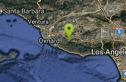
| GPS: |
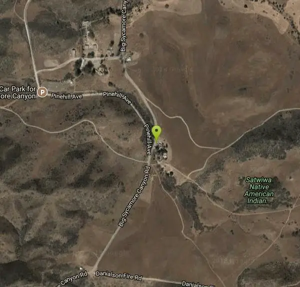
34°9'3.0"N 118°57'42.0"W Maps | Directions |
| State: | California |
Hike
Satwiwa Loop Trail is an easy, 2.5 mile hike in the Santa Monica Mountains National Recreation Area that will take about 1.5 hours to complete with Fido. This picturesque hike is close to the city but will have you feeling like you entered a different world. The trail offers some of the best opportunities around to see roadrunners, prairie falcons, hawks, rabbits, deer, and coyote.
More Information
Be courteous, informed, and prepared. Read trailhead guidelines, stay on the trail, and don't feed the wildlife.
Read More
- Plan Ahead and Prepare
- Travel & camp on durable surfaces
- Dispose of waste properly
- Leave what you find
- Minimize campfire impacts
- Respect wildlife
- Be considerate of other visitors
Directions
From Westlake Village, California
- Head southeast on Agoura Rd toward Lindero Canyon Rd (489 ft)
- Turn left at the 1st cross street onto Lindero Canyon Rd (453 ft)
- Keep left to stay on Lindero Canyon Rd (0.2 mi)
- Merge onto US-101 N/Ventura Fwy via the ramp to Ventura (5.6 mi)
- Take exit 45 for Lynn Rd (0.3 mi)
- Turn left onto Lynn Rd (4.6 mi)
- Turn left onto S Reino Rd (0.2 mi)
- Continue straight onto Potrero Rd (0.4 mi)
- Turn left onto Big Sycamore Canyon RdRestricted usage roadDestination will be on the left(0.4 mi)
From Highway 101/Ventura Freeway in Newbury Park, exit on Wendy Drive. Drive 2.5 miles south to Lynn Road and turn right. Continue a mile or so, then just past Reino road turn left into Rancho Sierra Vista/Satwiwa Park on the left side of the road. (Courtesy of localhikes.com)
Other Hiking Trails Nearby
Arroyo Sequit Park
Malibu, California
5.9 miles SEA perennial stream, loop trail, rocks, and wildflower-covered meadows make Arroyo Sequit one of the western Santa Monica Mountains' most beautiful and ecologically rich parks.
Hike, Horseback
Point Dume State Beach
Malibu, California
13.4 miles SEHeadlands, rocky coves, a quiet beach, gray whale watching from December to April, an easy coastal hike to sweeping views, and a fun Iron Man movie cameo — all at Point Dume in Malibu.
Dive, Hike, Rock Climb, Swim
Malibu Creek State Park
Calabasas, California
13.7 miles EJust 25 miles from downtown LA, 15 miles of streamside trail wind through oak and sycamore woodlands in a park with rich Chumash history and film location fame.
Camp, Hike, Horseback, Mountain Bike, Rock Climb 0.3-1.0 mi
Rock Pool
Agoura Hills, California
13.7 miles EA river-fed swimming hole deep in Malibu Creek State Park, ringed by forest and rock formations — reach it via a short level path from the Visitor Center or a scenic 2-mile out-and-back from the campsite.
Camp, Hike, Swim
Carpinteria State Beach
Carpinteria, California
35.9 miles NWTwelve miles south of Santa Barbara, a mile of clean swimming beach with year-round lifeguards, stellar tidepools, seal and whale sightings, and campsite access to hiking trails and town.
Camp, Hike, Swim
Hollywood Sign on Mt. Lee
Los Angeles, California
36.6 miles EThe iconic Hollywood Sign sits on the southern slope of Mount Lee in Griffith Park, best viewed driving north up Gower Street or along Beachwood Drive.
Hike
Elysian Park
Los Angeles, California
41.7 miles EA sprawling municipal park in Central Los Angeles encompassing Chavez Ravine and Dodger Stadium's neighborhood — green space and open land in the heart of the city.
Hike
Fish Creek
Lake Hughes, California
42.2 miles NEA super-deep upper pool and a lower pool about 5 feet deep, with a slideable waterfall — plus some higher jump spots for those willing to do a bit of rock climbing.
Hike, Rock Climb, Swim
Switzer Falls
Los Angeles-Long Beach-Santa Ana, CA, California
46.8 miles EA relatively easy hike into a spectacular San Gabriel canyon where the stream meanders under oaks and alder, cascades over granite into mirror pools, and passes above the 50-foot Switzer Falls.
Hike
Sam Merrill Trailhead
Altadena, California
47.8 miles EA historically significant San Gabriel Mountain trail built in the 1930s climbs through Las Flores Canyon to the top of Echo Mountain, once home to the Mount Lowe Railway.
Hike 1.2 mi
Seven Falls and Three Pools
Santa Barbara, California
47.9 miles NWA steep four-mile round trip leads to Seven Falls, then the cool, waterfall-fed Three Pools — with a natural waterslide when spring flows run high.
Hike, SwimNearby Campsites
Malibu Creek State Park
Calabasas, California
13.7 miles EJust 25 miles from downtown LA, 15 miles of streamside trail wind through oak and sycamore woodlands in a park with rich Chumash history and film location fame.
Camp, Hike, Horseback, Mountain Bike, Rock Climb 0.3-1.0 mi
Rock Pool
Agoura Hills, California
13.7 miles EA river-fed swimming hole deep in Malibu Creek State Park, ringed by forest and rock formations — reach it via a short level path from the Visitor Center or a scenic 2-mile out-and-back from the campsite.
Camp, Hike, Swim
Carpinteria State Beach
Carpinteria, California
35.9 miles NWTwelve miles south of Santa Barbara, a mile of clean swimming beach with year-round lifeguards, stellar tidepools, seal and whale sightings, and campsite access to hiking trails and town.
Camp, Hike, Swim


