


Carpinteria State Beach
Carpinteria, California

| GPS: |
34°23'30.8"N 119°31'13.1"W Maps | Directions |
| State: | California |
Restrooms Picnic Tables
Camp, Hike, and Swim
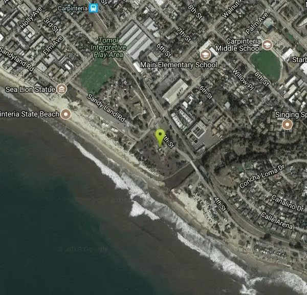
Twelve miles south of Santa Barbara, Carpinteria State Beach offers a mile of beach for swimming, surf fishing, tidepool exploring and camping. The Spanish named the area Carpinteria because of the Chumash tribe, who lived in the area, had a large seagoing canoe-building enterprise, or "carpentry shop" there. The tribe had chosen the location because of naturally occurring surface tar which was used to seal the boats. Seals and sea lions can be seen in the area December through May, as well as an occasional gray whale. Tidepools contain starfish, sea anemones, crabs, snails, octopi and sea urchin.
Carpinteria Beach is a clean beach with fantastic staff. Lifeguards patrol the beach year-round and are staffed from Memorial Day weekend to Labor Day weekend. Camping at this beach is a peaceful getaway where you are within walking distance to town so there is no need to drive. It's close enough to shopping places in case you need anything. There are group sites, family sites, and RV sites with full hookups. The campground is in excellent proximity to the beach and the hiking trail. You'll wake up to the waves crashing right by your "backdoor"! Explore the tar pits, tidepools, and the bluffs as well as learn about the local history at the nearby visitors center. Carpinteria Beach has breathtaking sunsets and isn't typically crowded due to the number of campsites available.
NOTE: It's best to reserve a camping spot ahead of time because they go fast and you're not likely to get one at the last minute.
More Information
Be courteous, informed, and prepared. Read trailhead guidelines, stay on the trail, and don't feed the wildlife.
Read More
- Plan Ahead and Prepare
- Travel & camp on durable surfaces
- Dispose of waste properly
- Leave what you find
- Minimize campfire impacts
- Respect wildlife
- Be considerate of other visitors
Directions
From Carpinteria, California
- Head northeast on Linden Ave toward Carpinteria Ave (30 ft)
- Turn right at the 1st cross street onto Carpinteria Ave (0.2 mi)
- Turn right onto Palm Ave (0.4 mi)
- Palm Ave turns right and becomes Sandy Land Rd (200 ft)
- Turn left onto Palm Ave (0.1 mi)
- Turn right onto 4th StDestination will be on the right(259 ft)
The park is off U.S. 101, twelve miles south of Santa Barbara. Exit at Casitas Pass Road, travel West on Casitas Pass Road to Carpinteria Avenue, make a right at the signal; then turn left on Palm. The beach is at the end of Palm Avenue.


Other Swimming Holes and Hiking Trails Nearby

Seven Falls and Three Pools
Santa Barbara, California
12.0 miles NWA steep four-mile round trip leads to Seven Falls, then the cool, waterfall-fed Three Pools — with a natural waterslide when spring flows run high.
Hike, Swim
Red Rock
Santa Barbara County, California
14.7 miles NWTall red and white rock walls, deep water, and cliffs to jump from along the Santa Ynez River — weekdays are quieter and rocky spots sit right at the water's edge.
Hike, Swim
White Rock
Santa Barbara, California
19.3 miles NWA deep, cool swimming hole with low rocks for jumping on the Santa Ynez River, with an oak-shaded picnic area and restrooms just a short walk away.
Swim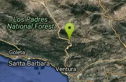
Sespe Gorge
Maricopa, California
19.7 miles NEMultiple swimming holes along the Sespe and Bear Creek junction, about 4.5 miles in, with good shade and a small camping area tucked into the canyon.
Swim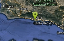
Ellwood Main Monarch Butterfly Grove
Goleta, California
21.2 miles WA free, no-admission butterfly grove in Goleta where Monarch butterflies migrate November through February, adjacent to 137 acres of open space trails with beach access.
Hike
Punchbowls
Santa Paula, California
26.7 miles EA series of beautiful swimming holes in Santa Paula Canyon, 3.5 miles from the trailhead, featuring a 25-foot waterfall and natural river slides of varying speeds above.
Swim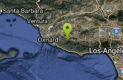
Satwiwa Loop Trail
Westlake Village, California
36.0 miles SEAn easy 2.5-mile loop in the Santa Monica Mountains perfect for wildlife watching — roadrunners, prairie falcons, hawks, rabbits, deer, and coyotes all call this trail home.
Hike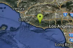
Arroyo Sequit Park
Malibu, California
41.7 miles SEA perennial stream, loop trail, rocks, and wildflower-covered meadows make Arroyo Sequit one of the western Santa Monica Mountains' most beautiful and ecologically rich parks.
Hike, Horseback
Point Dume State Beach
Malibu, California
48.8 miles SEHeadlands, rocky coves, a quiet beach, gray whale watching from December to April, an easy coastal hike to sweeping views, and a fun Iron Man movie cameo — all at Point Dume in Malibu.
Dive, Hike, Rock Climb, Swim
Malibu Creek State Park
Calabasas, California
49.5 miles SEJust 25 miles from downtown LA, 15 miles of streamside trail wind through oak and sycamore woodlands in a park with rich Chumash history and film location fame.
Camp, Hike, Horseback, Mountain Bike, Rock Climb 0.3-1.0 mi
Rock Pool
Agoura Hills, California
49.6 miles SEA river-fed swimming hole deep in Malibu Creek State Park, ringed by forest and rock formations — reach it via a short level path from the Visitor Center or a scenic 2-mile out-and-back from the campsite.
Camp, Hike, SwimNearby Campsites
Malibu Creek State Park
Calabasas, California
49.5 miles SEJust 25 miles from downtown LA, 15 miles of streamside trail wind through oak and sycamore woodlands in a park with rich Chumash history and film location fame.
Camp, Hike, Horseback, Mountain Bike, Rock Climb 0.3-1.0 mi
Rock Pool
Agoura Hills, California
49.6 miles SEA river-fed swimming hole deep in Malibu Creek State Park, ringed by forest and rock formations — reach it via a short level path from the Visitor Center or a scenic 2-mile out-and-back from the campsite.
Camp, Hike, Swim


