


Monterey Town Beach
Monterey
Canoe, Kayak, and Swim
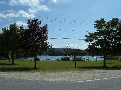
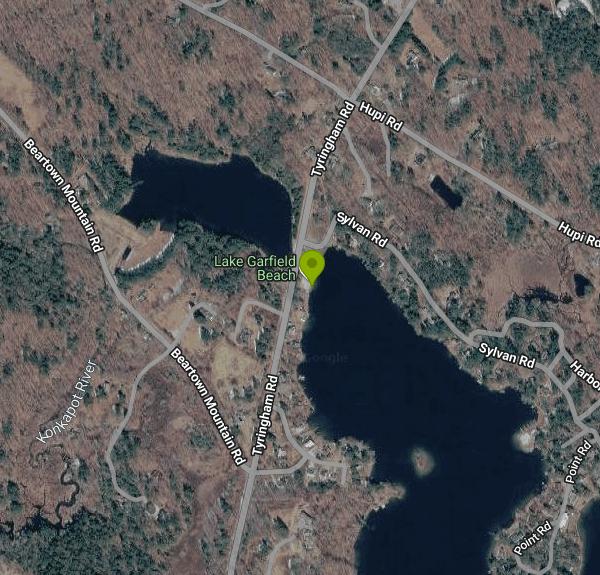
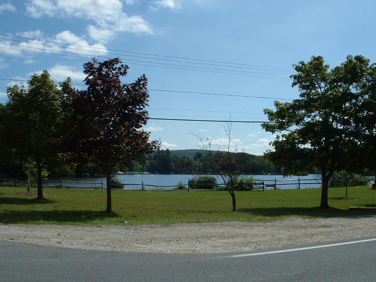
Monterey Town Beach, also called the Lake Garfield town beach, is the municipal swimming beach of the Town of Monterey in the southern Berkshires. It sits on the western tip of Lake Garfield along Tyringham Road (street address 78 Tyringham Road), a little more than half a mile north of the Route 23 village center. The town owns the land, and its Parks Commission runs the beach, the lifeguards and the boat ramp next door. Lake Garfield covers about 275 acres, averages around 16 feet deep and reaches roughly 35 feet at its deepest point. It is the headwater of the Konkapot River, which leaves the lake through a culvert under Tyringham Road right beside the beach.
From Route 23 in Monterey, turn north on Tyringham Road and the beach is on the right after about half a mile, where the road meets Sylvan Road. Parking is the sticking point. The pull-off spaces along Tyringham Road are reserved for Monterey residents showing a current town sticker, and a beach attendant checks. Visitors from out of town are usually directed to a grassy lot just north of the beach. The small gravel lot at the boat ramp holds about 15 cars and has two accessible spaces close to the sand.
The beach itself is a short strip of fine sand that slopes gently into the water, backed by a mowed lawn with picnic tables and a split-rail fence along the road. A swim area is roped off with buoys, and the town sometimes anchors a float about 50 feet out. Certified lifeguards are on duty in summer, typically from noon to 6 pm, and swimming is meant to stay inside the buoy line. There is an accessible portable restroom by the parking area. The posted town rules prohibit dogs, glass, alcohol, fires and inflatables on the beach.
Monterey residents use the beach for free. For the 2026 season the Parks Commission has asked non-residents for a suggested fee of $20 per vehicle per day, payable by phone through a QR code on the entrance signs, to help pay for lifeguards, sand replacement and restroom upkeep. The commission's own minutes describe the fee as voluntary: non-residents may still use the beach if they choose not to pay. Town officials have also stated on the record that this is not a residents-only beach. Organized camps and camp groups are not allowed to use it.
The boat ramp just south of the swim area is closed to launching and retrieving every day from noon to 6 pm, from the last Saturday in June through Labor Day, so trailered boats stay clear of swimmers while the guards are on duty. Outside those hours powerboats, paddlers and anglers share the lake, so swimmers outside the roped area should expect boat traffic. Eurasian watermilfoil grows in parts of the lake, and the town lowers the water level each late fall for flood and weed control, which has no effect on the summer season. Lake Garfield is otherwise ringed by private homes, and the town beach and ramp are the only public shoreline.
Across Tyringham Road, a crosswalk leads to Brewer Pond Park, a small town park with a short wooded loop trail around Brewer Pond. Kayakers can paddle from the lake into the pond through the culvert under the road. Racks for stored kayaks sit across from the beach, but those are assigned to town residents by annual lottery. The lake holds bass, pickerel, perch and stocked trout, and the ramp area is a common ice fishing access point in winter.
More Information

- Plan Ahead and Prepare
- Travel & camp on durable surfaces
- Dispose of waste properly
- Leave what you find
- Minimize campfire impacts
- Respect wildlife
- Be considerate of other visitors
Directions
From Monterey
- Head south on Dutra St toward Madison St (108 ft)
- Turn left onto Madison St (0.1 mi)
- Turn right onto Hartnell St (0.1 mi)
- Turn left onto Webster St (0.1 mi)
- Turn right onto Munras Ave (322 ft)
- Continue straight onto Fremont St (0.6 mi)
- Take the ramp onto CA-1 N (13.5 mi)
- Slight right onto CA-156 E (signs for US-101/
Castroville/ San Jose) (6.2 mi) - Keep left to stay on CA-156 E, follow signs for US-101 N (0.1 mi)
- Slight right to merge onto CA-156 E/
US-101 N toward Hollister/ San Francisco Continue to follow US-101 NPass by Country Kitchen (on the right in 0.4 mi)(48.0 mi) - Take exit 384 for Route 280/
Route 680 toward Downtown/ San Jose/ Sacramento (0.6 mi) - Keep right, follow signs for I-680/
Sacramento and merge onto I-680 N (29.4 mi) - Keep left to stay on I-680 N (20.8 mi)
- Keep left to stay on I-680 N, follow signs for Martinez/
Sacramento Toll road(5.9 mi) - Keep left to continue on I-680Toll road(14.4 mi)
- Take exit 71A to merge onto CA-12 E/
I-80 E toward Fairfield/ Sacramento Continue to follow I-80 E(41.4 mi) - Take the I-80 E exit toward Reno (0.7 mi)
- Continue onto I-80 EPassing through NevadaEntering Utah(650 mi)
- Take the exit onto I-15 S/
I-80 E toward Cheyenne/ Las Vegas (3.2 mi) - Take exit 304 for I-80 E toward Cheyenne (0.6 mi)
- Continue onto I-80 EPassing through WyomingEntering Nebraska(674 mi)
- Take exit 199 toward Brady/
NE-56D (0.3 mi) - Turn left onto NE-56D Link/
S L 56D (2.2 mi) - Turn left onto US-30 E/
I-80 ALT (13.0 mi) - Turn right onto Avenue E/
Lake Ave (0.3 mi) - Turn left onto 4th St (164 ft)
- Turn right onto NE-47 S (0.7 mi)
- Turn left to merge onto I-80 E (233 mi)
- Keep left to stay on I-80 EEntering Iowa(146 mi)
- Keep left to stay on I-80 E (152 mi)
- Take exit 290 for I-280 E/
US-6 E/ US-61 S toward Rock Island/ Moline (0.6 mi) - Continue onto I-280 E/
US-6 E/ US-61 N Continue to follow I-280 EEntering Illinois(26.7 mi) - Continue onto I-80 E (115 mi)
- Keep left (0.8 mi)
- Keep left (0.1 mi)
- Continue straight (5.5 mi)
- Merge onto I-80 EToll road(23.4 mi)
- Keep left to stay on I-80 EToll roadEntering Indiana(23.7 mi)
- Take exit 16 to merge onto I-80 E/
I-90 E Toll roadEntering Ohio(278 mi) - Continue straight onto I-80 EToll road(9.2 mi)
- Take exit 151 to merge onto I-480 E toward Cleveland (9.8 mi)
- Take exit 11 toward Cleveland (0.8 mi)
- Merge onto Berea Fwy (0.5 mi)
- Merge onto I-71 N (7.4 mi)
- Take the exit toward I-90 E (1.1 mi)
- Continue onto I-90 E (14.3 mi)
- Take the exit toward I-90 E (0.4 mi)
- Continue onto I-90 E (2.6 mi)
- Keep left to stay on I-90 EToll roadPassing through PennsylvaniaEntering New York(448 mi)
- Slight right onto Governor Thomas E. Dewey Thruway/
NY State Thruway (signs for I-87 S/ New York/ Boston) (1.0 mi) - Continue onto I-87 S/
Governor Thomas E. Dewey Thruway/ NY State Thruway Toll road(13.6 mi) - Take exit 21A toward I-90 E/
Mass Tpke Toll road(1.0 mi) - Continue onto NY-912M EToll road(6.4 mi)
- Continue onto I-90 EToll roadEntering Massachusetts(28.1 mi)
- Take exit 10 for US-20 EToll road(0.3 mi)
- Turn left onto US-20 E (200 ft)
- Turn right onto MA-102 W (0.1 mi)
- Turn left onto Tyringham Rd (2.5 mi)
- Continue onto Main Rd (3.1 mi)
- Turn right onto Monterey Rd (1.4 mi)
- Continue onto Tyringham RdDestination will be on the left(1.7 mi)
Other Swimming Holes, Canoeing Areas, and Kayaking Areas Nearby

Upper Goose Pond
Lee, Massachusetts
6.8 miles NSwim near Lee, Massachusetts
Swim
Umpachene Falls
New Marlborough, Massachusetts
7.3 miles SWSwim near New Marlborough, Massachusetts
Swim
Buck River
Sandisfield, Massachusetts
7.8 miles SESwim near Sandisfield, Massachusetts
Swim
Green River
Southwick, Massachusetts
8.7 miles WSwim near Southwick, Massachusetts
Swim
Bash Bish Falls
Mount Washington, Massachusetts
15.4 miles WSwim near Mount Washington, Massachusetts
Swim
Hubbard River
Granville, Massachusetts
15.6 miles SESwim near Granville, Massachusetts
Swim
Ore Pit Pond
Copake Falls, New York
16.3 miles WA roped-off quarry swimming area with a diving platform and lifeguards — a classic Taconic-region swim spot in Copake Falls, New York.
Swim
Glendale Falls
Chester, Massachusetts
16.7 miles NESwim near Chester, Massachusetts
Swim
Huntington Area
Granville, Massachusetts
17.7 miles ESwim near Granville, Massachusetts
Swim
Riga Falls
Salisbury, Connecticut
18.1 miles SWRiga Falls is a scenic, little-known waterfall and swimming hole on Wachocastinook Creek in Connecticut's wild Mount Riga Preserve near Salisbury.
Swim
Salmon River
Salisbury, Connecticut
18.1 miles SWSwim near Salisbury, Connecticut
Swim
Granville Gorge
Southwick, Massachusetts
21.2 miles EGranville Gorge is a magical little slice of the southern Berkshire Hills — a lush, green gorge where the Hubbard River carves a series of mini waterfalls and clear swimming holes through the...
Mountain Bike, Swim
Windsor State Forest
Cummington, Massachusetts
24.0 miles NESwim near Cummington, Massachusetts
Swim
Cummington
Cummington, Massachusetts
24.6 miles NEA small, cool pond on the river with a wide sandy beach and a mostly gay social atmosphere — clothing is optional, and parking near Route 9 is limited.
Swim
Satans Kingdom
New Hartford, Connecticut
26.3 miles SESwim near New Hartford, Connecticut
Swim
Nassau Area
Ravena, New York
26.8 miles NWSwim near Ravena, New York
Swim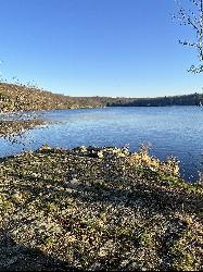
Lake Taghkanic State Park
Ancram
27.0 miles WWest Beach at Lake Taghkanic State Park is a lifeguarded sand beach on a clear 168-acre lake off the Taconic Parkway near Ancram. Summer entry is $10 per car.
Camp, Canoe, Hike, Kayak, Swim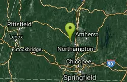
Orange Dam
Northampton, Massachusetts
28.4 miles NESwim near Northampton, Massachusetts
Swim
Bellevue Falls
Adams, Massachusetts
28.8 miles NSwim near Adams, Massachusetts
Swim
Mount Hope Park
Williamstown, Massachusetts
33.8 miles NSwim near Williamstown, Massachusetts
SwimNearby Campsites
Lake Taghkanic State Park
Ancram
27.0 miles WWest Beach at Lake Taghkanic State Park is a lifeguarded sand beach on a clear 168-acre lake off the Taconic Parkway near Ancram. Summer entry is $10 per car.
Camp, Canoe, Hike, Kayak, Swim
South Lake Swimming Area
Haines Falls
42.7 miles WSouth Lake is the western basin of New York's North-South Lake, up on the Catskill Escarpment above Haines Falls, with a rebuilt sand beach, boat rentals and a boardwalk to the water. DEC charges $10 per vehicle at the gate in season.
Camp, Canoe, Hike, Kayak, Swim


