


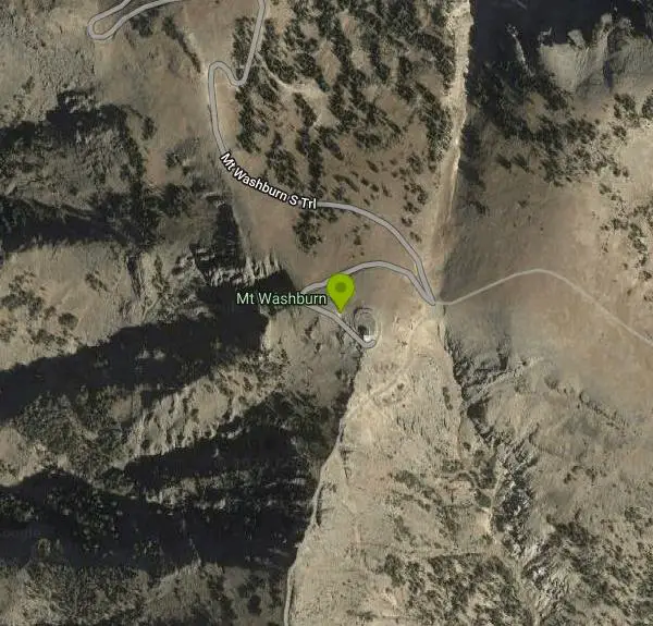
Mount Washburn Bike Trail
Devils Den, Wyoming

| Address: | Mt Washburn, Wyoming 82190, USA |
| GPS: |
44°49'27.5"N 110°26'42.0"W Maps | Directions |
| State: | Wyoming |
| Trails/Routes: | 2.8 mi |
Mountain Bike
Mount Washburn Bike Trail follows Chittenden Service Road for 2.5 miles to the top of Mount Washburn. This steep climb up the mountain provides a challenging elevation gain of 1500 feet. Mount Washburn is a popular hiking destination in Yellowstone, and the Mount Washburn Bike Trail provides an adventurous alternative to hiking, while still providing the sweeping views of Yellowstone from the top.
Mount Washburn Bike Trail is a wide dirt and gravel trail with a couple of switchbacks. It takes an average of two to five hours to complete this trail. Mountain Biker's should be aware of their surroundings as this is a service road and that will have occasion vehicles on it. Mountain bikes are no allowed on any of the nearby hiking trails and must stick to the Chittenden Service Road. Parking is available at the Chittenden Road Parking Area.
Mount Washburn is home to several species of wildlife, including black bears and grizzly bears. Visitors to this area should be on the lookout for wildlife and make sure to keep a safe distance. It is also recommended that visitors to this area carry bear spray with them.
More Information
Never modify trail features. Ride trails when they're dry enough that you won't leave ruts. Speak up when you see others on the trail and always yield to hikers, horses, and others coming uphill. Always ride on the established trail.
Read More- Plan Ahead and Prepare
- Travel & camp on durable surfaces
- Dispose of waste properly
- Leave what you find
- Minimize campfire impacts
- Respect wildlife
- Be considerate of other visitors
Directions
From Devils Den, Wyoming
- Head southeast on Grand Loop RdToll roadMay be closed at certain times or days(6.2 mi)
- Turn left onto Mount Washburn S TrlDestination will be on the left(1.3 mi)

Trails
Distance ?
2.8 milesElevation Gain ?
1,473 feetReal Ascent ?
1,479 feetReal Descent ?
6 feetAvg Grade (6°)
10%Grade (-2° to 11°)
-3% to 19%Elevation differences are scaled for emphasis. While the numbers are accurate, the cut-away shown here is not to scale.
Other Mountain Bike Trails Nearby

Bunsen Peak Loop Bike Trail
Yellowstone National Park, Wyoming
15.7 miles NWBunsen Peak Loop Bike Trail is a challenging trail that follows several service roads around Bunsen Peak. This 10 mile loop has a total elevation change of 1,120 feet, with several miles of the trail...
Mountain Bike
Mammoth/Gardiner Back Road
Mammoth Hot Springs, Yellowstone National Park
16.4 miles NWThe only road open in Yellowstone National Park is Highway 89 at Gardiner, Montana to park Headquarters at Mammoth Hot Springs and from Mammoth Hot Springs to Silver Gate and Cooke City, Montana.
Hike, Mountain Bike 0.9 mi
Old Lake Road Bike Trail
Yellowstone National Park, Wyoming
19.1 miles SNear Lake Hotel in Yellowstone is a old road bed that provides mountain bikers with a beautiful lakeside ride. Old Lake Road Bike Trail is about a mile long trail with parking lots available on...
Mountain Bike 3.8 mi
Abandoned Railroad Bed Bike Trail
Gardiner, Montana
19.5 miles NWThe Abandoned Railroad Bed Bike Trail, otherwise known as Shortline Trail, is a easily accessible bike trail found just inside the North Entrance of Yellowstone National Park. This bike trail follows...
Mountain Bike 2.3 mi
Natural Bridge Trail
Lake Village, Yellowstone National Park
20.3 miles SNatural Bridge Trail is an exciting and easy 2 mile trail to the beautiful rock formation that is Natural Bridge Yellowstone. This Natural Bridge was formed by Bridge Creek as it wore a hole in...
Hike, Mountain Bike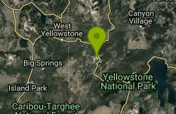
Fairy Creek Trail
Madison, Yellowstone National Park
26.1 miles SWThe trail is well-compacted gravel, of car width. There is absolutely no technical features, it is flat and smooth.This is a ride for all the family, and is about the scenery and...
Mountain Bike 4.0 mi
Fountain Freight Road Bike Trail
26.2 miles SW
Fountain Freight Road Bike Trail is a four mile stretch of paved road along Fairy Falls Trail. This stretch of trail is no longer open to vehicles but allows bikes. Despite being paved, it is...
Mountain Bike 1.2 mi
Old Faithful Lower General Store to Morning Glory Pool Bike Trail
Yellowstone National Park, Wyoming
31.5 miles SWThe biking trail from Old Faithful General Store to Morning Glory Pool is an easy paved bike trail with incredible views of the Upper Geyser Basin and a stunning destination. The trail to Morning...
Mountain Bike 2.6 mi
Lone Star Geyser Trail
Old Faithful, Yellowstone National Park
33.2 miles SWLone Geyser Star Trail is a hiking and mountain biking trail that leads through the forest to the colorful Lone Star Geyser. The Geyser here has beautiful white, yellow and orange colors in the...
Hike, Mountain Bike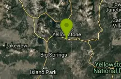
Rendezvous Loop
West Yellowstone, Montana
34.6 miles WGentle rolling hills that wind though tall stands of lodgepole pine and open meadows. Easy ride with great potential for speed.
Mountain Bike
Little Wapiti
Gallatin Gateway, Montana
43.5 miles WThe climb is partially double track. The descent is narrow, at times rocky, singletrack. Gorgeous views. At 9,000 plus feet...wolf tracks, too.
Mountain Bike
Targhee Creek Trail
Island Park, Idaho
43.9 miles WSpecial attractions along the trail include five alpine lakes amid the mountains, abundant wildlife, wildflowers, and great scenic views of the mountains and valley floor. The Targhee...
Mountain Bike
Cabin Creek
West Yellowstone, Montana
44.1 miles WStarts out as a nice, buff trail. After a mile or two, there are a lot of tough creek crossings and when I rode it in 2010 there were a lot of trees down. This was from a recent...
Mountain Bike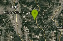
Buck Ridge
Gallatin Gateway, Montana
47.7 miles NWThis is a ride you do for the scenery rather than the singletrack. It is an out-and-back on about 8 miles of doubletrack/atv trail. Most of the ride give you fantastic views of the...
Mountain Bike
Hyalite Creek Trail
Gallatin Gateway, Montana
47.7 miles NWSummer activities are on a timeshare basis, with specific days and activities listed at the trailhead. The entire trail is 11 miles, with eleven waterfalls along the trail! Bear...
Hike, Horseback, Mountain Bike
Boundary Trail
Island Park, Idaho
48.0 miles SWBoundary Trail, (Trail #272 and #244) is a 37 mile loop trail that allows stock travel, mountain bike, motorcycle and ATV travel. This trail can be reached by several trailheads,...
Mountain Bike
Sheep Creek Trail
48.7 miles W
The trail has a few interesting spots (rocks, roots, etc.), but mostly it's pretty simple and straightforward. A pretty good climb, especially the last few hundred yards to the lake....
Mountain Bike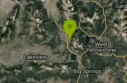
Mile Creek Trail
49.4 miles W
It is important to note that Mile Creek Trail is part of the Continental Divide Trail system, so it connects to other trails of various difficulties. Mile Creek Trail itself is a great...
Mountain BikeNearby Campsites

Tower Falls
Tower Junction, Yellowstone National Park
5.4 miles NETower Fall is a waterfall on Tower Creek in the northeastern region of Yellowstone National Park, in the U.S. state of Wyoming. Approximately 1,000 yards (910 m) upstream from the creek's...
Camp, Hike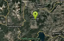
Canyon Campground
Canyon Junction, Yellowstone National Park
6.5 miles SCanyon Campground is a popular choice for visitors to Yellowstone National Park, and it's easy to see why. Located in the heart of the park, the campground offers easy access to some of the...
Camp
Hellroaring Creek Trail
Yellowstone National Park
8.7 miles NIf the name didn't scare you enough, the Hellroaring creek trail begins with an arduous descent down to the the Yellowstone River Suspension Bridge.The suspension bridge is a beautiful...
Camp, Hike, Swim
Slough Creek Campground
Tower Junction, Yellowstone National Park
10.9 miles NESlough Creek campground is a small but very popular campground on the Northeast Entrance Road. Most of the campsites are situated right on the banks of Slough Creek where fishing is a favorite...
Camp 1.5-3.8 mi
Little Gibbon Falls
Norris, Yellowstone National Park
11.8 miles SWIce Lake and Little Gibbon Falls Loop is a 4.5 mile loop trail located near Yellowstone National Park, Wyoming. The trail is good for all skill levels and primarily used for hiking, but there are...
Camp, Canoe, Hike
Norris Campground
Norris, Yellowstone National Park
13.7 miles SWNorris campground is centrally located in Yellowstone National Park and offers a good spot for those planning to visit many of the most famous features in Yellowstone. Norris is a relatively short...
Camp
Indian Creek Campground Yellowstone
Mammoth Hot Springs, Yellowstone National Park
14.7 miles WIndian Creek Campground is a quiet and secluded wooded campground within Yellowstone National Park, ideal for tent campers. It’s close to lots of hiking and fishing, and only a few miles to...
Camp
Mammoth Hot Springs Campground
Mammoth Hot Springs, Yellowstone National Park
16.1 miles NWMammoth Hot Springs Campground is the only campground in Yellowstone that is open to campers year-round. Campsites cannot be reserved and are available on a first come first served basis. It is...
Camp 0.1-5.2 mi
Mammoth Hot Springs
Mammoth, Yellowstone National Park
16.3 miles NWMammoth Hot Springs is a unique sight in Yellowstone National Park. The soft limestone in this area allowed the water to form colorful terraces. The extremely hot running water is clear and smooth,...
Camp, Hike
Pebble Creek Campground
Northeast Entrance, Yellowstone National Park
17.5 miles EPebble Creek is a popular campground for fishermen and those seeking a more quiet and smaller campground in Yellowstone National Park. The campsites can fill very early, so get there before 11 AM...
Camp
Fishing Bridge RV Campground
Lake Village, Yellowstone National Park
18.4 miles SThe Fishing Bridge Recreational Vehicle Park is located near the mouth of the Yellowstone River as it leaves Yellowstone Lake. The RV park is named after the Fishing Bridge, a wooden vehicle bridge...
Camp
Bridge Bay
Lake Village, Yellowstone National Park
20.1 miles SBridge Bay Campground was named for its proximity to Bridge Bay Marina on Yellowstone Lake. The area is quite scenic, with wooded areas, open meadows and some limited views of the lake. Because of...
Camp
Madison Campground
Madison, Yellowstone National Park
24.2 miles SWMadison Campground is named for its proximity to the Madison River, which runs through the area in a lush mountain setting rich in wildlife. Madison Campground is at an elevation of 6,800’ and...
Camp
Grant Village
Grant Village, Yellowstone National Park
30.3 miles SGrant Village was built in 1984 and named after Ulysses S. Grant, president when Yellowstone became the world’s first national park in 1872. Located near the West Thumb of Yellowstone Lake,...
Camp, Canoe, Kayak 14.8 mi
Biscuit Basin to Fairy Falls and Firehole Meadows
Old Faithful, Yellowstone National Park
33.4 miles SWFreight Road trail is a almost 15 mile hike that leaves from Biscuit Basin or Fountain Flats Drive. This hike is a beautiful remote hike that passes several unique landmarks, breaking up this hike...
Backpack, Camp, Hike 6.9 mi
Heart Lake Trail
Grant Village, Yellowstone National Park
35.8 miles SThe trail is very clear and leads to a moderate eight mile hike to Heart Lake. This hike has many possibilities. Day hikers need to push their time to make sure they are on the trail early to allow...
Backpack, Camp, Hike, Hot Springs 0.1 mi
Lewis Lake Campground
Grant Village, Yellowstone National Park
38.5 miles SLewis Lake is located in the southern part of Yellowstone National Park. It is 4 miles southeast of Shoshone Lake. Lewis Lake offers a plethora great water activities. This lake offers...
Camp, Canoe, Kayak
Big Springs
Island Park, Idaho
45.9 miles SWThere's also a great little walking trail along the river with placards that tell about the ecosystem and history of the area. There's about a 1/2 mile that's paved and then a 1/2 mile...
Camp, Hike 25.6 mi
East Rosebud Lake
Roscoe, Montana
47.1 miles NEA scenic backpacking trip through some of the most beautiful areas in the Beartooth Mountains of Montana, East Rosebud trail takes hikers into some of the more secluded parts of Montana.
Backpack, Camp, Canoe, Hike


