


Hyalite Creek Trail
Gallatin Gateway, Montana
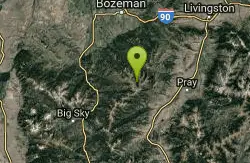
| Address: | Hyalite Creek Trail, Gallatin Gateway, MT 59730, USA |
| GPS: |
45°24'49.5"N 110°57'27.2"W Maps | Directions |
| State: | Montana |
Restrooms Lakes Waterfalls Streams Trails Rocks Wildflowers National Park State Park
Hike, Horseback, and Mountain Bike
Summer activities are on a timeshare basis, with specific days and activities listed at the trailhead. The entire trail is 11 miles, with eleven waterfalls along the trail! Bear activity sign at the trailhead was completely accurate - just a few minutes into our hike, a black bear ran down a drainage and across the trail about 50 yards ahead of us. Lots of dogs, most not leashed, on the trail. Beautiful hike!
More Information
Add ResourceNever modify trail features. Ride trails when they're dry enough that you won't leave ruts. Speak up when you see others on the trail and always yield to hikers, horses, and others coming uphill. Always ride on the established trail.
Read MoreBe courteous, informed, and prepared. Read trailhead guidelines, stay on the trail, and don't feed the wildlife.
Read More
- Plan Ahead and Prepare
- Travel & camp on durable surfaces
- Dispose of waste properly
- Leave what you find
- Minimize campfire impacts
- Respect wildlife
- Be considerate of other visitors
Directions
From Gallatin Gateway, Montana
- Head east on Gateway South Rd/Mill St toward US-191 N (161 ft)
- Turn right at the 1st cross street onto US-191 S (0.5 mi)
- Turn left onto S Cottonwood Rd (6.8 mi)
- Turn right onto S 19th Rd (1.0 mi)
- Turn right onto Hyalite Canyon Rd (8.3 mi)
- Slight right onto Hyalite Canyon Rd/NF-62 (5.4 mi)
Trailhead (NFS trail 427) has room for plenty of vehicles. There's also a pit toilet, and the trail, clearly marked, starts just beyond the toilet.

Other Mountain Bike Trails, Hiking Trails, and Horseback Trails Nearby
Garnett Mountain
Gallatin Gateway, Montana
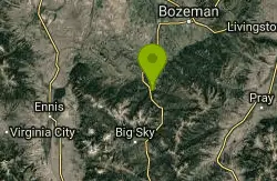
13.0 miles WA merciless but rewarding singletrack climb near Gallatin Gateway — relentlessly steep all the way to a forest service cabin, with a great downhill return and loop option via Rat Lake.
Mountain Bike 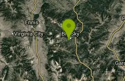
Ousel Falls
Big Sky, Montana
21.7 miles SWA scenic switchback trail near Big Sky that climbs to a gorgeous waterfall, with a swimming hole under a bridge, horses and bikes welcome, and bathroom at the top.
Mountain Bike 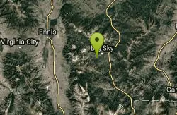
Ousel Falls
Gallatin Gateway, Montana
22.5 miles SWA 1.7-mile out-and-back trail near Big Sky, Montana, leading through forest to a beautiful waterfall — accessible from May through October for a rewarding short hike.
Hike, Rock Climb, Swim 
Buck Ridge
Gallatin Gateway, Montana
23.1 miles SWA scenic out-and-back mountain bike ride on doubletrack with sweeping views of surrounding wilderness and mountain ranges — with an optional expert singletrack extension into truly wild country.
Mountain Bike 
Daly Creek
Gallatin Gateway, Montana
26.8 miles SA 5.2-mile out-and-back trail good for all skill levels near Gallatin Gateway, Montana, primarily used for hiking and accessible from May through October.
Hike 10.1 mi
Sky Rim Trail to Sheep Mountain
Big Sky, Montana
27.2 miles SA challenging 10-mile out-and-back hike climbing to some of Yellowstone's highest peaks — Sky Rim Trail rewards with sweeping views and bighorn sheep sightings near Big Horn and Sheep Mountain.
Backpack, Hike 3.8 mi
Abandoned Railroad Bed Bike Trail
Gardiner, Montana
28.9 miles SEAn 8-mile out-and-back bike trail along the Yellowstone River on an old railroad bed near the North Entrance of Yellowstone, with mountain, plain, and river scenery — and frequent wildlife sightings.
Mountain Bike 7.9 mi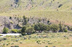
Rescue Creek Trail
Mammoth Hot Springs, Yellowstone National Park
30.2 miles SEA level, well-marked 8-mile point-to-point hike across the Montana-Wyoming border through colorful grasslands near Yellowstone, with frequent bighorn sheep, pronghorn, and elk sightings.
Hike 
Little Wapiti
Gallatin Gateway, Montana
30.3 miles SWA gorgeous high-altitude descent — partly double track, partly narrow rocky singletrack — at over 9,000 feet where wolf tracks have been spotted.
Mountain Bike 
Mammoth/Gardiner Back Road
Mammoth Hot Springs, Yellowstone National Park
32.6 miles SThe only road open into Yellowstone in winter runs from Gardiner, Montana through park headquarters at Mammoth Hot Springs and east to Silver Gate and Cooke City.
Hike, Mountain Bike 8.1 mi
Sepulcher Mountain Trail
Mammoth Hot Springs, Yellowstone National Park
32.8 miles SAn 11-mile loop from Mammoth Hot Springs to the 9,652-foot peak of Sepulcher Mountain, passing colorful meadows, aspen forests, and stunning views of Electric Peak — with frequent bighorn, moose, and grizzly sightings.
Hike 0.1-5.3 mi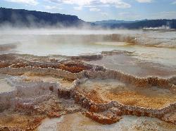
Mammoth Hot Springs
Mammoth, Yellowstone National Park
32.8 miles SColorful limestone terraces covered in glistening hot-spring water, a 1-mile boardwalk with 300 feet of elevation, elk in the parking lot, and an easy family-friendly loop — Yellowstone's showiest geology.
Camp, Hike 5.3 mi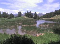
Beaver Ponds Trail
Mammoth, Yellowstone National Park
32.9 miles SA 5-mile loop above Mammoth Hot Springs with beaver ponds of varying sizes, elk, wildflowers, birds, and occasional bear sightings — a perfect morning or evening hike.
Hike 4.0 mi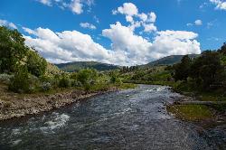
Lava Creek Trail
Mammoth Hot Springs, Yellowstone National Park
32.9 miles SEA 4.2-mile hike along scenic Lava Creek to the 60-foot tiered Undine Falls, with distant Mammoth Hot Springs views, meadows, Mount Everts, and frequent elk and bison sightings.
Hike 2.0 mi
Snow Pass Trail
Yellowstone National Park Wyoming
33.6 miles SA moderately difficult 2.4-mile out-and-back with 700 feet of gain near Mammoth Hot Springs, passing impressive boulder hoodoos and ending at a secluded mountain valley — hike in groups and carry bear spray.
Backpack, Hike 7.8 mi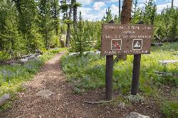
Osprey Falls Trail
Mammoth Hot Springs, Yellowstone National Park
35.1 miles SAn 8-mile out-and-back near Mammoth Hot Springs hiking green meadows and burned forest to the rim of Sheepeater Canyon and a breathtaking 150-foot waterfall on the Gardner River.
Hike 4.0 mi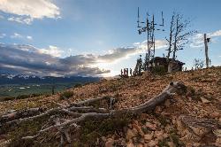
Bunsen Peak Trail
Mammoth Hot Springs, Yellowstone National Park
35.1 miles SA moderately difficult 4.6-mile hike to Bunsen Peak with a 1,300-foot climb and sweeping views of Mammoth Hot Spring Terraces, Swan Lake Flats, and the Gallatin Mountains.
Hike 8.4 mi
Bunsen Peak Loop Bike Trail
Yellowstone National Park, Wyoming
35.1 miles SA challenging 10-mile mountain bike loop around Bunsen Peak in Yellowstone with 1,120 feet of elevation gain, sharp switchbacks, and frequent sightings of bears, elk, and bison.
Mountain Bike 7.4 mi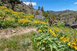
Blacktail Deer Creek to Yellowstone River Trail
Mammoth Hot Springs, Yellowstone National Park
36.3 miles SEA 7-mile out-and-back trail dropping through green fields and boulder formations to waterfall views along the Yellowstone River, with a suspension bridge connecting onward trails.
Hike 0.8 mi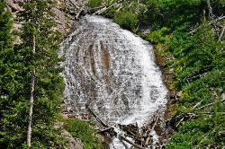
Wraith Falls Trail
Mammoth Hot Springs, Yellowstone National Park
36.5 miles SEA less-than-a-mile family-friendly hike near Mammoth Hot Springs to the unique fan-shaped 79-foot Wraith Falls — open year-round and easy for all skill levels.
HikeNearby Campsites
Mammoth Hot Springs
Mammoth, Yellowstone National Park
32.8 miles SColorful limestone terraces covered in glistening hot-spring water, a 1-mile boardwalk with 300 feet of elevation, elk in the parking lot, and an easy family-friendly loop — Yellowstone's showiest geology.
Camp, Hike 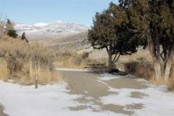
Mammoth Hot Springs Campground
Mammoth Hot Springs, Yellowstone National Park
32.9 miles SEThe only year-round campground in Yellowstone, with 85 first-come sites at 5 miles from the North Entrance, walking distance to the famous Mammoth Hot Springs Terraces and nearby hiking and fishing.
Camp 
Indian Creek Campground Yellowstone
Mammoth Hot Springs, Yellowstone National Park
38.4 miles SIndian Creek Campground is a quiet, wooded, tent-friendly Yellowstone campground near Mammoth Hot Springs, big on wildlife and peace.
Camp 
Hellroaring Creek Trail
Yellowstone National Park
41.0 miles SEA suspension bridge over the Yellowstone River leads to sandy creek-side beaches and a mild backcountry trail past Yellowstone's largest granite slab — great for all ages.
Camp, Hike, Swim 
Slough Creek Campground
Tower Junction, Yellowstone National Park
45.2 miles SEA small, popular Yellowstone campground right on Slough Creek where wolf packs are frequently spotted — sites fill fast, so arrive early.
Camp 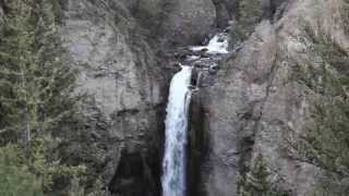
Tower Falls
Tower Junction, Yellowstone National Park
45.6 miles SETower Fall plunges 132 feet off Tower Creek in Yellowstone, framed by dramatic rock pinnacles — located about 3 miles south of Roosevelt Junction.
Camp, Hike 
Norris Campground
Norris, Yellowstone National Park
48.4 miles SCentrally located in Yellowstone NP, this campground puts you within a short drive of Grand Canyon of the Yellowstone, Hayden Valley, Old Faithful, and Yellowstone Lake.
Camp


