


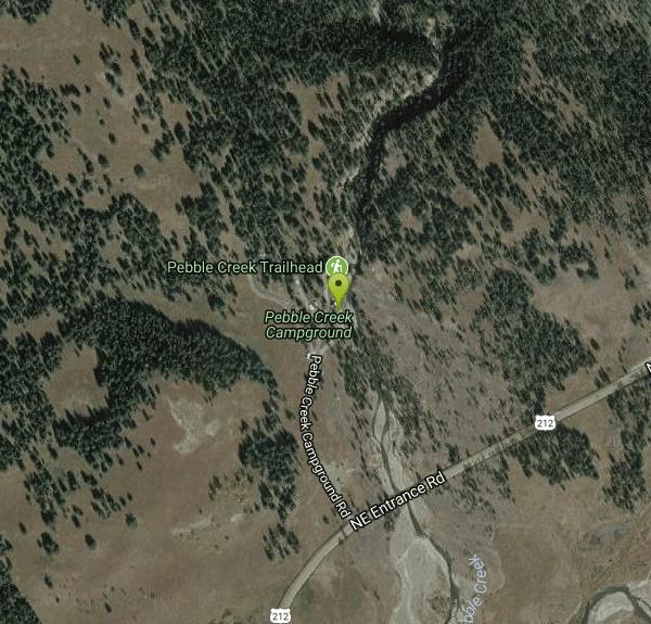
Pebble Creek Campground
Northeast Entrance, Yellowstone National Park

| Address: | Pebble Creek Campground Rd, Yellowstone National Park, WY 82190, USA |
| GPS: |
44°55'2.7"N 110°6'48.6"W Maps | Directions |
| State: | Wyoming |
Camp
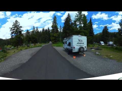
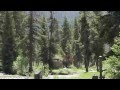
Pebble Creek is a popular campground for fishermen and those seeking a more quiet and smaller campground in Yellowstone National Park. The campsites can fill very early, so get there before 11 AM during peak hours if you want a choice camping spot.. Pebble Creek campground is tucked far in the northeast corner of Yellowstone National Park, away from the main attractions. However, for fishermen, the location is ideal because of nearby Trout Lake and world class trout rivers like the Lamar and Soda Butte(which is just across from the campground). Courtesy of parkcamper.com
More Information
- Plan Ahead and Prepare
- Travel & camp on durable surfaces
- Dispose of waste properly
- Leave what you find
- Minimize campfire impacts
- Respect wildlife
- Be considerate of other visitors
Directions
From Northeast Entrance, Yellowstone National Park
- Head southeast on US-212 EToll road(9.5 mi)
- Turn left onto Pebble Creek Campground Rd (0.2 mi)
- Slight right to stay on Pebble Creek Campground Rd (302 ft)
Located at Yellowstone National Park, WY 82190, United States
Other Arenas Nearby
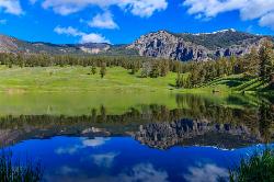
Trout Lake and Buck Lake
Tower Junction, Yellowstone National Park
1.3 miles SThe Trout Lake trail is a steep 1/2-mile trail through a Douglas fir forest which leads to the lake. Trout Lake is also known to be called Fish Lake and Soda Butte Lake .The most difficult...
Hike
Slough Creek Campground
Tower Junction, Yellowstone National Park
9.7 miles WSlough Creek campground is a small but very popular campground on the Northeast Entrance Road. Most of the campsites are situated right on the banks of Slough Creek where fishing is a favorite...
Camp 8.5 mi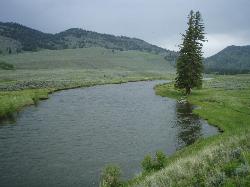
Slough Creek Trail
Tower Junction, Yellowstone National Park
9.7 miles WSlough Creek Trail is a 3.4 mile out and back trail that follows a historic wagon trail through several meadows. This trail is a fairly easy hike that has beautiful views of Slough Creek. The...
Hike 4.0 mi
Specimen Ridge Day Hike and Fossil Forrest Trail
Buffalo Ford, Wyoming
10.5 miles WSpecimen Ridge Day Hike is a strenuous almost 4 mile trail to Specimen Ridge. This trail is rugged with a high elevation, and is not recommended for hikers with respiratory or heart...
Hike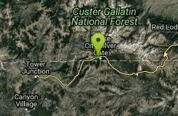
Cooke City Disc Golf Course
Cooke City-Silver Gate, Montana
11.1 miles NEChallenging. 16 trees & 2 tones. Not marked well - best to find a guide. The Cooke City Bike Shack has more info. Great scenery, in a great little Montana town. Public (No Fee)
Disc Golf 16.9 mi
Specimen Ridge Trail (2K4)
Buffalo Ford, Wyoming
13.4 miles WSpecimen Ridge Trail is a challenging hike that requires navigational and technical skills to complete. This 17 mile hike is remote, and though it is marked by carins and blazes, it is often...
Hike
Tower Falls
Tower Junction, Yellowstone National Park
13.5 miles WTower Fall is a waterfall on Tower Creek in the northeastern region of Yellowstone National Park, in the U.S. state of Wyoming. Approximately 1,000 yards (910 m) upstream from the creek's...
Camp, Hike 0.3 mi
Yellowstone River Picnic Area Trail
Tower Junction, Yellowstone National Park
14.0 miles WThe Yellowstone River Picnic Area trail is 3.9 miles loop trail. It is called the Yellowstone Picnic Area trail because the beginning of the trail is in a picnic area.This hike features a...
Hike 7.3 mi
Agate Creek Trail
Tower Junction, Wyoming
14.0 miles WAgate Creek Trail is a moderately difficult trail through some of Yellowstone's most beautiful and isolated landscapes. This 7.3 mile hike starts at the Yellowstone River Picnic Area. Parking is...
Hike 8.2 mi
Garnet Hill Trail
Tower Junction, Yellowstone National Park
14.7 miles WGarnet Hill Trail is a 7.6 mile loop that follows an old, dirt stagecoach road. This trail passes through large meadows, dusty areas with sagebrush, forests and beside the Yellowstone River. This...
Hike 2.4 mi
Lost Lake Trail
Tower Junction, Yellowstone National Park
15.0 miles WLost Lake Trail is a 2.8 mile hike that can be completed in less than two hours. This is an easy hike with very little elevation change. Hikers can enjoy forests, meadows and a view of Lost Lake...
Hike
Hellroaring Creek Trail
Yellowstone National Park
15.9 miles WIf the name didn't scare you enough, the Hellroaring creek trail begins with an arduous descent down to the the Yellowstone River Suspension Bridge.The suspension bridge is a beautiful...
Camp, Hike, Swim 2.8 mi
Mount Washburn Bike Trail
Devils Den, Wyoming
17.5 miles WMount Washburn Bike Trail follows Chittenden Service Road for 2.5 miles to the top of Mount Washburn. This steep climb up the mountain provides a challenging elevation gain of 1500 feet. Mount...
Mountain Bike 4.4 mi
Chittenden Road - Mount Washburn Trail
Canyon Village, Yellowstone National Park
17.7 miles SWHiking Mount Washburn via Chittenden Road is the shortest and easiest route to the top. The trail was once a service road and is now a clear well packed trail with a steady, gradual incline. The...
Hike 16.3 mi
Mount Washburn Spur Trail
Canyon Village, Yellowstone National Park
17.8 miles SWWashburn Spur Trail is an exciting 8-mile trail connecting the peak of Mount Washburn to Seven Mile Hole Trail near Canyon Village. Hikers typically hike the trail starting at Mount Washburn and...
Hike 3.4 mi
Dunraven Pass - Mount Washburn Trail
Canyon Village, Yellowstone National Park
19.0 miles SWHikers looking for a scenic hike to the peak Mount Washburn will be pleased hiking the Mount Washburn Trail via Dunraven Pass. This trail winds through quiet forests to the peak. The trailhead for...
Hike 7.6 mi
Observation Peak Trail
Canyon Village, Yellowstone National Park
21.6 miles SWObservation Peak Trail is one of the most famous hikes in Yellowstone National Park. The hike is an almost 10 miles there and back hike that starts and ends at the same trailhead. Observation...
Hike 2.4 mi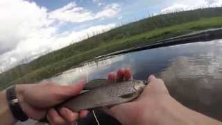
Cascade Lake Trail
Canyon Village, Yellowstone National Park
21.6 miles SWCascade Lake Trail is an easy, short hike through picturesque meadows to the beautiful cascade lake. The trailhead is located North of Canyon Village on Grand Loop Road. There is a pullout here where...
Hike 9.0 mi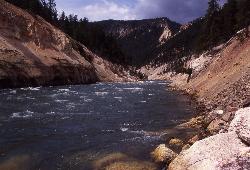
Seven Mile Hole Trail
Canyon Village, Yellowstone National Park
21.9 miles SWSeven Mile Hole is a challenging out and back trail that winds along and into the Grand Canyon of Yellowstone. This 10-mile hike begins and ends at Canyon Village where parking is available. From...
Hike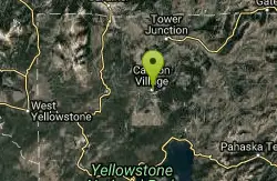
Canyon Campground
Canyon Junction, Yellowstone National Park
22.3 miles SWCanyon Campground is a popular choice for visitors to Yellowstone National Park, and it's easy to see why. Located in the heart of the park, the campground offers easy access to some of the...
CampNearby Campsites
Slough Creek Campground
Tower Junction, Yellowstone National Park
9.7 miles WSlough Creek campground is a small but very popular campground on the Northeast Entrance Road. Most of the campsites are situated right on the banks of Slough Creek where fishing is a favorite...
Camp
Tower Falls
Tower Junction, Yellowstone National Park
13.5 miles WTower Fall is a waterfall on Tower Creek in the northeastern region of Yellowstone National Park, in the U.S. state of Wyoming. Approximately 1,000 yards (910 m) upstream from the creek's...
Camp, Hike
Hellroaring Creek Trail
Yellowstone National Park
15.9 miles WIf the name didn't scare you enough, the Hellroaring creek trail begins with an arduous descent down to the the Yellowstone River Suspension Bridge.The suspension bridge is a beautiful...
Camp, Hike, Swim
Canyon Campground
Canyon Junction, Yellowstone National Park
22.3 miles SWCanyon Campground is a popular choice for visitors to Yellowstone National Park, and it's easy to see why. Located in the heart of the park, the campground offers easy access to some of the...
Camp
Fishing Bridge RV Campground
Lake Village, Yellowstone National Park
27.5 miles SWThe Fishing Bridge Recreational Vehicle Park is located near the mouth of the Yellowstone River as it leaves Yellowstone Lake. The RV park is named after the Fishing Bridge, a wooden vehicle bridge...
Camp
Mammoth Hot Springs Campground
Mammoth Hot Springs, Yellowstone National Park
28.7 miles WMammoth Hot Springs Campground is the only campground in Yellowstone that is open to campers year-round. Campsites cannot be reserved and are available on a first come first served basis. It is...
Camp 1.5-3.8 mi
Little Gibbon Falls
Norris, Yellowstone National Park
28.9 miles SWIce Lake and Little Gibbon Falls Loop is a 4.5 mile loop trail located near Yellowstone National Park, Wyoming. The trail is good for all skill levels and primarily used for hiking, but there are...
Camp, Canoe, Hike 0.1-5.2 mi
Mammoth Hot Springs
Mammoth, Yellowstone National Park
29.1 miles WMammoth Hot Springs is a unique sight in Yellowstone National Park. The soft limestone in this area allowed the water to form colorful terraces. The extremely hot running water is clear and smooth,...
Camp, Hike 25.6 mi
East Rosebud Lake
Roscoe, Montana
30.3 miles NEA scenic backpacking trip through some of the most beautiful areas in the Beartooth Mountains of Montana, East Rosebud trail takes hikers into some of the more secluded parts of Montana.
Backpack, Camp, Canoe, Hike
Indian Creek Campground Yellowstone
Mammoth Hot Springs, Yellowstone National Park
30.5 miles WIndian Creek Campground is a quiet and secluded wooded campground within Yellowstone National Park, ideal for tent campers. It’s close to lots of hiking and fishing, and only a few miles to...
Camp
Bridge Bay
Lake Village, Yellowstone National Park
30.9 miles SWBridge Bay Campground was named for its proximity to Bridge Bay Marina on Yellowstone Lake. The area is quite scenic, with wooded areas, open meadows and some limited views of the lake. Because of...
Camp
Norris Campground
Norris, Yellowstone National Park
31.2 miles SWNorris campground is centrally located in Yellowstone National Park and offers a good spot for those planning to visit many of the most famous features in Yellowstone. Norris is a relatively short...
Camp
Madison Campground
Madison, Yellowstone National Park
41.5 miles SWMadison Campground is named for its proximity to the Madison River, which runs through the area in a lush mountain setting rich in wildlife. Madison Campground is at an elevation of 6,800’ and...
Camp
Grant Village
Grant Village, Yellowstone National Park
42.5 miles SWGrant Village was built in 1984 and named after Ulysses S. Grant, president when Yellowstone became the world’s first national park in 1872. Located near the West Thumb of Yellowstone Lake,...
Camp, Canoe, Kayak 6.9 mi
Heart Lake Trail
Grant Village, Yellowstone National Park
47.9 miles SWThe trail is very clear and leads to a moderate eight mile hike to Heart Lake. This hike has many possibilities. Day hikers need to push their time to make sure they are on the trail early to allow...
Backpack, Camp, Hike, Hot Springs


