


89 Mountain Bike Trails near Ashton Hill
first prev 1 2 3 4 5 next lastShowing Mountain Bike Trails within 50 miles Distance miles of Forest Road 344, Ashton, ID 83420, USA City, Zip, or Address

Big Bend Ridge Trail
Ashton, Idaho
5.1 miles NWTrail is open to OHVs. source: fs.usda.gov
Mountain Bike 29.6 mi
Ashton to Tetonia Trail
Ashton, Idaho
6.5 miles SThe Idaho Department of Parks and Recreation undertook the project to transform the old Teton Valley Branch of the Union Pacific Railroad from Ashton to Tetonia into a trail for bikes, ATVs, and...
Mountain Bike 3.2-47.0 mi
Yellowstone Branch Line Trail
Ashton, Idaho
8.0 miles SEYellowstone branch line trail runs from Warm River to the Montana border totaling 39 miles. There are a few places to jump on and off the trail as well as a few smaller trails that branch off of this...
Backpack, Cross-country Ski, Hike, Horseback, Mountain Bike 0.6-4.7 mi
Harriman State Park
Island Park, Idaho
10.7 miles NHarriman State Park is found 38 miles from Yellowstone along Henry's Fork. This 11,000-acre wildlife refuge is open year round for most activities. In addition to having beautiful scenery and...
Cross-country Ski, Hike, Horseback, Mountain Bike, Snowshoe
Flat Canyon Trail
Island Park, Idaho
12.5 miles NENon-motorized use. souce: fs.usda.gov
Mountain Bike 17.5 mi

Tear Drop Lake
Ashton, Idaho
16.8 miles ENestled in the Targhee National Forest just off of Ashton's Fish Creek Road, this tear drop shaped lake is a family adventure waiting to happen. The lake isn't very big but it is teeming with...
Camp, Canoe, Hike, Kayak, Mountain Bike, Swim 5.8 mi
Box Canyon Trail
Island Park, Idaho
17.3 miles NVarious species of tress and wildflowers can be seen on the trail, as well as songbirds, waterfowl and occasional wildlife. The trail is open for the following uses: Motorcycle Trail Riding, Off...
Hike, Mountain Bike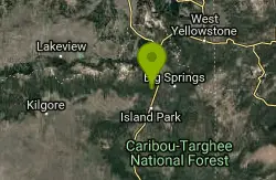
Coffee Pot Rapids Trail
Island Park, Idaho
22.7 miles NHiker and fisherman parking is available at the campground entrance. Coffee Pot Rapids trail is 2.2 miles in length, is a non-motorized trail that follows the Henry's Fork of the Snake...
Mountain Bike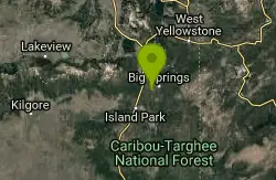
Boundary Trail
Island Park, Idaho
23.3 miles NBoundary Trail, (Trail #272 and #244) is a 37 mile loop trail that allows stock travel, mountain bike, motorcycle and ATV travel. This trail can be reached by several trailheads,...
Mountain Bike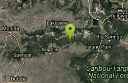
Howard Creek Trail
Island Park, Idaho
25.0 miles NWThe Howard Creek trail follows Howard Creek upstream to the old Taylor Creek Road. The old Taylor Creek Road connects the Howard Creek trail to the Continental Divide Trail. Howard...
Mountain Bike
Badger Creek
Tetonia, Idaho
26.2 miles SEBadger Creek is a stream located just 13.6 miles from Ashton, in Teton County, in the state of Idaho, United States, near France, ID. Whether you’re spinning, baitcasting or fly fishing your...
Camp, Cross-country Ski, Hike, Mountain Bike, Rock Climb
Wright Creek Trail
Tetonia, Idaho
26.6 miles SOpen to MTB, horseback riding, snowshoeing, and hiking. source: fs.usda.gov
Mountain Bike
Sawtell Peak Trail
Island Park, Idaho
26.7 miles NThis trail offers great views of the valley floor, mountain peaks and wildlife. source: fs.usda.gov
Mountain Bike 0.6 mi
Packsaddle Lake
Tetonia, Idaho
27.9 miles SPacksaddle is one of the less well known lakes/trails in the area. If you've got a good offroad vehicle, you can probably make it all the way to the end of the road, otherwise, it's just an...
Dive, Hike, Mountain Bike, Snowshoe, Swim 0.4-0.7 mi
Rexburg Bike Park
Rexburg, Idaho
28.3 miles SWIt's a small but great bike park for all ages; if you are a beginner, then this is the bike park to go to. The mounts are a decent size and approximately 4-6 mounts in different sizes for the...
Mountain Bike, Sled 0.1-1.3 mi
Hidden Valley Trails
Rexburg, Idaho
28.4 miles SWRight on the edges of town outside of the Hidden Valley subdivision, you'll find this fun little set of trails that's pretty good for mountain bikes. What was once just dirt roads and...
Hike, Mountain Bike 0.1-0.5 mi
Eagle Park
Rexburg, Idaho
28.5 miles SWEagle Park is a little urban oasis. Once you drive in to this cottonwood forest along the river, you may forget that you're still inside Rexburg city limits. You can camp, picnic, throw rocks in...
Camp, Hike, Mountain Bike, Sled
Probation And Burg Bumper
Tetonia, Idaho
30.3 miles SThe Probation part of the trail is the steepest downhill in the area. Has multiple bridges and log jumps in the short mile down. The Burg portion of the trail is uphill with some...
Mountain Bike
Sharks Belly
Driggs, Idaho
31.8 miles STrail system can start from Channel lock or Bovine. Channel Lock is an easier climb than Bovine. This description and mileage starts at the Channel Lock trail, forest service boundary marker. Take...
Mountain Bike
Channel Lock
Driggs, Idaho
31.8 miles STrail is a little over 1 mile uphill. Recommended route up to access the larger Horseshoe canyon trail system. Makes a nice downhill with twists. Gets its name from the deep ruts made from cows....
Mountain Bike


