


Flat Canyon Trail
Island Park, Idaho
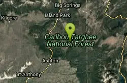
| Address: | ~National Forest Develop Rd 153 Trail, Idaho, USA |
| GPS: |
44°15'14.5"N 111°14'10.2"W Maps | Directions |
| State: | Idaho |
| Trail Length: | 3.00 miles |
| Trail Type: | Out & Back |
| MTB Trail Type: | Singletrack |
Mountain Bike
Non-motorized use. souce: fs.usda.gov Courtesy of Singletracks.com
More Information
Flat Canyon Trail
Flat Canyon Trail is a singletrack mountain bike trail in Ashton, Idaho. View maps, videos, photos, and reviews of Flat Canyon Trail bike trail in Ashton.
http://www.singletracks.com/bike-trails/flat-canyon-trail/Never modify trail features. Ride trails when they're dry enough that you won't leave ruts. Speak up when you see others on the trail and always yield to hikers, horses, and others coming uphill. Always ride on the established trail.
Read More
- Plan Ahead and Prepare
- Travel & camp on durable surfaces
- Dispose of waste properly
- Leave what you find
- Minimize campfire impacts
- Respect wildlife
- Be considerate of other visitors
Directions
From Island Park, Idaho
- Head south on US-20 W toward Riverside Dr (7.5 mi)
- Turn left onto Mesa Falls Scenic Byway/Mesa Falls TrailContinue to follow Mesa Falls Scenic Byway(4.1 mi)
- Turn left onto N Hatchery Butte Rd (4.7 mi)
- Turn right onto Forest Rd 150 (1.8 mi)
- Turn left (1.4 mi)
- Continue onto Flat Canyon RdDestination will be on the left(2.7 mi)

Other Mountain Bike Trails Nearby
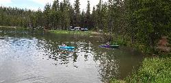
Tear Drop Lake
Ashton, Idaho
5.7 miles EA small, lively lake in the Targhee forest for kayaking, swimming, and an easy loop trail — family fun with primitive lakeside camping.
Camp, Canoe, Hike, Kayak, Mountain Bike, Swim 3.2-47.0 mi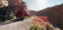
Yellowstone Branch Line Trail
Ashton, Idaho
10.0 miles SA 39-mile trail from Warm River to the Montana border — open to backpackers, hikers, mountain bikers, horseback riders, and ATVs through the Targhee National Forest.
Backpack, Cross-country Ski, Hike, Horseback, Mountain Bike 0.6-4.7 mi
Harriman State Park
Island Park, Idaho
12.1 miles NWAn 11,000-acre wildlife refuge 38 miles from Yellowstone along Henry's Fork — world-class fly-fishing, hiking among wildflowers and wildlife, plus 24 miles of Nordic ski trails in winter.
Cross-country Ski, Hike, Horseback, Mountain Bike, Snowshoe 2.9 mi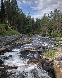
Box Canyon Trail
Island Park, Idaho
13.5 miles NWA scenic 3-mile riverside singletrack along Henry's Fork in Box Canyon — open to OHVs under 50 inches wide, with river views most of the trail and great trout fishing.
Hike, Mountain Bike 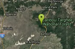
Big Bend Ridge Trail
Ashton, Idaho
14.2 miles WA smooth, swooping singletrack network near Driggs, Idaho with low elevation change, multiple route options, and a long riding season — one of the first trails to dry out each spring.
Mountain Bike 29.6 mi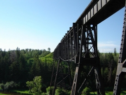
Ashton to Tetonia Trail
Ashton, Idaho
15.8 miles SWA 29.6-mile multi-use trail along a converted Union Pacific Railroad right-of-way from Ashton to Tetonia — open to bikes, ATVs, snowmobiles, runners, skiers, and horses with 787 ft of elevation gain southbound.
Mountain Bike 
Boundary Trail
Island Park, Idaho
16.2 miles NA 37-mile loop in Idaho accessible from multiple trailheads, open to stock, mountain bikes, motorcycles, and ATVs — with steep, rocky sections not suited for beginners.
Mountain Bike 
Coffee Pot Rapids Trail
Island Park, Idaho
17.6 miles NA 2.2-mile non-motorized trail following the Henry's Fork of the Snake River, where the water shifts from placid stream to raging rapids — lined with wildflowers and diverse shrubs.
Mountain Bike 
Sawtell Peak Trail
Island Park, Idaho
23.2 miles NWA trail at Island Park, Idaho offering great views of the valley floor, mountain peaks, and wildlife.
Mountain Bike 2.6 mi
Lone Star Geyser Trail
Old Faithful, Yellowstone National Park
24.0 miles NEA 4.8-mile round-trip trail through forest to a colorful geyser that erupts 30–45 feet into the air about every 3 hours — bikeable the entire way.
Hike, Mountain Bike 1.2 mi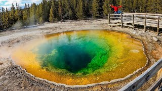
Old Faithful Lower General Store to Morning Glory Pool Bike Trail
Yellowstone National Park, Wyoming
24.5 miles NEAn easy 2-mile paved bike trail from Old Faithful to Morning Glory Pool through the Upper Geyser Basin — brilliant colors and stark geyser views await.
Mountain Bike 
Howard Creek Trail
Island Park, Idaho
27.4 miles NWA very primitive trail following Howard Creek upstream through a low canyon near Island Park — remote, quiet, and best used as a connector to the Continental Divide Trail.
Mountain Bike 
Rendezvous Loop
West Yellowstone, Montana
28.6 miles NGentle rolling hills wind through tall lodgepole pines and open meadows on this easy, fast-potential loop near West Yellowstone.
Mountain Bike 
Targhee Creek Trail
Island Park, Idaho
29.0 miles NFive alpine lakes, wildflowers, and sweeping mountain and valley views — plus grizzly bear habitat that makes wildlife watching very real on this Island Park trail.
Mountain Bike 4.0 mi
Fountain Freight Road Bike Trail
29.3 miles NE
A 4-mile paved former road along Fairy Falls Trail, passing Goose Lake, crossing the Firehole River, and overlooking the stunning Grand Prismatic Spring.
Mountain Bike 
Fairy Creek Trail
Madison, Yellowstone National Park
29.3 miles NEA flat, compact gravel trail perfect for the whole family — bike to a branch trail leading to Fairy Falls (hike only, bike rack provided) in the heart of Yellowstone.
Mountain Bike 
Divide Road
Island Park, Idaho
32.9 miles NA double-track dirt road along the Continental Divide between Montana and Idaho with gorgeous views of the Centennial Mountains, Henry's Lake, and the Tetons — and plenty of deer, elk, and occasional bears.
Mountain Bike 
Wright Creek Trail
Tetonia, Idaho
33.1 miles SA multi-use trail near Tetonia, Idaho open for mountain biking, horseback riding, snowshoeing, and hiking in Targhee National Forest terrain.
Mountain Bike 0.6 mi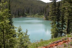
Packsaddle Lake
Tetonia, Idaho
33.6 miles SA secluded, steep-access Teton lake with a 300-foot descent from the trailhead, water that drops off quickly at the edge, and a small camp on the eastern shore.
Dive, Hike, Mountain Bike, Snowshoe, Swim 1.7 mi
Rick's Basin
Driggs, Idaho
34.6 miles SERick's Basin is the beloved cross-country trail network at Grand Targhee Resort, tucked onto the quiet, western "sunny side" of the Tetons in Alta, Wyoming, a short and scenic drive up from Driggs,...
Mountain BikeNearby Campsites
Tear Drop Lake
Ashton, Idaho
5.7 miles EA small, lively lake in the Targhee forest for kayaking, swimming, and an easy loop trail — family fun with primitive lakeside camping.
Camp, Canoe, Hike, Kayak, Mountain Bike, Swim 0.3-0.6 mi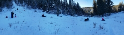
Bear Gulch
Ashton, Idaho
7.5 miles SAn abandoned ski hill from 1969 with overgrown runs that still deliver great sledding — the lower run is fast and winding all the way down to the old ski lift.
Camp, Cross-country Ski, Hike, Sled 
Horseshoe Lake
Ashton, Idaho
9.2 miles SEA lily-pad-dotted lake hidden in the Targhee National Forest with a gradual beach entry perfect for wading, a floating dock for jumping, and no motorized boats.
Camp, Canoe, Dive, Swim 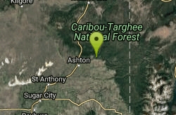
Warm River Campground
Ashton, Idaho
9.9 miles SSlow-moving warm water and willow-lined banks make this campground a perfect spot for tubing, trout fishing, and peaceful mountain biking at 5,200 ft elevation.
Camp 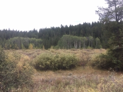
Porcupine Creek
Ashton, Idaho
11.5 miles SA backcountry hunting, fishing, camping, and swimming spot in Targhee National Forest, surrounded by forests, meadows, a creek, and unmarked trails — bear country, so pack and store food carefully.
Camp, Swim 0.9 mi
Buffalo River Campground
Island Park, Idaho
13.6 miles NWAn easy, clear, and often warm float on the Buffalo River near Island Park, with slow enough current to paddle back upstream in a canoe or kayak after your run.
Camp, Canoe, Kayak, Swim 
Sheep Falls on Fall River
Ashton, Idaho
14.0 miles SEA local gem off Cave Falls Road where the river splits into multiple falls tumbling over each other — primitive campsites and beautiful views make it a great picnic stop.
Camp 
Cave Falls of Yellowstone
Ashton, Idaho
14.1 miles SEA campground right on the Fall River along Yellowstone's south boundary puts you steps from legendary fishing, with fire rings and bear-proof boxes at each site.
Camp, Hike 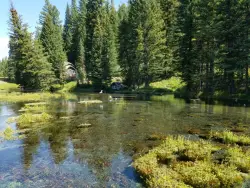
Big Springs
Island Park, Idaho
16.9 miles NA Big Springs campground shaded by Lodgepole Pines on Henry's Fork — with a 1-mile interpretive trail, fish feeding under the bridge, the historic Johnny Sack Cabin, and access to the Mesa Falls Scenic Byway.
Camp, Hike 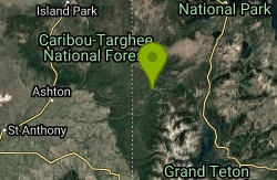
Loon Lake
Ashton, Idaho
17.2 miles SELoon Lake is a small, lively mountain lake tucked into the Caribou-Targhee National Forest just off Ashton's Fish Creek Road, in the timbered high country of eastern Idaho near the gateway to...
Camp, Kayak, Swim 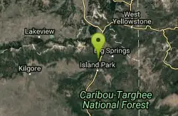
Upper Coffee Pot Campground
Island Park, Idaho
17.6 miles NHenry's Fork of the Snake River winds through a lodgepole pine forest past this campground, offering fly-fishing for rainbow and brook trout and easy tubing and canoeing.
Camp, Canoe 14.8 mi
Biscuit Basin to Fairy Falls and Firehole Meadows
Old Faithful, Yellowstone National Park
22.0 miles NEA nearly 15-mile backcountry hike starting at Biscuit Basin passes turquoise pools, a 70-foot waterfall, Firehole Meadows, Imperial Geyser, and three stunning blue lakes with rust-red shores.
Backpack, Camp, Hike 
Pine Butte / The Caldera
St. Anthony, Idaho
29.0 miles WAn old volcano in the Idaho desert that feels like stepping into a mountain forest — pine-covered hillsides, a meadow ringed by aspen and boulders, and a quarter-mile easy trail to the caldera floor.
Camp, Hike, Horseback 0.1 mi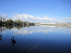
Lewis Lake Campground
Grant Village, Yellowstone National Park
30.2 miles EYellowstone's third-largest lake draws canoeists, kayakers, and serious anglers, with a quiet campground open mid-June through early November on a first-come basis.
Camp, Canoe, Kayak 6.9 mi
Heart Lake Trail
Grant Village, Yellowstone National Park
31.8 miles EAn 8-mile moderate hike to a remote backcountry lake with blue thermal pools, fumaroles, Rustic Geyser, and remarkable fishing for native cutthroat, mountain whitefish, and Arctic grayling.
Backpack, Camp, Hike, Hot Springs 
Madison Campground
Madison, Yellowstone National Park
32.5 miles NEA partly wooded riverside campground at 6,800 feet in Yellowstone, close to Old Faithful and the geyser basins, with great fishing on the Madison River and 270-plus individual sites.
Camp 
Grant Village
Grant Village, Yellowstone National Park
34.6 miles ENamed for President Grant near Yellowstone Lake's West Thumb, this village has lakeside dining, a geyser basin next door, campfire ranger programs, and tree-lined campsites steps from the water.
Camp, Canoe, Kayak 4.8 mi
Aldous Lake and Hancock Lake
Kilgore, Idaho
34.6 miles NWTwin alpine lakes — Aldous and Hancock — on a scenic 1.5-to-2.5-mile hike near Kilgore, with beautiful mountain scenery and heavier weekend crowds.
Backpack, Camp, Hike, Horseback, Swim 
Reunion Flat Campground
Alta, Wyoming
37.1 miles SCamp near Alta, Wyoming
Camp 
Teton Canyon Campground
Alta, Wyoming
37.9 miles SETeton Canyon Campground is the gateway to Alaska Basin, Table Rock, and the Teton Crest Trail — each site stocked with a picnic table, fire ring, and bear box.
Camp


