


116 Mountain Bike Trails near Cat Peaks - Blevin - Moonrock
first prev 1 2 3 4 5 6 next lastShowing Mountain Bike Trails within 50 miles Distance miles of 10234 E Usery Park Rd, Mesa, AZ 85207, USA City, Zip, or Address
Browns Ranch to Granite Mountain
Scottsdale, Arizona
24.4 miles NWStarts off at a trailhead onto a two track that can be taken to a variety of trails
Mountain Bike
Pima Road and Dynamite Blvd
Scottsdale, Arizona
24.9 miles NWThis is desert highlands and a beautiful part of the Sonoran Desert. (not much left with all the development) There are some jeep trails here and this area is also used by ATV and dirt...
Mountain Bike 4.8 mi
Trail 1A
Phoenix, Arizona
25.1 miles WThe trail can be accessed from the Dreamy Draw Park parking lot. From there, the trail can be ridden south towards its origin, or east (the trail makes an "L" shape). It is a mix of double...
Mountain Bike 1.3 mi
Dreamy Draw Loop Trail
Phoenix, Arizona
25.2 miles WThe Dreamy Draw Nature Trail is a short multi-access loop trail that provides a true Sonoran Desert experience. The trail crosses a number of desert washes and, at times, becomes somewhat rocky....
Hike, Horseback, Mountain Bike
Trail #100
Phoenix, Arizona
25.2 miles WFrom Dreamy Draw you can head NW on Trail 100 and immeadiately hit a ridge with good views. Ride on for 5 - 6 miles of nice single track and great views, to 7th and return. If you...
Mountain Bike 2.3 mi
Hidden Valley Trail Via Mormon Trail
Phoenix, Arizona
25.4 miles WHidden Valley Trail via Mormon Trail is a 2-4 mile hike, depending on the route you choose to take and how much additional exploring you do. This hike offers a natural rock tunnel, petroglyphs,...
Hike, Mountain Bike 4.6 mi
Perl Charles Memorial Trail (#1A)
Phoenix, Arizona
25.5 miles WThis is a technical singletrack loop with some very steep up and down sections located in the Phoenix Mountain Preserves. This trail is for advanced riders who like to bleed and leave their skin on...
Hike, Horseback, Mountain Bike 2.5 mi
Hidden Valley from Buena Vista Trail
Phoenix, Arizona
26.6 miles WFor an easily accessible trail, butting right up against Phoenix’s southern border, it is truly surprising how special, quiet and natural the hike through Hidden Valley is! The path...
Hike, Mountain Bike
Holbert-Hidden Valley-Mormon Trail Shuttle
Phoenix, Arizona
27.8 miles WHolbert- Hidden Valley- Mormon Trail is a combination trail hike on the north side of South Mountain near Phoenix, Arizona. This trail is approximately 6.5 miles long, and is suitable for...
Hike, Mountain Bike
Shaw Butte and Charles M Christiansen Loop Trail
Phoenix, Arizona
27.9 miles WWhen you say "North Mountain," I think most Arizonans know where it is or can find it. When you say "Shaw Butte," it seems like you get a lot more questioning glances and "huh?". Shaw...
Hike, Mountain Bike 5.4 mi
Denton Trail #69
Tonto Basin, Arizona
28.0 miles NEFrom FR 421, the trail climbs steadily up the east face of the mountain. Some sections are quite steep. The trail eventually tops out at 5,760 feet elevation and then descends to Big Pine Flat for...
Hike, Mountain Bike
Sycamore Trail #68
Tonto Basin, Arizona
28.1 miles NEFrom FR 421, the trail climbs steadily through lower Sonoran Desert and riparian vegetation up the arroyo formed by Sycamore Creek. It turns northward and continues to climb along a...
Mountain Bike
Picket Post
Superior, Arizona
28.3 miles SEFrom the parking lot head south as this trail begins to climb, and climb very high into the hills. You don't climb Picket Post mountain but go around it's western side as you climb and...
Mountain Bike 0.8-1.0 mi
Kiwanis Trail to Telegraph Pass Lookout
Phoenix, Arizona
28.4 miles WAn ideal hike to take children on as the distance is short and the elevation gain is not extreme. Avid hikers have opportunities to embark on longer hikes into South Mountain. ... This short hike is...
Hike, Mountain Bike
Scarlett Canyon
Phoenix, Arizona
28.7 miles NWScarlett Canyon trail (not officially named) is an unmarked trail adjacent to the Scarlett Canyon residential neighborhood. This is a 3 mile loop trail considered to be easy to...
Hike, Horseback, Mountain Bike, Rock Climb
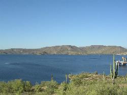
Vineyard Trail #131
Tonto Basin, Arizona
29.2 miles NETrail passes through a variety of Lower Sonoran Desert vegetation plant communities. Spectacular views of Roosevelt Lake, Apache Lake, Roosevelt Dam and Four Peaks. Historic Camp...
Mountain Bike
Three Bar Route
Tonto Basin, Arizona
29.2 miles NEThe Three Bar Wildlife Enclosure is a fenced wildlife study area operated by Arizona Game and Fish. The proximity of two recreation sites provides ample parking should you want to cool...
Mountain Bike
Park Trail #66
Tonto Basin, Arizona
31.7 miles NEFrom the Park Creek Trailhead, the trail crosses Park Creek and climbs gradually through lower Sonoran Desert and riparian vegetation for ½ mile. The trail then ascends steeply...
Mountain Bike 21.4 mi
Spur Cross to Lake Pleasant
Cave Creek, Arizona
32.1 miles NWStart at the Flat Tire Bike Shop and head north on Spur Cross Road. You will arrive at the Spur Cross Conservation Ranch in 3.2mi. From there enter the Maricopa Trail system and follow the signs...
Mountain Bike
Cave Creek Park
Cave Creek, Arizona
32.1 miles NWMultiple singletrack loops, just explore and find what works best for you. Watch out for hikers and horses.
Mountain Bike


