


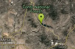
Three Bar Route
Tonto Basin, Arizona
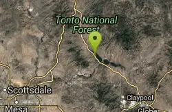
| Address: | ~AZ-188, Tonto Basin, AZ 85553, USA |
| GPS: |
33°43'32.5"N 111°12'27.9"W Maps | Directions |
| State: | Arizona |
| Trail Length: | 7.00 miles |
| Trail Type: | Out & Back |
| MTB Trail Type: | Singletrack |
Mountain Bike
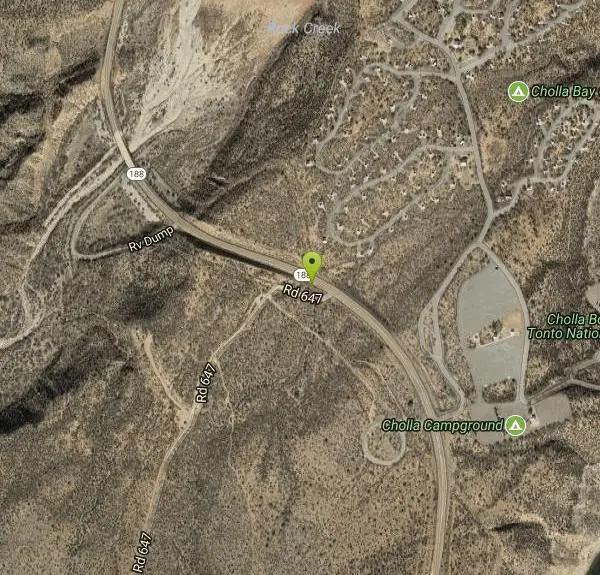
The Three Bar Wildlife Enclosure is a fenced wildlife study area operated by Arizona Game and Fish. The proximity of two recreation sites provides ample parking should you want to cool off in Roosevelt Lake after your ride. Scenery includes the riparian habitat associated with Roosevelt Lake and watershed as well as chaparral vegetation.Follow FR 647 from SR 188 around the Three Bar Wildlife Enclosure and back to SR 188. The Junction of State Highway 188 and the northern routehead of FR 647 and the junction of State Highway 188 and the southern routehead of FR 647 are separated by approximately 9/10 of a mile. This route may be traveled in either direction. Difficulty: more difficult. source: fs.usda.gov Courtesy of Singletracks.com
More Information
Add ResourceNever modify trail features. Ride trails when they're dry enough that you won't leave ruts. Speak up when you see others on the trail and always yield to hikers, horses, and others coming uphill. Always ride on the established trail.
Read More- Plan Ahead and Prepare
- Travel & camp on durable surfaces
- Dispose of waste properly
- Leave what you find
- Minimize campfire impacts
- Respect wildlife
- Be considerate of other visitors
Directions
From Tonto Basin, Arizona
- Head southeast on AZ-188 S toward Tonto Creek TrailDestination will be on the right(11.2 mi)
Other Mountain Bike Trails Nearby
Vineyard Trail #131
Tonto Basin, Arizona
2.4 miles SETrail passes through a variety of Lower Sonoran Desert vegetation plant communities. Spectacular views of Roosevelt Lake, Apache Lake, Roosevelt Dam and Four Peaks. Historic Camp...
Mountain Bike
Sycamore Trail #68
Tonto Basin, Arizona
8.1 miles NWFrom FR 421, the trail climbs steadily through lower Sonoran Desert and riparian vegetation up the arroyo formed by Sycamore Creek. It turns northward and continues to climb along a...
Mountain Bike 5.4 mi
Denton Trail #69
Tonto Basin, Arizona
8.1 miles NWFrom FR 421, the trail climbs steadily up the east face of the mountain. Some sections are quite steep. The trail eventually tops out at 5,760 feet elevation and then descends to Big Pine Flat for...
Hike, Mountain Bike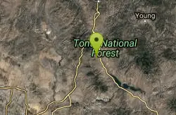
Park Trail #66
Tonto Basin, Arizona
12.5 miles NWFrom the Park Creek Trailhead, the trail crosses Park Creek and climbs gradually through lower Sonoran Desert and riparian vegetation for ½ mile. The trail then ascends steeply...
Mountain Bike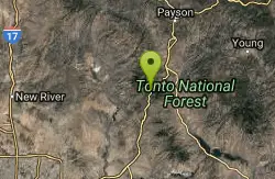
Slate Creek Divide Loop
Phoenix, Arizona
20.5 miles NWVarious routes available - Alternative #1 (From above): 13 Mi. (22 km) Alternative #2 (From above): 10 Mi. (16 km) Loop top half only (Inc. dirt. to 8 from SR 87): 12 Mi. (19 km) Figure eight: 16 Mi....
Mountain Bike
Lost Dutchman State Park
Apache Junction, Arizona
24.6 miles SWThis park has dirt biking trails. Bikes can use the lower trails (#58) shared with hikers. Bikes are not allowed above Jacobs Crosscut Trail.The park has added a new "Mountain Bike...
Mountain Bike
Secret, Tech & K
Gold Canyon, Arizona
26.1 miles SWFrom the parking lot start riding the main trail by the sign. Ride about 30 feet and then take the single track trail to the right. This is called the Horse Trail and leads to all of...
Mountain Bike
Cloudview
Gold Canyon, Arizona
26.3 miles SWThis parking area is used primarily for the very popular Hieroglyphs hiking trail and the Lost Goldmine hiking trail which connects with Peralta Road seven miles to the East. It is also...
Mountain Bike
Lost Goldmine & Cougar Loop
Gold Canyon, Arizona
26.4 miles SWThis is a short, fun but pretty technical ride. The technical part is the fact that it starts out with a ride on the Lost Goldmine trail which is a very rocky trail built for hiking....
Mountain Bike
K-trail & Vortex
Gold Canyon, Arizona
26.4 miles SWThis is definitely a challenging way to ride both the entire K and Vortex trails. They are best ridden from the North to the South but to do this you need to get to the North end of the...
Mountain Bike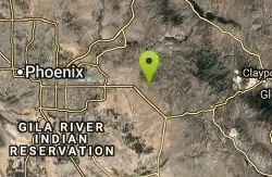
Holy Hill And Gila Monster
Gold Canyon, Arizona
27.3 miles SWThe Holy Hill By-Pass Trail was the newest trail in the Gold Canyon system as of April 2012. The Gila monster trail was listed as still under construction earlier in the year but seemed...
Mountain Bike
Prospector Loop
Apache Junction, Arizona
27.6 miles SWA fast beginners to intermediate (only if youre into speed) training loop. The trail has no markings but is the only trail in the area as it is undeveloped gravel desert. The trail is...
Mountain Bike
Blevins Via Meridian
Apache Junction, Arizona
28.4 miles SWThe ride East down Meridian trail is a one mile intermediate to beginner ride. However if you can stay on the pedals through the several dry wash crossings you are definitely not a...
Mountain Bike
Pass Mountain
Mesa, Arizona
28.5 miles SWMultiple loop options and trails with various degrees of difficulty. Beginners/novices will enjoy Moonrock and Blevins trails while experts will enjoy Pass Mt and the Cat Peaks loops. I...
Mountain Bike
Cat Peaks Via Ruidoso
Apache Junction, Arizona
28.9 miles SWThe Ruidoso trail is a beginner ride with a few tricky dry wash crossings that will challenge you to try and stay on the pedals. This trail ends at the Spillway trail after 1.2 miles....
Mountain Bike
Cat Peaks - Blevin - Moonrock
Apache Junction, Arizona
29.2 miles SWFollow Blevins trail 0.6 miles, the entrance to the Moonrock loop will be on your right, marked by a brown sign and arrow. Take this loop (around 1.4 miles) until it returns to Blevin's...
Mountain Bike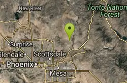
Sport Loop
Fountain Hills, Arizona
29.4 miles WMountain Bike near Fountain Hills, Arizona
Mountain Bike
Usery Mountain Regional Park
Mesa, Arizona
29.4 miles SWThere are many miles of two-way single-track trails in the park at several levels of difficulty. The Pass Mountain Trail should challenge intermediate to advanced riders. The Cat Peaks...
Mountain Bike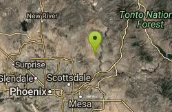
Pemberton Loop
Fort McDowell, Arizona
29.4 miles WThere are many places to start this loop from really as it crosses other trails and the main road twice. The 15 mile loop can be cut in half or about more by either the Tonto Tank tr or...
Mountain Bike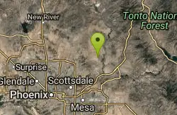
McDowell Mountain Park
Fort McDowell, Arizona
29.5 miles WThis trail is great. It is not as rocky as other Phoenix area trails( ie: Trail 100, National, Estrella Mtn Park). Twisty singletrack on rolling contour. The surface consists of small...
Mountain BikeNearby Campsites

Lower Salt River Nature Trail
Fort McDowell, Arizona
28.9 miles SWThe Lower Salt River Nature Trail is a scenic walk to take at the Tonto National Forest. This trail provides stunning views as you walk alongside the Salt River. This rustic trail is older and less...
Camp, Hike
Buckhorn Campground Nature Trail
Apache Junction, Arizona
29.5 miles SWCamp and Hike near Apache Junction, Arizona
Camp, Hike
Hell's Gate
Payson, Arizona
34.8 miles NThis Wilderness was established in 1984, and contains approximately 37,440 rough acres with a major canyon and perennial stream extending its entire length. Deep pools of water may be separated by...
Backpack, Camp, Hike, Swim
Haigler Canyon Campground
Payson, Arizona
36.9 miles NThis campground was constructed in 2007 and offers 2 day-use sites and 2 campground areas with 14 overnight sites. This campground boasts a diversity of trees. Fishing for rainbow trout is a popular...
Camp, Hike, Swim 1.1 mi
Christopher Creek Campground
Payson, Arizona
41.7 miles NChristopher Creek is a popular campground situated just east of Payson, nestled between the Christopher Creek river, and the town of the same name. This site is used for both overnight and day-use...
Camp, Canyoneer, Cross-country Ski, Hike, Swim
Upper Tonto Creek Campground
Payson, Arizona
42.7 miles NUpper Tonto Creek Campground is a beautiful place to camp at the intersection of Tonto and Horton Creeks. In addition to camping, this is a popular destination to both fish and hike. The campground...
Camp, Hike 1.1-3.5 mi
Horton Springs
Payson, Arizona
42.9 miles NHorton Springs is a spring on the Mogollon Rim that leads into Horton Creek. There are campsites near the springs, and several hiking trails in the area that lead to the spring itself. Between the...
Backpack, Camp, Hike
Sinkhole Campground
Payson, Arizona
44.0 miles NESinkhole Campground is a camping area near Willow Springs Lake. There are also hikes, mountain biking trails, and fishing opportunities nearby. There are 26 campsites in total at this...
Camp, Hike, Mountain Bike
Aspen Campground
Payson, Arizona
44.2 miles NAspen Campground is a large campground near Payson, Arizona. Between the proximity to Woods Canyon Lake and the seclusion of the encompassing Apache-Sitgreaves National Forest, this is a...
Camp 4.0 mi
Woods Canyon Lake
Payson, Arizona
44.7 miles NWoods Canyon Lake is a fishing lake near Payson, Arizona located near the Mogollon Rim. The lake has a hike that loops around it, and several other hikes nearby to look at the particularly scenic...
Camp, Hike, Swim


