


119 Mountain Bike Trails near Tolleson, AZ
first prev 1 2 3 4 5 6 next lastShowing Mountain Bike Trails within 50 miles Distance miles of Tolleson, AZ, USA City, Zip, or Address

Estrella Mountains Competitive Track
Tolleson, Arizona
6.6 miles SWThe third competitive track in the Maricopa County Regional Park system, located in Estrella Mountain Regional Park, was completed in February 2000. The track consists of two loops totaling 13 miles....
Hike, Horseback, Mountain Bike 13.8 mi
Butterfield to Gadsen Loop Trail
Goodyear, Arizona
8.4 miles SWAs with other trails in Estrella, the trail is wide and the surface tends to be rather benign, varying from mostly smooth, to occasionally strewn with small rocks, sandy in the washes. Butterfield...
Hike, Horseback, Mountain Bike 2.9 mi
Coldwater Trail
Goodyear, Arizona
8.4 miles SWThe Cold Water Trail #27 is a seldom visited, remote backcountry destination along the backdrop of the rugged Verde Rim with healthy mixed vegetation and unique geology. The trail was originally used...
Hike, Horseback, Mountain Bike 1.0 mi
Quail Trail
Goodyear, Arizona
8.4 miles SWQuail Trail is the access trail from the Nature Center to the main trail system. It is a pretty steep climb, but smooth and steady. Quail Trail is a spur trail in the Estrella Mountain...
Hike, Horseback, Mountain Bike
Estrella Mountain Park
Goodyear, Arizona
8.5 miles SWNice mix of singletrack and doubletrack. One way loops, long loop and tech loop. A few mild climbs and some mild rock gardens, just let it ride. There is a lot of loose rocks on the...
Mountain Bike 3.6 mi
Toothaker Trail
Goodyear, Arizona
8.5 miles SWToothaker is an easy roller coaster of a trail. It crosses numerous washes ranging from small to large and can be a tad loose and/or rocky in some sections. The end reward is a nice view of Rainbow...
Hike, Horseback, Mountain Bike
Dysart Trail
Goodyear, Arizona
8.5 miles SW$6 entry fee per car.
Hike, Horseback, Mountain Bike
Rainbow Valley to Toothaker Loop Trail
Goodyear, Arizona
8.5 miles SWEstrella Mountain Regional Park has many trails within it, a great beginner to intermediate friendly trail is the Rainbow Valley to Toothaker Loop Trail. This 6.6 mile hike is mostly flat with a few...
Hike, Horseback, Mountain Bike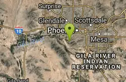
South Mountain Park / National Trail
Phoenix, Arizona
9.0 miles SENational trail can be acended or decended. Both require expert skills and fitness. You cannot and will not find a climb this technical, challenging and fun in AZ. It will kick your...
Mountain Bike 12.6 mi
National Trail
Phoenix, Arizona
10.6 miles SENational Trail is the gem of South Mountain and home to the infamous Waterfall. It’s a local favorite as well as a destination trail for MTB snowbirds. Like most trails in the Sonoran...
Hike, Mountain Bike
Glendale Canal
Glendale, Arizona
12.2 miles NHike, Horseback, and Mountain Bike near Glendale, Arizona
Hike, Horseback, Mountain Bike
Black jack
Goodyear, Arizona
12.5 miles SWExtreme terrain, advance riders only.
Mountain Bike
Holbert-Hidden Valley-Mormon Trail Shuttle
Phoenix, Arizona
12.9 miles SEHolbert- Hidden Valley- Mormon Trail is a combination trail hike on the north side of South Mountain near Phoenix, Arizona. This trail is approximately 6.5 miles long, and is suitable for...
Hike, Mountain Bike 0.8-1.0 mi
Kiwanis Trail to Telegraph Pass Lookout
Phoenix, Arizona
13.0 miles SEAn ideal hike to take children on as the distance is short and the elevation gain is not extreme. Avid hikers have opportunities to embark on longer hikes into South Mountain. ... This short hike is...
Hike, Mountain Bike 4.6 mi

Perl Charles Memorial Trail (#1A)
Phoenix, Arizona
14.1 miles NEThis is a technical singletrack loop with some very steep up and down sections located in the Phoenix Mountain Preserves. This trail is for advanced riders who like to bleed and leave their skin on...
Hike, Horseback, Mountain Bike 2.3 mi
Hidden Valley Trail Via Mormon Trail
Phoenix, Arizona
14.4 miles SEHidden Valley Trail via Mormon Trail is a 2-4 mile hike, depending on the route you choose to take and how much additional exploring you do. This hike offers a natural rock tunnel, petroglyphs,...
Hike, Mountain Bike 2.5 mi
Hidden Valley from Buena Vista Trail
Phoenix, Arizona
14.5 miles SEFor an easily accessible trail, butting right up against Phoenix’s southern border, it is truly surprising how special, quiet and natural the hike through Hidden Valley is! The path...
Hike, Mountain Bike
Shaw Butte and Charles M Christiansen Loop Trail
Phoenix, Arizona
15.1 miles NEWhen you say "North Mountain," I think most Arizonans know where it is or can find it. When you say "Shaw Butte," it seems like you get a lot more questioning glances and "huh?". Shaw...
Hike, Mountain Bike 1.7 mi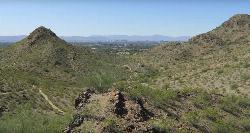
Quartz Ridge Trail
Phoenix, Arizona
15.3 miles EThis is a very popular trail on weekend mornings. Casual hikers can get great views of Phoenix with moderate effort. Good place to bring out of town visitors The Quartz Ridge Trail is a short,...
Hike, Mountain Bike 4.8 mi
Trail 1A
Phoenix, Arizona
15.4 miles NEThe trail can be accessed from the Dreamy Draw Park parking lot. From there, the trail can be ridden south towards its origin, or east (the trail makes an "L" shape). It is a mix of double...
Mountain Bike


