


Papago to Tempe Town Lake
Phoenix, Arizona
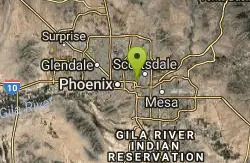
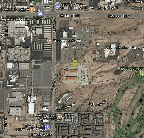
| Address: | ~1301 N 52nd St, Phoenix, AZ 85008, USA |
| GPS: |
33°27'41.5"N 111°58'4.4"W Maps | Directions |
| State: | Arizona |
| Trail Length: | 12.50 miles |
| Trail Type: | Loop |
| Hike Difficulty: | Beginner |
| Elevation Gain: | 433 feet |
Lakes Rivers Trails Rocks Pet Friendly
Hike
Linking two of the Phoenix area's signature destinations, the route from Papago Park to Tempe Town Lake is one of the Valley's most rewarding urban walks and bike rides — an easy, scenic way to string together desert buttes and cool waterfront in a single outing.
Papago Park itself is a 1,500-acre expanse of distinctive red sandstone buttes rising straight from the desert floor. Its trails lead to famous spots like Hole-in-the-Rock — a naturally eroded opening the ancient Hohokam used to track the sun — along with lagoons, Hunt's Tomb, and easy paths with sweeping city-and-mountain views. From there, a network of canal-side paths connects toward Tempe Town Lake, where the route rolls along the water and slips beneath the century-old Tempe bridges and the historic railroad bridge.
You can mix and match the interconnected trails and paths to suit your mood — a short desert stroll among the buttes, or a longer ride out to the lakefront and back. The Desert Botanical Garden and Phoenix Zoo sit right in Papago Park too, making it easy to build a full day.
This is exposed Sonoran Desert, so go early in the warm months, carry plenty of water, and wear sun protection.
More Information
Papago Park - Tempe Tourism
Papago Park is one of the most scenic desert areas in the Phoenix metro area. Explore its 1,500 acres filled with hiking and biking trails
https://www.tempetourism.com/things-to-do/papago-park/Papago Park | Visit Arizona
Papago Park might feel more like walking on the surface of a red planet with its massive red sandstone boulders. Plan a hiking or biking trip today!
https://www.visitarizona.com/places/parks-monuments/papago-parkBe courteous, informed, and prepared. Read trailhead guidelines, stay on the trail, and don't feed the wildlife.
Read More
- Plan Ahead and Prepare
- Travel & camp on durable surfaces
- Dispose of waste properly
- Leave what you find
- Minimize campfire impacts
- Respect wildlife
- Be considerate of other visitors
Directions
From Phoenix, Arizona
- Head west on W Washington St toward 1st Ave (0.5 mi)
- Turn right onto N 7th Ave (0.8 mi)
- Turn right to merge onto I-10 E toward Tucson (2.3 mi)
- Take exit 147A-147B for AZ-202 Loop E (0.4 mi)
- Keep left to continue toward AZ-202 Loop E (0.3 mi)
- Continue onto AZ-202 Loop E (3.2 mi)
- Take exit 4 for 52nd St toward Van Buren St (0.4 mi)
- Turn left onto N 52nd St (0.5 mi)
Other Hiking Trails Nearby

Double Butte Loop Trail
Phoenix, Arizona
0.9 miles SEA beginner-friendly 2.3-mile flat loop trail in Papago Park through Sonoran Desert vegetation — cholla, saguaro, and desert wildlife — with plenty of parking at the West Park lot.
Hike, Mountain Bike 
Crosscut Canal Trail
Tempe, Arizona
2.0 miles SEA two-mile concrete multi-use trail linking Tempe Town Lake to Papago Park, with canal views, desert buttes, a reservoir hidden in the Papago Buttes, and panoramic city views from the high point.
Hike 4.9 mi
Tempe Town Lake Trail
Tempe, Arizona
2.2 miles SEA lakeside paved trail at Tempe Town Lake connecting ASU, Tempe Beach Park, Tempe Marketplace, and extending east to Riverview Park in Mesa — with a water-level marina connection on the north side.
Hike 2.0 mi
Loma and Canal Trails
Tempe, Arizona
2.3 miles SEMountain biking and hiking trails through Papago Park in Tempe — the Loma Trail winds through hills to a small lake and playground, while the Canal Trail hugs the shady south canal.
Hike, Mountain Bike 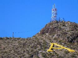
Hayden Butte And Tempe Town Lake Trail
Tempe, Arizona
2.9 miles SEHayden Butte, better known to generations of locals as "A" Mountain for the giant gold letter "A" near its top, is the landmark volcanic butte rising right in the heart of downtown Tempe beside...
Hike 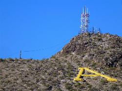
'A' Mountain at Hayden Butte
Tempe, Arizona
3.1 miles SEA short, slightly steep hike through Arizona State University's backyard with Hohokam petroglyphs and panoramic views of downtown Tempe at the top — a quick urban escape.
Hike 1.0-1.2 mi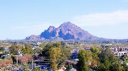
Camelback Mountain
Phoenix, Arizona
4.1 miles NTwo summit trails at Camelback Mountain — the steep 1.23-mile Echo Canyon Trail and the slightly easier 1.4-mile Cholla Trail — both with fantastic valley views.
Hike, Rock Climb 
Arizona Canal Trail
Phoenix, Arizona
5.2 miles NWMulti-purpose paved canal trails stretching from the Pima Indian Reservation to Glendale, tucked away from city traffic with underpasses, architecture, and space to bike, jog, walk, or ride horses.
Hike, Horseback 1.7 mi
Quartz Ridge Trail
Phoenix, Arizona
5.5 miles NWA short but strenuous hike through the Phoenix Mountain Preserve past towering Saguaro Cacti to great views of the city — a classic southwest desert trail.
Hike, Mountain Bike 0.9 mi
Ruth Hamilton Trail
Phoenix, Arizona
6.0 miles NThe Ruth Hamilton Trail (#8B) is a short, rocky climb in the Phoenix Mountains Preserve with big skyline views from a ridgeline bench.
Hike, Mountain Bike 1.9 mi
Javelina Trail
Phoenix, Arizona
6.1 miles SA fast and fun descent on Javelina Trail at South Mountain — a great warm-up climb and crowd-free alternative to the busier Pima Canyon trail.
Hike, Horseback, Mountain Bike 1.8 mi
Javelina-Beverly Canyon Loop Trail
Phoenix, Arizona
6.1 miles SA scenic, less-crowded mountain bike trail through beautiful hills and valleys that feels surprisingly remote, with fun singletrack options connecting to Bevery Canyon.
Hike, Horseback, Mountain Bike 1.4 mi
Mohave Trail (#200)
Phoenix, Arizona
6.2 miles NWA swift 0.6-mile one-way hike with a 300-foot elevation gain up switchbacks to a private summit view in Phoenix's Mountain Preserve — a quick escape from the crowds near Piestewa Peak.
Hike, Horseback 3.9 mi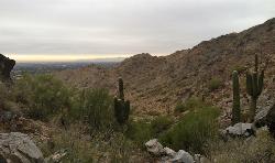
Freedom Loop Trail (#302)
Phoenix, Arizona
6.3 miles NWA 3.8-mile loop around Piestewa Peak with great views of Phoenix and a quieter feel than the crowded summit route — rocky but manageable, with saguaros all around.
Hike 1.1 mi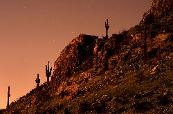
Piestewa Peak Summit Trail #300
Phoenix, Arizona
6.3 miles NWA steep, jagged, internationally recognized 1-mile climb to a 360-degree view of the entire Phoenix metro area — carved steps, two handrail sections, and water at the trailhead.
Hike 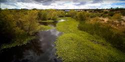
Rio Salado Habitat Restoration Area
Phoenix, Arizona
6.5 miles SWThe Rio Salado Habitat Restoration Area is a remarkable urban oasis just south of downtown Phoenix, where the historic Salt River, once a year-round river before it was diverted and drained, has been...
Hike 1.5 mi
Desert Classic
Phoenix, Arizona
6.9 miles SA classic 9-mile out-and-back (or 9-mile shuttle) on hardpacked sand, sandy washes, and small chunky rocks through South Mountain Park — the most accessible ride in the park.
Hike, Mountain Bike 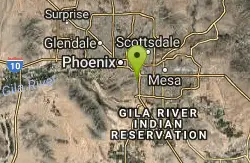
Pima Wash Trail to West Loop
Phoenix, Arizona
6.9 miles SHike near Phoenix, Arizona
Hike 
Desert Classic - Goat Trail
Phoenix, Arizona
6.9 miles SHike and Mountain Bike near Phoenix, Arizona
Hike, Mountain Bike 
National to Hidden Valley to Mormon Loop
Phoenix, Arizona
6.9 miles SHike near Phoenix, Arizona
HikeNearby Campsites

Lower Salt River Nature Trail
Fort McDowell, Arizona
18.6 miles EA 2-mile beginner loop alongside the Salt River in Tonto National Forest, with worn markers that keep things adventurous — watch for wild horses and spring cactus blooms.
Camp, Hike 
Buckhorn Campground Nature Trail
Apache Junction, Arizona
20.1 miles ECamp and Hike near Apache Junction, Arizona
Camp, Hike


