


Perrine Bridge
Jerome, Idaho
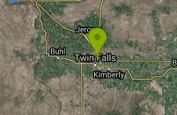
| Address: | Perrine Memorial Bridge, Jerome, ID 83338, USA |
| GPS: |
42°36'3.0"N 114°27'12.4"W Maps | Directions |
| State: | Idaho |
| Trail Type: | Point A to B |
| Hike Difficulty: | Beginner |
Restrooms Rivers Trails Rocks Wildflowers Pet Friendly Fishing Lakes Waterfalls Streams Glaciers Ponds Fall Colors Paintball Permitted National Park State Park
Hike
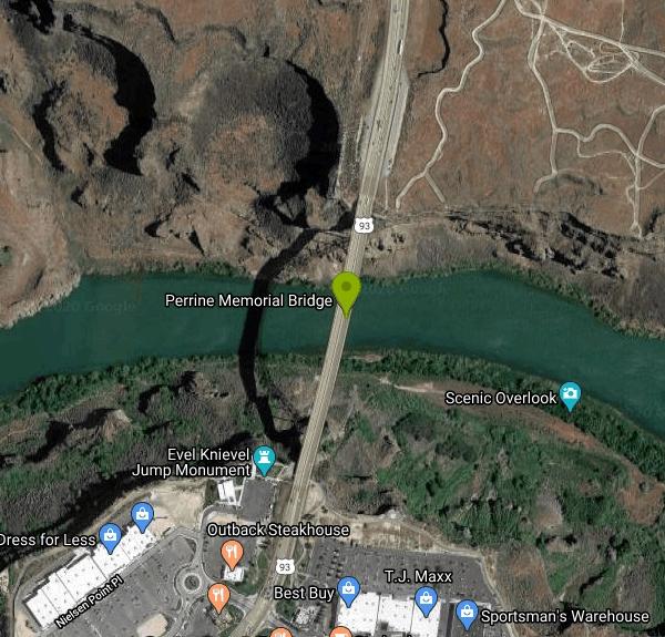
Perrine Bridge is located just above the Snake River. It spans 1,500ft, and is 486ft above the Snake River. You can drive over this bridge on the way back from Boise, or get out, park, and take it all in. There is a parking lot located in the Twin Falls Visitor Center. From there, you can access the canyon trails leading to the Bridge. This bridge is also home to many base jumpers who come prepared with parachutes year round.
More Information
Add ResourceBe courteous, informed, and prepared. Read trailhead guidelines, stay on the trail, and don't feed the wildlife.
Read More
- Plan Ahead and Prepare
- Travel & camp on durable surfaces
- Dispose of waste properly
- Leave what you find
- Minimize campfire impacts
- Respect wildlife
- Be considerate of other visitors
Directions
From Jerome, Idaho
- Head west on ID-25 W/
W Main St toward N Alder St Continue to follow ID-25 W(1.5 mi) - Turn left to merge onto I-84 E (7.1 mi)
- Take the exit toward US-93 S (0.8 mi)
- Keep right at the fork and merge onto US-93 S (2.9 mi)
- Turn right onto Fillmore St (322 ft)
- At the traffic circle, take the 3rd exit and stay on Fillmore St (0.1 mi)
- Turn left onto US-93 N (0.3 mi)
Other Hiking Trails Nearby
Shoshone Falls Park
Twin Falls, Idaho
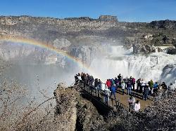
2.7 miles EBreathtaking spring runoff views of Shoshone Falls roaring so hard you feel the mist hundreds of feet up — plus a 2.5-mile canyon rim trail to Evel Knievel's 1974 Snake River jump site.
Hike 
Indian Springs
Kimberly, Idaho
13.8 miles SMulti-use trail system in south of Kimberly / Twin Falls, Idaho. Used for Mountain Biking, Hiking, and Horseback Riding.
Hike, Hot Springs, Mountain Bike 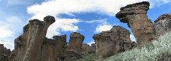
Little City of Rocks
Gooding, Idaho
37.7 miles NA volcanic hoodoo landscape of natural arches, towers, and mushroom-cap formations near Gooding, Idaho — best visited in spring when desert wildflowers bloom and the main loop trail is scenic.
Camp, Hike 4.8 mi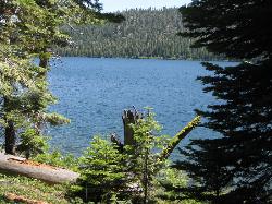
Independence Lakes
Elba, Idaho
47.3 miles SEA 7.7-mile hike that climbs to the summit of Mt. Independence, revealing four jewel-tone glacial lakes — plus free kayaks, motorized boats, and floats available from Memorial Day through October 1.
Backpack, Camp, Canoe, Hike, Kayak, SwimNearby Campsites
Kimama Wind Caves
Paul, Idaho
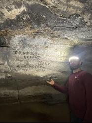
31.5 miles EA labyrinth of lava tubes in the desert north of Paul — tight crawls, varying ceiling heights, and graffiti throughout — strictly for experienced cavers with proper lights.
Camp, Cave 
McKinney Butte Lava Tubes
Gooding, Idaho
34.7 miles NWTwo forking lava tubes near Bliss — one open to anyone, the other gated (BLM permit required) — that survived the Bonneville Flood and a 1993 landslide.
Camp, Cave
Little City of Rocks
Gooding, Idaho
37.7 miles NA volcanic hoodoo landscape of natural arches, towers, and mushroom-cap formations near Gooding, Idaho — best visited in spring when desert wildflowers bloom and the main loop trail is scenic.
Camp, Hike 4.8 mi
Independence Lakes
Elba, Idaho
47.3 miles SEA 7.7-mile hike that climbs to the summit of Mt. Independence, revealing four jewel-tone glacial lakes — plus free kayaks, motorized boats, and floats available from Memorial Day through October 1.
Backpack, Camp, Canoe, Hike, Kayak, Swim


