


Squire Creek Park
Arlington, Washington
| GPS: |
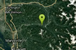
48°16'19.0"N 121°40'22.4"W Maps | Directions |
| State: | Washington |
Swim
More Information

- Plan Ahead and Prepare
- Travel & camp on durable surfaces
- Dispose of waste properly
- Leave what you find
- Minimize campfire impacts
- Respect wildlife
- Be considerate of other visitors
Directions
From Arlington, Washington
- Head west toward Broadway St (26 ft)
- Exit the traffic circle onto Broadway St (0.1 mi)
- Turn right onto WA-530 E/E Burke Ave/State Rte 530 NEContinue to follow WA-530 E/State Rte 530 NE(24.1 mi)
- Turn left onto Squire Creek Park RdDestination will be on the left(0.2 mi)

Other Swimming Holes Nearby
Skykomish Area
Leavenworth, Washington
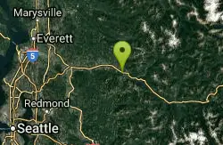
30.0 miles SSwim near Leavenworth, Washington
Swim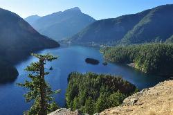
Diablo Lake
Rockport, Washington
39.9 miles NEA brilliantly turquoise glacial lake framed by Colonial, Pyramid, and Davis Peaks — kayak or canoe on Diablo Lake and explore trails to waterfalls in the North Cascades.
Camp, Canoe, Hike, Kayak, Swim
Jade Lake
Skykomish, Washington
44.4 miles SEA 26-mile overnight backpacking route through the Snoqualmie region past wildflower meadows, Marmot Lake, and a steep talus scramble to a remote alpine lake for swimming.
Backpack, Camp, Swim
Cranberry Lake Swim Beach (Deception Pass State Park)
Oak Harbor, Washington
45.8 miles WRoped freshwater swim beach on Cranberry Lake at Deception Pass State Park, a few hundred feet from the saltwater at West Beach, with kayak rentals, a CCC-era bathhouse and the park's main campground.
Camp, Hike, Kayak, Swim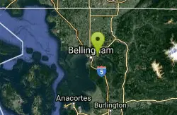
Whatcom Falls Park
Bellingham, Washington
47.8 miles NWSwim near Bellingham, Washington
SwimNearby Campsites
Diablo Lake
Rockport, Washington
39.9 miles NEA brilliantly turquoise glacial lake framed by Colonial, Pyramid, and Davis Peaks — kayak or canoe on Diablo Lake and explore trails to waterfalls in the North Cascades.
Camp, Canoe, Hike, Kayak, Swim
Jade Lake
Skykomish, Washington
44.4 miles SEA 26-mile overnight backpacking route through the Snoqualmie region past wildflower meadows, Marmot Lake, and a steep talus scramble to a remote alpine lake for swimming.
Backpack, Camp, Swim
Cranberry Lake Swim Beach (Deception Pass State Park)
Oak Harbor, Washington
45.8 miles WRoped freshwater swim beach on Cranberry Lake at Deception Pass State Park, a few hundred feet from the saltwater at West Beach, with kayak rentals, a CCC-era bathhouse and the park's main campground.
Camp, Hike, Kayak, Swim


