


Jade Lake
Skykomish, Washington

| Address: | Deception Creek, King County, WA, United States |
| GPS: |
47°42'55.2"N 121°11'43.7"W Maps | Directions |
| State: | Washington |
Lakes Waterfalls Glaciers Trails
Backpack, Camp, and Swim
Jade Lake is a beautiful treasure of a lake located in the Snoqualmie region of Washington. This trail is about 26 miles and is usually done as an over night backpacking trip. This hike will take backpackers past some beautiful lakes as well as provide excellent views of the nearby moutains.
The trail to Jade Lake has several starting points, some will have parking lots available, but they fill up rather quickly on weekends. Following the Deception Creek trail, hikers will go for about 5 miles until they reach Deception Pass. Here the trail becomes a junction for several other trails in the area, but hikers will want to take the trail for Marmot Lake. At first, this part of the trail will be about a 2 mile descent through wildflower meadows (depending on the season) followed by a 2 mile climb back up, eventually reaching Marmot Lake. Some people choose to camp here for the first night and catch their breath at this beautiful lake. This lake is great for swimming and provides a refreshing soak after a long hike.
After resting at Marmot Lake, continue on the east side of the lake where a trail will take hikers up a steep scramble of talus. This eventually opens up into an alpine meadow, and be sure to look for local wildlife while hiking around. The next lake hikers will see is No-Name-Lake, and from here it is only a short distance to Jade Lake. At Jade Lake, there are several other activities to do including swimming or fishing in the lake. In the mountains surrounding Jade Lake is a glacier that can be hiked to. If hiking to the glacier, it might be best to have some crampons and an ice axe. This makes the hike much easier, though isn't required. Views at Jade Lake include Mount Daniel, which is the highest point in Kings Canyon. Most people will take a day pack with them so they don't have to carry around their heavy backpack while exploring the area.
For the return trip, just take the trail back to the parking lot. This can also be split into multiple days if wanting to take it slower, or it can be done in one day.
More Information
Backpacking Guide: Jade Lake and Dip Top Gap
https://www.youtube.com/watch?v=JXS-KRHKeyQ+Overview+High+up+in+the+Alpine+Lakes+Wilderness%2C+there+is+a+shimmering+blue+lake+surrounded+by+soaring%2C+snow-covered+peaks.+The+experience+of+hiking+to+Jade+Lake+feels+like+a+dream%2C+especially+once+you+return+to+civilization.+If+my+sore+legs+didn%E2%80%99t+serve+as+a+reminder%2C+I+would+question+whether+it+even+happened.+In+August+2020%2C+I+hiked+to+Jade+Lake+with+my+dog+Arrow.+After+setting+up+camp+at+Jade+Lake%2C+we+continued+up+the+snowfield+to+Dip+Top+Gap+to+get+a+view+of+Pea+Soup+Lake.+We+spent+a+night+at+Jade%2C+then+hiked+back+down+to&feature=youtu.be
https://backobeyond.blog/backpacking-guide-jade-lake-and-dip-top-gap/Checking your browser...
This will only take a few seconds…
https://thirst4adventure.com/2016/08/29/jade-lake/Jade Lake, Marmot Lake
This was the longest backpacking trip I’ve ever attempted (26miles in total with our day tripping/exploring around Jade Lake), but OH MY was it worth it. Trail was well maintained until deception…
https://www.wta.org/go-hiking/trip-reports/trip_report.2015-07-08.8292101536The Ultimate 64-Hour Weekend: Take a Dip in Marmot and Jade Lakes
Call in sick if you can for this long weekend jaunt from Seattle to two of the Cascades’ prettiest lakes.
https://www.backpacker.com/trips/the-ultimate-64-hour-weekend-take-a-dip-in-marmot-and-jade-lakes/
- Plan Ahead and Prepare
- Travel & camp on durable surfaces
- Dispose of waste properly
- Leave what you find
- Minimize campfire impacts
- Respect wildlife
- Be considerate of other visitors
Directions
From Skykomish, Washington
- Head west on E Railroad Ave toward 5th St N (138 ft)
- Turn right onto 5th St N (0.2 mi)
- Turn right onto US-2 EDestination will be on the left(8.0 mi)


Other Swimming Holes and Backpacking Trails Nearby
Rock Island
Leavenworth, Washington
14.9 miles SESwim near Leavenworth, Washington
Swim
Skykomish Area
Leavenworth, Washington
23.1 miles WSwim near Leavenworth, Washington
Swim
island lake
North Bend, Washington
24.3 miles SWA quieter alternative to the crowded Snoqualmie Pass hikes — shed the weekend throngs who turn back at Talapus or Olallie Lake and discover Island Lake in western Washington.
Camp, Hike, Swim
French Cabin Creek
Ronald, Washington
25.1 miles STwo cold, clear swimming spots in a National Forest creek on either side of a bridge near Ronald, Washington — clothing may be optional.
Swim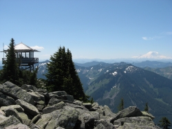
Granite Mountain
North Bend, Washington
25.9 miles SWA steep, rewarding hike up Granite Mountain gaining about 1,000 feet per mile, with panoramic summit views of Mount Rainier, Mount Stewart, and the Teanaway — best tackled after the snow melts.
Backpack, Hike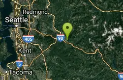
Snoqualmie River Area
Leavenworth, Washington
30.4 miles SWScenic Snoqualmie River swimming areas are best visited in late summer when currents slow — strong currents have caused drownings at other times of year.
Swim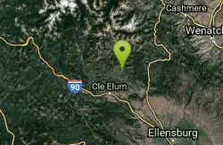
Teanaway River
Cle Elum, Washington
33.7 miles SESwim near Cle Elum, Washington
Swim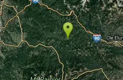
Green River Area
Ronald, Washington
37.4 miles SSeveral informal swimming spots in the Upper Green River east of Seattle and North Bend — a casual and scenic escape with clothing sometimes optional.
Swim
Lake Sammamish State Park Beaches
Issaquah, Washington
41.7 miles WSunset Beach and Tibbetts Beach at the south end of Lake Sammamish, a 512-acre state park off I-90 in Issaquah with paddle rentals, playgrounds, trails and a boat launch.
Hike, Kayak, Mountain Bike, Swim
Squire Creek Park
Arlington, Washington
44.3 miles NWSwim near Arlington, Washington
Swim
Lake Wilderness Park Swim Beach
Maple Valley, Washington
46.0 miles SWFree city park beach on Lake Wilderness in Maple Valley with summer lifeguards, canoe and paddleboard rentals, a concession stand, a big playground and a 40-acre arboretum.
Canoe, Hike, Kayak, Swim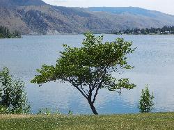
Daroga State Park
Orondo
46.1 miles EA mile and a half of Columbia River shoreline six miles north of Orondo, with a marked swim beach, a warm shallow lagoon behind the spit, and primitive campsites you can only reach on foot or by boat. Discover Pass required, open April through September.
Camp, Hike, Kayak, Swim
Taneum Creek
Thorp, Washington
46.8 miles SA popular swimming hole with a deep front pool and a wide, shallow play area directly above and across the creek — a great combo for mixed groups of swimmers.
Swim
Seattle Area Beaches
Leavenworth, Washington
47.5 miles WSwim near Leavenworth, Washington
Swim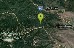
Rainier East Area
Naches, Washington
47.6 miles SSwim near Naches, Washington
SwimNearby Campsites
island lake
North Bend, Washington
24.3 miles SWA quieter alternative to the crowded Snoqualmie Pass hikes — shed the weekend throngs who turn back at Talapus or Olallie Lake and discover Island Lake in western Washington.
Camp, Hike, Swim
Daroga State Park
Orondo
46.1 miles EA mile and a half of Columbia River shoreline six miles north of Orondo, with a marked swim beach, a warm shallow lagoon behind the spit, and primitive campsites you can only reach on foot or by boat. Discover Pass required, open April through September.
Camp, Hike, Kayak, Swim


