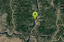
Steamboat Rock State Park Swim Beach
Electric City, Washington

| GPS: |
47°51'34.2"N 119°7'17.4"W Maps | Directions |
| State: | Washington |
Camp, Hike, Kayak, Mountain Bike, and Swim
Steamboat Rock is the landmark of the Grand Coulee: an 800-foot basalt butte with a 600-acre flat top, standing alone in the middle of Banks Lake like a ship at anchor. The state park wraps around its base on a peninsula at the north end of the lake, and the swim beach is on the day-use side of the campground, a long stretch of sand with a buoy line marking the swim area, lawn and shade trees behind it, restrooms and outdoor showers. The water is warm by July in a way the Cascades never are, because Banks Lake is a shallow, sun-baked reservoir in the coulee floor, and by August the afternoon swim is the point of the day.
The park is 14 miles south of Grand Coulee on WA 155, about a two-and-a-half-hour drive from Spokane or Wenatchee, and its 5,043 acres include 50,000 feet of shoreline. A Discover Pass, $10 for the day or $45 for the year, is required to park; the pass is a state fee and covers all Washington state parks. Hours are 6:30 a.m. to dusk for day use. There is no lifeguard on the beach.
The campground has more than 150 sites, from primitive walk-ins to full hookups, plus cabins, and reservations run April 1 through October 31; the summer weekends are among the hardest to book in Washington. Boaters get seven launch ramps at three locations, with the Northrup Point ramp open 24 hours, and Banks Lake is a serious walleye and smallmouth fishery. Kayakers stay close to the rock, where the cliffs drop straight into the water and the wind is quieter than out on the open lake. Jones Bay and Osborn Bay, farther down the lake, have primitive campsites for anyone who wants a quieter night.
The hike up Steamboat Rock is short and steep, a mile or so up a scree gully to the plateau, where trails wander across the top through sagebrush and spring wildflowers with the whole coulee spread out below. Northrup Canyon, across the highway, is the other hike, a quiet side canyon with the ruins of an early homestead, the largest stand of trees in the county and bald eagles roosting in winter. Watch for rattlesnakes on both trails in summer. Add the Grand Coulee Dam laser show at night and Dry Falls a half hour south and this is an easy three-day weekend.
More Information
Never modify trail features. Ride trails when they're dry enough that you won't leave ruts. Speak up when you see others on the trail and always yield to hikers, horses, and others coming uphill. Always ride on the established trail.
Read MoreBe courteous, informed, and prepared. Read trailhead guidelines, stay on the trail, and don't feed the wildlife.
Read More
- Plan Ahead and Prepare
- Travel & camp on durable surfaces
- Dispose of waste properly
- Leave what you find
- Minimize campfire impacts
- Respect wildlife
- Be considerate of other visitors
Directions
From Electric City, Washington
- Head northwest on Stevens Ave toward W Grand Ave (0.1 mi)
- Turn left onto WA-155 S/
Coulee Blvd (8.7 mi) - Turn right onto Steamboat Rock Park Entrance Rd (2.6 mi)
- Turn right (459 ft)
- Turn left (144 ft)
- Turn right (144 ft)
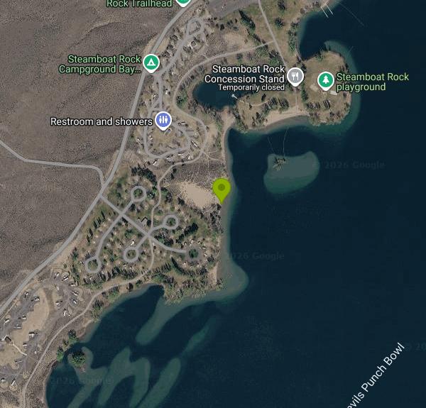 Steamboat Rock above Banks Lake courtesy of Steamboat Rock State Park↗ (CC BY-SA 4.0↗)

 The park shoreline on Banks Lake courtesy of Steven Pavlov↗ (CC BY-SA 4.0↗)

 Aerial view of Steamboat Rock and the park peninsula courtesy of Joe Mabel↗ (CC BY-SA 3.0↗)

 Steamboat Rock from WA 155 courtesy of Steven Pavlov↗ (CC BY-SA 4.0↗)

 Approaching Steamboat Rock across Banks Lake courtesy of brewbooks from near Seattle, USA↗ (CC BY-SA 2.0↗)
 Banks Lake in fall colors on the Coulee Corridor courtesy of Unknown authorUnknown author or not provided↗ (Public domain↗)
 On top of Steamboat Rock courtesy of brewbooks from near Seattle, USA↗ (CC BY-SA 2.0↗)

Other Mountain Bike Trails, Swimming Holes, Hiking Trails, and Kayaking Areas Nearby

Chelan Falls Park
Chelan Falls, Washington
40.2 miles WFree Chelan County PUD park on the Columbia River with a roped swim area, two-lane boat launch, docks, showers and ball fields, four miles below the town of Chelan.
Hike, Kayak, Swim 
Douglas Creek
Palisades, Washington
44.6 miles SWSwim near Palisades, Washington
Swim