


Columbia Cove Park
Brewster
Kayak and Swim
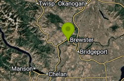
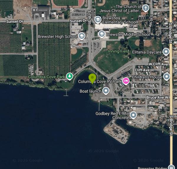
Columbia Cove Park is the City of Brewster's waterfront park on the north bank of the Columbia River in Okanogan County, Washington. This stretch of the river is Lake Pateros, the reservoir behind Douglas County PUD's Wells Dam, and the park is one of the public shoreline sites developed under the PUD's Wells Project license and run by the city. Along with the river beach it has a boat launch, two boat docks, covered picnic shelters, restrooms, a playground and a large lawn, with the city pool and the Columbia Cove RV Park right next door.
The park sits at the south edge of Brewster, a few blocks from downtown, at the foot of 7th Street off West Bruce Avenue (the RV park office uses 604 West Bruce Avenue). Brewster is on US 97 between Pateros and Okanogan, and the park is a short drive from the highway through town. There are parking lots by the boat launch and near the shelters. On busy fishing weekends the launch lot fills with trucks and trailers, so beachgoers do better parking by the picnic area.
The swim beach is a small strip of shoreline near the middle of the park, just west of the picnic shelters and a short way up the shore from the boat ramp, facing a sheltered cove. The water is the Columbia itself, which stays cool even in midsummer because it flows out of the big reservoirs upstream, so expect a bracing first plunge, especially before late July. The cove itself is calm, but the main channel beyond it has a steady current, and depth drops off unevenly. Hydroplane organizers who ran a race here in 2022 reported shallow spots scattered across the water off the park. The city does not advertise lifeguards at the river beach. If you want a guarded pool, the Brewster city pool is a few steps away and charges $3 daily admission during its summer season (it closed for 2026 in late August).
Swimming at the beach is free, as is the boat launch. The city does not publish separate hours for the beach; it is a day-use park area. Picnic gazebos are first come, first served unless someone has reserved one through City Hall ($112 reservation fee in 2026). Overnight stays are only in the RV park, which charges nightly rates and is not part of the free day-use area.
Watch for boats. The launch and docks are right beside the beach, and summer brings water skiers, tubers and anglers heading out to the salmon grounds. The city warns of a rock bar in front of the boat launch that gets worse when the reservoir is low, which also means more exposed rock near shore on low-water days. Brewster hosts its salmon derby from this launch in summer, and in recent Septembers the park has been the venue for the Tony Newton Memorial Regatta hydroplane races, so check the city's event notices before planning a quiet beach day on those weekends. No current health advisory has been posted for this part of Lake Pateros, but blue-green algae has prompted alerts downstream on the Columbia in late summer, so skip the water if you see scum or mats.
Beyond swimming, the park is a launch point for fishing, paddling and boating on roughly 20 miles of open river between Wells and Chief Joseph dams. The lawn and shade trees make it an easy place to spend a hot Okanogan afternoon, and the city's ballfields and recreation center are a short walk away.
More Information
Brewster approves hydro event application at Columbia Cove Park - Quad City Herald
BREWSTER – Hydroplane races took a step closer to becoming an annual event in the Columbia River off Columbia Cove Park when the city council, at its regular monthly meeting last Thursday, …
https://www.qcherald.com/stories/brewster-approves-hydro-event-application-at-columbia-cove-park,37425Brewster study expands Columbia Cove RV parking - Quad City Herald
BREWSTER – A concept rendering of expanded RV parking at Columbia Cove was unveiled by Public Works Director Lee Webster at last Wednesday’s regular monthly meeting of the city council on …
https://www.qcherald.com/stories/brewster-study-expands-columbia-cove-rv-parking,96328Debut hydro race is a hit at Columbia Cove - Quad City Herald
BREWSTER – The Tony Newton Memorial Regatta debuted at Columbia Cove Park on Saturday and Sunday, Sept. 10-11, and the reviews from both quarters – city and race officials – are …
https://www.qcherald.com/stories/debut-hydro-race-is-a-hit-at-columbia-cove,36681Hydro racing! next stop Brewster Washington.
The City of Brewster brings you the Brewster Thunderfest and the Tony Newton Memorial Boat Race, September Seventh and Eighth at Columbia Cove Park in Brewster.
https://thequake1021.com/brewster-thunderfest-hydroplane-racing/Visit Brewster — Brewster Washington Chamber of Commerce
Brewster Washington Chamber of Commerce. Join Us in Building Business and Celebrating Community. Supporting Business, Recreation, Services and Community Events in Brewster, Okanogan County, Washington. Located at the base of the Cascade Mountains and the confluence of the Columbia, Okanogan, and Methow Rivers, Brewster is a scenic town with amazing fishing, including our annual Salmon Derby. The area is surrounded by Cherry and Apple Orchards. Orchard agriculture, as well as, apple and cherry fruit packing plants are the major driver of our community. Near by you can find amazing golf at Gamble Sands and Alta Lake, as well as Skiing at Loup Loup Ski Bowl. So come by, try our restaurants, shop at our boutique stores, enjoy the abundant recreation and try some of the best most fresh fruit on earth. Visit Brewster Washington.
https://www.brewsterwachamber.com/visit-brewster
- Plan Ahead and Prepare
- Travel & camp on durable surfaces
- Dispose of waste properly
- Leave what you find
- Minimize campfire impacts
- Respect wildlife
- Be considerate of other visitors
Directions
From Brewster
- Head southwest (0.7 mi)
- Slight right (0.4 mi)
- Turn left onto W Cedar Springs Rd (0.2 mi)
- Turn right to stay on W Cedar Springs Rd (1.1 mi)
- Turn right (0.5 mi)
- Turn right onto 9 Point Mesa Ranch Rd (16.5 mi)
- Turn right onto TX-118 N (43.4 mi)
- Slight right onto S Cockrell St (0.3 mi)
- Turn left onto E Ave East (0.4 mi)
- Continue onto US-90 W/
W Ave E (signs for Marfa) Continue to follow US-90 W(99.6 mi) - Turn left onto W Frontage Rd (0.2 mi)
- Slight left to merge onto I-10 W (128 mi)
- Keep left to stay on I-10 WEntering New Mexico(31.3 mi)
- Keep right to continue on I-25 N, follow signs for Las Cruces/
Albuquerque (6.7 mi) - Keep left to stay on I-25 N (20.4 mi)
- Take the exit toward Border Patrol Checkpoint (374 ft)
- Continue onto Border Patrol Checkpoint (344 ft)
- Continue straight (0.2 mi)
- Merge onto I-25 N (177 mi)
- Take exit 203 for NM-6 toward Los Lunas (0.2 mi)
- Turn left onto NM-6 W/
Main St NW Continue to follow NM-6 W(32.7 mi) - Turn left to merge onto I-40 W toward Grants (106 mi)
- Take exit 20 toward Muñoz Blvd (0.2 mi)
- Turn right onto US-491 NPass by KFC (on the right in 0.6 mi)Passing through ArizonaEntering New Mexico(92.1 mi)
- Turn left onto US-491 N/
Hesperus Peak Blvd Continue to follow US-491 NEntering Colorado(41.3 mi) - Slight left onto US-491 N/
S Broadway (signs for I-491) Continue to follow US-491 NEntering Utah(60.3 mi) - Turn right onto US-191 N/
N Main St Continue to follow US-191 N(85.4 mi) - Turn left onto the I-70 W/
US-6 W/ US-191 W ramp (0.5 mi) - Merge onto I-70 W/
US-191 N/ US-6 W (23.3 mi) - Take exit 157 to merge onto US-191 N/
US-6 W toward Price/ Salt Lake City Continue to follow US-6 W(127 mi) - Slight right to merge onto I-15 N toward Salt Lake City (122 mi)
- Keep left to continue on I-84 W, follow signs for BoisePassing through IdahoEntering Oregon(505 mi)
- Take exit 188 to merge onto US-395 N toward Stanfield/
Hermiston (0.8 mi) - Turn right onto County 1201 Rd/
S Edwards Rd Continue to follow S Edwards Rd(6.5 mi) - Turn right onto E Punkin Center Rd (472 ft)
- Turn left onto S Edwards Rd (1.0 mi)
- Turn right onto OR-207 N (2.1 mi)
- Turn right onto US-730 EEntering Washington(17.8 mi)
- Slight left (0.2 mi)
- Turn left onto US-12 W (16.2 mi)
- Take exit 14 to merge onto US-395 N toward Spokane (23.1 mi)
- Take the WA-17 N exit toward Mesa/
Moses Lake (0.4 mi) - Turn left onto WA-17 N/
Pepiot Rd Continue to follow WA-17 N(22.0 mi) - At the traffic circle, take the 2nd exit and stay on WA-17 N (22.3 mi)
- Slight right to stay on WA-17 N (signs for Ephrata/
Soap Lake) (3.8 mi) - At the traffic circle, continue straight to stay on WA-17 N (41.0 mi)
- Turn left onto US-2 W (1.6 mi)
- Turn right onto WA-17 N (21.4 mi)
- Slight left to stay on WA-17 N (16.1 mi)
- Turn left onto Foster Creek Ave (0.7 mi)
- Turn left onto 18th St (167 ft)
- Turn right onto Douglas Ave (0.6 mi)
- Turn left onto 10th St (312 ft)
- 10th St turns slightly right and becomes WA-173 W/
Maple St Continue to follow WA-173 W(9.4 mi) - Turn left onto Bruce Ave W (0.2 mi)
- Turn right onto S 7th St (167 ft)
- Turn left (190 ft)
Other Swimming Holes and Kayaking Areas Nearby
Alta Lake State Park
Pateros
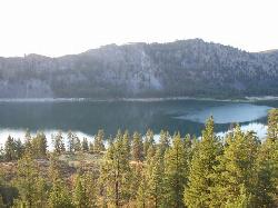
8.3 miles SWWashington state park beach on the north shore of Alta Lake, two miles southwest of Pateros, with a day-use swim area below tall rock cliffs. Discover Pass required; open April through October.
Camp, Hike, Kayak, Swim
Chelan Falls Park
Chelan Falls, Washington
22.1 miles SWFree Chelan County PUD park on the Columbia River with a roped swim area, two-lane boat launch, docks, showers and ball fields, four miles below the town of Chelan.
Hike, Kayak, Swim
Lake Chelan State Park
Chelan
24.2 miles SWWashington State Parks swim beach on the south shore of Lake Chelan, about 9 miles west of Chelan, with a roped swim area below the day-use lot. Discover Pass required ($10 day, $45 annual).
Camp, Hike, Kayak, Swim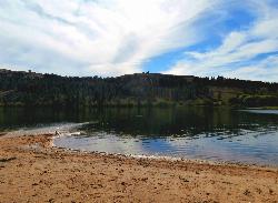
Pearrygin Lake State Park
Winthrop
31.8 miles NWA marked sand swim beach on the warm southeast shore of Pearrygin Lake, a mile and a half from Winthrop, with a shaded day use lawn and a bathhouse with hot showers. Washington State Parks posts no lifeguards, and day use takes a Discover Pass.
Camp, Canoe, Hike, Kayak, Swim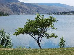
Daroga State Park
Orondo
32.7 miles SWA mile and a half of Columbia River shoreline six miles north of Orondo, with a marked swim beach, a warm shallow lagoon behind the spit, and primitive campsites you can only reach on foot or by boat. Discover Pass required, open April through September.
Camp, Hike, Kayak, Swim
Steamboat Rock State Park Swim Beach
Electric City, Washington
34.8 miles SESandy roped swim beach on Banks Lake below the 800-foot basalt butte of Steamboat Rock State Park, 14 miles south of Grand Coulee Dam in the Washington desert.
Camp, Hike, Kayak, Mountain Bike, Swim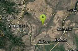
Douglas Creek
Palisades, Washington
43.7 miles SSwim near Palisades, Washington
Swim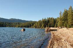
Lake Wenatchee State Park South Beach
Leavenworth
47.9 miles SWThe designated swim beach at Lake Wenatchee State Park, a sandy stretch of cold, clear glacier-fed lake in the eastern Cascades about 20 road miles from Leavenworth. Discover Pass required ($10 per day).
Camp, Canoe, Hike, Kayak, SwimNearby Campsites
Alta Lake State Park
Pateros
8.3 miles SWWashington state park beach on the north shore of Alta Lake, two miles southwest of Pateros, with a day-use swim area below tall rock cliffs. Discover Pass required; open April through October.
Camp, Hike, Kayak, Swim
Lake Chelan State Park
Chelan
24.2 miles SWWashington State Parks swim beach on the south shore of Lake Chelan, about 9 miles west of Chelan, with a roped swim area below the day-use lot. Discover Pass required ($10 day, $45 annual).
Camp, Hike, Kayak, Swim
Pearrygin Lake State Park
Winthrop
31.8 miles NWA marked sand swim beach on the warm southeast shore of Pearrygin Lake, a mile and a half from Winthrop, with a shaded day use lawn and a bathhouse with hot showers. Washington State Parks posts no lifeguards, and day use takes a Discover Pass.
Camp, Canoe, Hike, Kayak, Swim
Daroga State Park
Orondo
32.7 miles SWA mile and a half of Columbia River shoreline six miles north of Orondo, with a marked swim beach, a warm shallow lagoon behind the spit, and primitive campsites you can only reach on foot or by boat. Discover Pass required, open April through September.
Camp, Hike, Kayak, Swim
Steamboat Rock State Park Swim Beach
Electric City, Washington
34.8 miles SESandy roped swim beach on Banks Lake below the 800-foot basalt butte of Steamboat Rock State Park, 14 miles south of Grand Coulee Dam in the Washington desert.
Camp, Hike, Kayak, Mountain Bike, Swim
Lake Wenatchee State Park South Beach
Leavenworth
47.9 miles SWThe designated swim beach at Lake Wenatchee State Park, a sandy stretch of cold, clear glacier-fed lake in the eastern Cascades about 20 road miles from Leavenworth. Discover Pass required ($10 per day).
Camp, Canoe, Hike, Kayak, Swim


