


Stoney Creek Swim Area
Weaverville
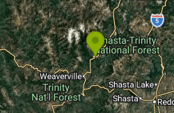
Swim
Stoney Creek Swim Area is a small Forest Service day-use beach on the Stuart Fork arm of Trinity Lake in Shasta-Trinity National Forest, inside the Trinity Unit of the Whiskeytown-Shasta-Trinity National Recreation Area. Trinity Lake is a large Bureau of Reclamation reservoir on the Trinity River, with a full-pool surface around 2,370 feet. The swim area is run for the Forest Service by its campground concessionaire, Shasta Recreation Company, which the Forest Service says was recently bought by Vista.
From Weaverville, drive north on State Route 3 for about 13.8 miles. The Trinity Journal places the turnoff about a mile past the Stuart Fork bridge. The entrance is a short paved loop beside the Stoney Creek group campground, with a paved parking lot and a paved path down to the beach. Weaverville is the closest town with groceries and fuel, roughly 14 road miles south.
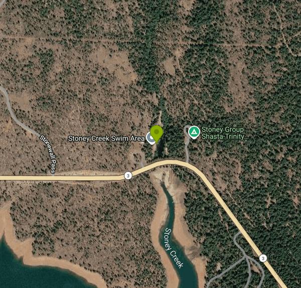
The water here is a small inlet on the inland side of Highway 3, where Stoney Creek passes under the road through a culvert and meets the lake. The main body of the Stuart Fork arm and Pinewood Cove sit across the highway. That layout keeps the swimming water sheltered from boat wakes, and the Trinity Journal describes it as a sandy beach on a cold pond. Because the inlet only fills when the reservoir is high, it depends entirely on the lake level. One campground guide notes the swim area goes dry once the summer drawdown starts, and the Forest Service says the lake level decides how long the season lasts. No lifeguard service is listed, and no depth is posted, so check the bottom before jumping in.
The posted season is May 20 to September 12. Day use costs $10 per vehicle per day, collected by the concessionaire on a first come, first served basis, with no reservations for the day-use side. It is not a free site. Facilities include two picnic sites with brick patios, five tables, two pedestal grills and two benches. The Forest Service page says there is no potable water and lists the restrooms as closed, while the concessionaire's day-use page lists flush restrooms, so bring your own drinking water and plan on the restrooms possibly being locked.
Dogs must stay on a leash of six feet or shorter in the developed site, and dogs are not allowed on the beach at all. Black bears are seen often around this part of the lake, so keep food in your car or a bear-proof locker rather than out on a picnic table. As of early October 2026 the site is past its posted closing date, and late-season visits are likely to find a low or empty inlet.
The neighboring Stoney Creek group campground holds up to 60 people and is reserved through Recreation.gov. Clark Springs Day Use Area, a few miles farther up Highway 3, has a larger beach on the open lake with a gentle slope, and its posted day-use season runs to October 31. A public boat ramp and a marina are less than a mile away, and anglers on the Stuart Fork arm fish for bass, trout, salmon and catfish.
More Information
Camping in Trinity County | Camping | trinityjournal.com
Campgrounds abound in Trinity County, offering a wide range of experiences from primitive areas well off the beaten path to easily accessed sites with piped water and toilets.
https://www.trinityjournal.com/tourism_info/camping/article_2360f3fa-1852-11ea-8237-bb8dad0a16a0.htmlCDEC Web Applications
Water in California is a complex topic. Managing water resources sustainably requires an integrated approach, as water flows across many lines and impacts every Californian. Learn the water basics for better understanding of our programs and the issues related to our work.
https://cdec.water.ca.gov/Shasta-Trinity National Forest : Recreation Region - Trinity Lake, Trinity River, and Trinity Alps W
Trinity Lake, when full, has 145 miles of shoreline, contains 17,000 surface acres and holds 2,500,000 acre-feet of water. Trinity Lake Dam is one of the highest earth filled dams in the world.Lewiston Lake is about five miles long. A quiet lake great for canoeing or fishing. One boat launching ramp (Pine Cove) and one undeveloped launch area available. Rainbow trout abundant; brown and brook trout are common. Speed limit for boats is 10 mph. The water is generally very cold but there are some excellent shallow areas with warmer water for wading or swimming. Excellent fly fishing and a good lake for a float tube. Excellent wildlife viewing opportunities. Seasonal duck hunting does occur on the lake. Invasive Mussel-Free Certifications are required for launching boats on Trinity and Lewiston Lakes click here to download the certification prior to your visit. Forest Order 14-25-29 prohibits possessing and transporting golden, zebra, and quagga mussels on the boat ramps and below the highwater mark of Trinity and Lewiston Lakes. A violation of this prohibition is punishable by a fine of not more than $5,000 for an individual or $10,000 for an organization, or imprisonment for not more than six months, or both. The Trinity River is a Wild and Scenic River flowing from Lewiston Dam to the confluence with the Klamath River in Weitchpec, CA. The river provides for fishing, rafting, swimming, and wildlife viewing. Go with a guide or go on your own, this is a beautifully diverse river where you can flow by houses, through a remote canyon, or through a floodplain. The Trinity River is known for its chinook salmon and steelhead fishing.The Trinity Alps Wilderness is the second largest wilderness area in California, the Trinity Alps Wilderness nearly doubled in size by the 1984 California Wilderness Act. In that same year, it was added to the National Wilderness Preservation System. It currently has over 600 miles of trails and embraces over 500,000 acres of land. Chiseled granite peaks and alpine lakes dot the Trinity Alps Wilderness, with elevations from 2,000 feet in creek drainages to 9,000 feet at summits. This wilderness offers many different trails ranging from 1.5 miles to 15 miles at varying levels of difficulty. Many trailheads may be inaccessible by car or truck due to snow during the winter months. Management of the Wilderness is shared by the Shasta-Trinity National Forest, Klamath National Forest, and the Six Rivers National Forest. Additional information about this wilderness can be found at wilderness.net, a website jointly managed by the University of Montana and the four federal agencies that manage Wilderness. Please practice Leave No Trace ethics while in the Trinity Alps Wilderness. Leave No Trace describes how to dispose of waste properly, where to travel and camp and other ways to minimize your impact on the land and your impact to other hikers.
https://www.fs.usda.gov/r05/shasta-trinity/recreation/trinity-lake-trinity-river-and-trinity-alps-wildernessShasta-Trinity National Forest : Recreation Site - Stoney Creek Swim Area
Located on the Stuart Fork Arm of Trinity Lake, 14 miles north of Weaverville on State Route 3. It is a popular swimming and picnic area with a beach, two picnic sites with brick patios, 5 tables and 2 pedestal grills. There are two benches, paved path to the beach, paved parking lot.
https://www.fs.usda.gov/r05/shasta-trinity/recreation/stoney-creek-swim-areaStoney Creek Group Campground - Trinity Lake
Stoney Creek Group Campground by Trinity Lake in the Shasta-Trinity National Forest. Complete camping information including facilities, reservations, fees, and much more.
https://www.californiasbestcamping.com/trinity/stoney-group.htmlStoney Group Shasta-Trinity, Shasta-Trinity National Forest - Recreation.gov
Explore Stoney Group Shasta-Trinity in Shasta-Trinity National Forest, California with Recreation.gov. Stoney Group Campground is nestled on the banks of Stoney Creek on the Stuart Fork Arm of Trinity Lake. This group camp can accommodate up to 60 people with ten
https://www.recreation.gov/camping/campgrounds/232362
- Plan Ahead and Prepare
- Travel & camp on durable surfaces
- Dispose of waste properly
- Leave what you find
- Minimize campfire impacts
- Respect wildlife
- Be considerate of other visitors
Directions
From Weaverville
- Head south on Merchants Way/
Merchants Alley toward Central Ave (203 ft) - Turn left onto Central Ave (49 ft)
- Turn left onto US-19 BUS N (131 ft)
- Turn left onto N Main St (0.4 mi)
- Turn left onto Weaver BlvdPass by AutoZone Auto Parts (on the left)(0.7 mi)
- Continue onto US-25 N/
US-70 W Pass by First Citizens Bank (on the left in 10.7 mi)(26.1 mi) - Turn right onto US-25 N/
US-70 W/ Bridge St Continue to follow US-25 N/US-70 W Entering Tennessee(24.0 mi) - Turn left onto Lincoln Ave (0.7 mi)
- Turn right onto Mineral St (0.2 mi)
- Turn right to stay on Mineral St (0.2 mi)
- Turn left onto Jones Cir (0.2 mi)
- Turn left onto US-321 S (0.7 mi)
- Take the ramp to Knoxville (0.2 mi)
- Merge onto I-40 (17.2 mi)
- Keep left to stay on I-40 (49.7 mi)
- Slight right to stay on I-40 (signs for Nashville) (155 mi)
- Continue straight to stay on I-40 (2.1 mi)
- Slight right onto I-24 W (signs for I-65 N/
Clarksville/ Louisville) (2.7 mi) - Keep right to stay on I-24 W, follow signs for I-65 N/
Clarksville/ Louisville (2.2 mi) - Take exit 88 on the left for I-24 W toward Clarksville (0.7 mi)
- Continue onto I-24 WPassing through KentuckyEntering Illinois(175 mi)
- Take exit 44B to merge onto I-57 N toward Chicago (52.1 mi)
- Keep left to continue on I-64 W, follow signs for St Louis (70.8 mi)
- Take exit 3B to merge onto I-70 W toward IL-3 N/
Kansas City Entering Missouri(3.2 mi) - Take the I-70 W exit toward Kansas City (0.3 mi)
- Continue onto I-70 W (103 mi)
- Keep left to stay on I-70 W (9.7 mi)
- Exit onto Old U.S. 40 (0.3 mi)
- Slight left to merge onto I-70 W (18.6 mi)
- Take exit 117 for MO-O/
MO-J toward Huntsdale/ Harrisburg (0.3 mi) - Merge onto I-70 W (115 mi)
- Keep right to continue on I-70 W/
US-24 W/ US-40 W, follow signs for I-29 N/ I-35 N/ US-71 N/ St Joseph/ Des Moines (0.8 mi) - Keep right to continue on US-71 N, follow signs for I-29 N/
I-35 N/ Saint Joseph/ Des Moines (0.2 mi) - Continue onto I-29 N/
I-35 N/ US-71 N (4.5 mi) - Keep left to continue on I-29 N/
US-71 N, follow signs for KCI Airport/ St Joseph (3.5 mi) - Keep right to continue on I-29 N (42.6 mi)
- Keep left to stay on I-29 NEntering Iowa(87.8 mi)
- Take exit 10 for IA-2 toward Sidney/
Nebr City (0.3 mi) - Turn left onto IA-2 W (3.0 mi)
- Continue onto NE-2 W/
J Sterling Morton Beltway Entering Nebraska(4.3 mi) - Keep left to continue on NE-2 W (44.9 mi)
- Merge onto US-77 N/
Homestead Expy (3.2 mi) - Turn right (0.3 mi)
- Merge onto Warlick Blvd (0.9 mi)
- Turn left onto Old Cheney Rd (1.0 mi)
- Turn right onto US-77 N/
Homestead Expy (4.7 mi) - Take the ramp onto I-80 WPassing through WyomingEntering Utah(872 mi)
- Take exit 123B-A for I-15 S/
UT-201 W toward W Valley/ Las Vegas (0.5 mi) - Take the ramp to UT-201 W (0.2 mi)
- Take the UT-201 W ramp (1.1 mi)
- Continue onto UT-201 W (16.8 mi)
- Merge onto I-80 WEntering Nevada(496 mi)
- Take exit 15 to merge onto US-395 N toward SusanvilleEntering California(80.5 mi)
- Continue straight onto CA-36 WPass by Round Table Pizza (on the right in 3.4 mi)(10.1 mi)
- Turn right onto CA-44 W (45.9 mi)
- Turn left onto CA-44 W/
CA-89 S Continue to follow CA-44 W(60.4 mi) - Turn right onto CA-273 N/
Pine St (signs for CA-299/ Weaverville/ Eureka) (0.1 mi) - Turn left onto CA-273 N/
Eureka Way (signs for Weaverville/ CA-299 W) Continue to follow Eureka WayPass by Carl's Jr (on the right in 0.4 mi)(7.6 mi) - Continue onto CA-299 W (19.9 mi)
- Turn right onto Trinity Dam Blvd (4.6 mi)
- Turn left onto Lewiston Turnpike Rd (0.7 mi)
- Turn left onto Rush Creek Rd (8.4 mi)
- Turn right onto CA-3 N (6.9 mi)
- Turn left (79 ft)
- Turn rightDestination will be on the right(102 ft)
Other Swimming Holes Nearby
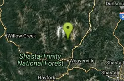
Stuarts Fork Swimming Hole
Trinity Center, California
5.9 miles NWStuart Fork next to the trailhead parking in Trinity County offers a quiet local swimming hole at the edge of California's Trinity Alps wilderness.
Swim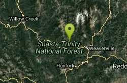
Willow Creek Area
Olympic Valley, California
15.5 miles WSwim near Olympic Valley, California
Swim
Brandy Creek Beach
Whiskeytown
21.8 miles SEThe busiest swim beach on Whiskeytown Lake: a long sandy shore with a roped swim area, summer store and kayak rentals, 8 miles west of Redding. An NPS entrance pass is required ($25 per vehicle for 7 days).
Camp, Kayak, Swim
Big Rock Day Use Area & River Access
Willow Creek
41.3 miles WBig Rock is a free Six Rivers National Forest day-use access on the Trinity River in Willow Creek, used for swimming, picnicking, fishing and floating. No lifeguard, cold spring flows and strong current around the rock.
Kayak, Swim
Forest Glen
Forest Glen, California
41.3 miles SWCamp and Swim near Forest Glen, California
Camp, SwimNearby Campsites
Brandy Creek Beach
Whiskeytown
21.8 miles SEThe busiest swim beach on Whiskeytown Lake: a long sandy shore with a roped swim area, summer store and kayak rentals, 8 miles west of Redding. An NPS entrance pass is required ($25 per vehicle for 7 days).
Camp, Kayak, Swim
Forest Glen
Forest Glen, California
41.3 miles SWCamp and Swim near Forest Glen, California
Camp, Swim


