


Big Rock Day Use Area & River Access
Willow Creek
Kayak and Swim
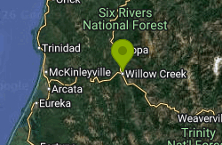
Big Rock Day Use Area & River Access is a Six Rivers National Forest site on the Trinity River in the town of Willow Creek, in eastern Humboldt County, California. The Lower Trinity Ranger District runs it as a day-use river access, and the Forest Service lists swimming, picnicking, river fishing and non-motorized boating as its uses. It sits on the town side of the river a few blocks from the Willow Creek ranger station, and on hot summer afternoons it is one of the busiest swimming spots on the lower Trinity.
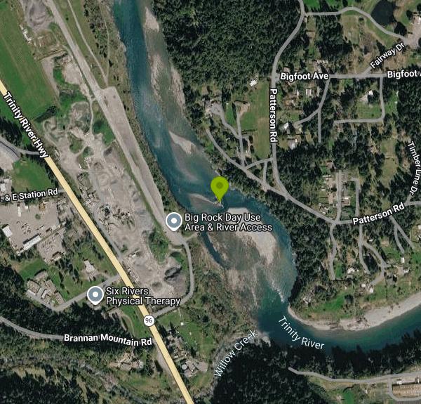
From the junction of Highway 299 and Highway 96 in the middle of Willow Creek, drive about a quarter mile north on Highway 96 and turn right toward the river. Cars park in the lot above the water, and a short walk leads down to the boat ramp and the shoreline. The coordinates the Forest Service publishes (40.94685, -123.63315) point to the parking area, not the shoreline. The Lower Trinity Ranger District office in Willow Creek can be reached at (530) 629-2118.
There is no marked swim area and no lifeguard. People swim and wade from the shore near the ramp, and the site takes its name from a large rock out in the river. Depth changes with the flow, so a spot that was knee deep in August can be over your head in June. The Trinity here is fed by releases from Lewiston Dam far upstream plus its tributaries. Water readings at Willow Creek were near 60 F in late June 2025 and about 70 F by late August 2025, so the river is far kinder in midsummer than in spring. Expect sunbathers, swimmers and rafters sharing the water on warm weekends.
The Forest Service lists no fee for Big Rock, and parking and river access are free. It is day use only, with no camping. Posted hours are not given on the forest's page, so plan on daylight use. The site has shaded picnic tables. The Forest Service description mentions two vault toilets while its amenity table says restrooms are not available, so don't count on a working toilet. There is no drinking water, so bring your own.
The river is the hazard here. On March 31, 2021, three swimmers from Arcata got stranded on a rock in the river at Big Rock and a Humboldt County sheriff's deputy, helped by people on the beach, brought them to shore with rescue gear. The Sheriff's Office warned afterward that spring is too early to swim the Trinity because of high, fast water, and asks swimmers to check river levels and Trinity River release schedules before going in, never swim alone, keep life jackets on young children, and not treat inflatable toys as flotation. Calm-looking water on this river still moves fast enough to pin a swimmer against a rock. If the current feels strong, get out.
Big Rock is also a working fishing and boating access. Anglers fish for half-pounder steelhead below the rock early in the morning, before the swimmers and rafters show up, and rafters and kayakers use it to put in or take out on the lower Trinity. Willow Creek's grocery stores, gas and restaurants are a few minutes away along Highway 299.
More Information
Six Rivers National Forest | Big Rock Day Use Area & River Access | Forest Service
Located approximately 1/4 mile on Highway 96 from the Highway 299 intersection in the town of Willow Creek, Big Rock offers day use for those who want to spend the day on the Trinity River. It is a popular spot in the summer months for swimming, sunbathing, picnicking and just relaxing. This site offers river access to fisherman and non-motorized boaters wishing to float the lower section of the Trinity River. It contains shaded picnic areas for those wanting to enjoy the river scenery out of the sun. There are two vault toilets for the convenience of river-bound visitors, and offers a place for those needing a break from the road.
https://www.fs.usda.gov/r05/sixrivers/recreation/big-rock-day-use-area-river-accessSix Rivers National Forest | Lower Trinity Ranger District | Forest Service
The Lower Trinity Ranger District is bisected by State Highway 299, the main travel route in Northwestern California to reach the Northcoast. Willow Creek is Approximately 100 miles west of Redding and 45 miles east of Eureka/Arcata. At one time, a major timber producing area, Willow Creek no longer supports a major manufacturing industry. Willow Creek however, is a recreation destination for sport fishing, including salmon and steelhead, kayakers, and river rafters who heavily use the Main Stem and South Fork of the Trinity River most of the year. The area is also famous for Bigfoot, achieving notoriety through the years as a hub for sightings. Hunting also is a big draw to the area with large deer and bear populations.
https://www.fs.usda.gov/r05/sixrivers/recreation/lower-trinity-ranger-district-0Six Rivers National Forest | Picnicking | Forest Service
Picnicking may be enjoyed anywhere on the National Forest, but tables and grills are provided at many designated picnicking sites.
https://www.fs.usda.gov/r05/sixrivers/recreation/opportunities/picnickingSix Rivers National Forest | Water Activities | Forest Service
The cool, clean lakes, rivers and streams of the Six Rivers National Forest can be a welcome relief from the heat and sun of the California summer. Always use caution when enjoying the water. Never swim or float alone and always wear appropriate safety equipment. Keep children close at all times and enjoy!
https://www.fs.usda.gov/r05/sixrivers/recreation/opportunities/water-activitiesThree Rescued from Trinity River
Three Arcata residents drawn to the Trinity River by warm temperatures this week were rescued at the Big Rock Day Use area after they became...
https://www.northcoastjournal.com/news-2/three-rescued-from-trinity-river-20123739/Trinity River - Willow Creek Weir Fish Report - Trinity River - Willow Creek Weir - Labor Day is Upo
Trinity River - Willow Creek Weir report from E.B. Duggan for August 24, 2025 - Trinity River - Willow Creek Weir - Labor Day is Upon Us With Hot Weather
https://www.norcalfishreports.com/fish_reports/229536/labor-day-is-upon-us-with-hot-weather.phpTrinity River - Willow Creek Weir Fish Report - Trinity River - Willow Creek Weir - Summer Has Arriv
Trinity River - Willow Creek Weir report from E.B. Duggan for June 22, 2025 - Trinity River - Willow Creek Weir - Summer Has Arrived!
https://www.norcalfishreports.com/fish_reports/226197/summer-has-arrived!.phpWillow Creek water rescue • County of Humboldt
On March 31, 2021, at about 4:45 p.m., a Humboldt County Sheriff’s deputy assigned to the Trinity River Division was contacted regarding multiple swimmers in distress at the Big Rock river access in W
https://flyacv.com/CivicAlerts.asp?AID=3844
- Plan Ahead and Prepare
- Travel & camp on durable surfaces
- Dispose of waste properly
- Leave what you find
- Minimize campfire impacts
- Respect wildlife
- Be considerate of other visitors
Directions
From Willow Creek
- Head south on CA-96 W toward CA-299 E (72 ft)
- Turn left onto CA-299 E (482 ft)
- Turn left onto Country Club Rd (0.9 mi)
- Country Club Rd turns left and becomes Patterson Rd (0.2 mi)
- Slight left to stay on Patterson Rd (436 ft)
Other Swimming Holes and Kayaking Areas Nearby
Willow Creek Area
Olympic Valley, California
28.3 miles SESwim near Olympic Valley, California
Swim
Oak Bottom River Access
Somes Bar
30.9 miles NFree Klamath National Forest gravel bar on the Wild and Scenic Salmon River near Somes Bar, across the road from Six Rivers' Oak Bottom Campground.
Camp, Kayak, Swim
Van Duzen River Area
Olympic Valley, California
36.0 miles SWSwim near Olympic Valley, California
Swim
Stuarts Fork Swimming Hole
Trinity Center, California
36.2 miles EStuart Fork next to the trailhead parking in Trinity County offers a quiet local swimming hole at the edge of California's Trinity Alps wilderness.
Swim
Swimmers Delight
Carlotta, California
36.4 miles SWA popular stretch of the Van Duzen River where gentle pools gather each summer, shared with salmon and steelhead fighting upstream to spawn in the river and its tributaries.
Swim
Scotia Firemen Park
Rio Dell, California
41.1 miles SWA riverside swimming hole on the Eel River right by the Scotia baseball park, with a small concrete jetty for jumping — check water levels and current before you leap.
Swim
Stoney Creek Swim Area
Weaverville
41.3 miles EA small, sheltered Forest Service swim beach on a Stoney Creek inlet of Trinity Lake's Stuart Fork arm, 14 miles north of Weaverville. $10 per vehicle, open May 20 to Sept. 12 while lake levels allow.
Swim
Forest Glen
Forest Glen, California
42.6 miles SCamp and Swim near Forest Glen, California
Camp, Swim
Leatherwood Bar
Redcrest, California
43.9 miles SThe Eel River runs alongside the Founders Grove redwoods at this swimming hole across from one of the most iconic groves in California's redwood parks.
Hike, Swim
Women's Federation Grove
Redcrest, California
44.8 miles SA secluded, less-crowded swimming hole on the Eel River inside Redwood State Park — park and hike down to the river bank for a quiet cool-off among the redwoods.
Swim
Humboldt Redwood Area
47.2 miles SW
Swim near
Swim
Lake Arrowhead Area
Redcrest, California
47.2 miles SWHot and cold spots along the Pacific Crest Trail northwest of Lake Arrowhead — a clothing-optional stretch for those seeking secluded soaks in the San Bernardino mountains.
Swim
Garden Club Grove
Myers Flat, California
47.5 miles SFollow the Eel River through Redwood State Park to a secluded swimming pool that few visitors know about — park roadside and hike down to the riverbank for a quiet summer afternoon.
SwimNearby Campsites
Oak Bottom River Access
Somes Bar
30.9 miles NFree Klamath National Forest gravel bar on the Wild and Scenic Salmon River near Somes Bar, across the road from Six Rivers' Oak Bottom Campground.
Camp, Kayak, Swim
Forest Glen
Forest Glen, California
42.6 miles SCamp and Swim near Forest Glen, California
Camp, Swim


