


Willow Creek Area
Olympic Valley, California
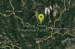
| GPS: |
40°47'14.0"N 123°8'6.0"W Maps | Directions |
| State: | California |
Swim
More Information

- Plan Ahead and Prepare
- Travel & camp on durable surfaces
- Dispose of waste properly
- Leave what you find
- Minimize campfire impacts
- Respect wildlife
- Be considerate of other visitors
Directions
From Olympic Valley, California
- Head north on Squaw Valley Rd (2.3 mi)
- Turn left onto CA-89 N (8.5 mi)
- At the traffic circle, take the 2nd exit and stay on CA-89 N heading to Interstate 80 W/Sacramento (0.1 mi)
- At the traffic circle, take the 2nd exit onto the I-80 W ramp to Sacramento (0.2 mi)
- Merge onto I-80 W (23.5 mi)
- Take exit 161 for CA-20 W toward Nevada City/Grass Valley (0.2 mi)
- Continue onto CA-20 W/State Hwy 20 W (492 ft)
- Turn right onto State Hwy 20 W (31.4 mi)
- Take the CA-20/Empire St exit toward Marysville St (0.2 mi)
- Turn right onto CA-20 W/State Hwy 20 W/W Empire St/Eric W. Rood Memorial Expy (signs for Marysville/Penn Valley)Continue to follow CA-20 W/State Hwy 20 W(25.9 mi)
- Turn right onto Woodruff Ln (5.1 mi)
- Turn right onto CA-70 N (26.3 mi)
- Continue onto CA-149 N (signs for CA-99/Chico/Red Bluff) (5.7 mi)
- Merge onto CA-99 N (48.0 mi)
- Continue onto CA-36 W/Antelope Blvd (2.1 mi)
- Merge onto I-5 N via the ramp to Redding (29.1 mi)
- Take exit 678 to merge onto CA-44 W toward Eureka (2.3 mi)
- Turn right onto CA-273 N/Pine St (signs for CA-299/Weaverville/Eureka) (0.1 mi)
- Turn left at the 1st cross street onto CA-273 N/Eureka Way (signs for Weaverville/CA-299 W)Continue to follow Eureka Way(7.6 mi)
- Continue onto CA-299 W (50.9 mi)
- Turn right onto E Fork Rd (0.6 mi)
- Turn right to stay on E Fork Rd (0.6 mi)

Other Swimming Holes Nearby
Stuarts Fork Swimming Hole
Trinity Center, California
12.8 miles NEStuart Fork next to the trailhead parking in Trinity County offers a quiet local swimming hole at the edge of California's Trinity Alps wilderness.
Swim
Stoney Creek Swim Area
Weaverville
15.5 miles EA small, sheltered Forest Service swim beach on a Stoney Creek inlet of Trinity Lake's Stuart Fork arm, 14 miles north of Weaverville. $10 per vehicle, open May 20 to Sept. 12 while lake levels allow.
Swim
Big Rock Day Use Area & River Access
Willow Creek
28.2 miles NWBig Rock is a free Six Rivers National Forest day-use access on the Trinity River in Willow Creek, used for swimming, picnicking, fishing and floating. No lifeguard, cold spring flows and strong current around the rock.
Kayak, Swim
Forest Glen
Forest Glen, California
30.2 miles SCamp and Swim near Forest Glen, California
Camp, Swim
Brandy Creek Beach
Whiskeytown
31.8 miles EThe busiest swim beach on Whiskeytown Lake: a long sandy shore with a roped swim area, summer store and kayak rentals, 8 miles west of Redding. An NPS entrance pass is required ($25 per vehicle for 7 days).
Camp, Kayak, Swim
Oak Bottom River Access
Somes Bar
43.8 miles NFree Klamath National Forest gravel bar on the Wild and Scenic Salmon River near Somes Bar, across the road from Six Rivers' Oak Bottom Campground.
Camp, Kayak, Swim
Swimmers Delight
Carlotta, California
48.6 miles SWA popular stretch of the Van Duzen River where gentle pools gather each summer, shared with salmon and steelhead fighting upstream to spawn in the river and its tributaries.
Swim
Van Duzen River Area
Olympic Valley, California
48.8 miles SWSwim near Olympic Valley, California
SwimNearby Campsites
Forest Glen
Forest Glen, California
30.2 miles SCamp and Swim near Forest Glen, California
Camp, Swim
Brandy Creek Beach
Whiskeytown
31.8 miles EThe busiest swim beach on Whiskeytown Lake: a long sandy shore with a roped swim area, summer store and kayak rentals, 8 miles west of Redding. An NPS entrance pass is required ($25 per vehicle for 7 days).
Camp, Kayak, Swim
Oak Bottom River Access
Somes Bar
43.8 miles NFree Klamath National Forest gravel bar on the Wild and Scenic Salmon River near Somes Bar, across the road from Six Rivers' Oak Bottom Campground.
Camp, Kayak, Swim


