


Stoughton Pond Recreation Area
Perkinsville
Canoe, Hike, Kayak, and Swim
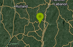
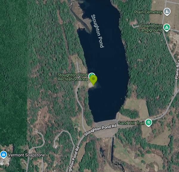
Stoughton Pond Recreation Area is a day-use park run by the U.S. Army Corps of Engineers, New England District, as part of its North Springfield Lake flood-control project. It sits on the west shore of Stoughton Pond, a roughly 50-acre impoundment of the North Branch of the Black River in the town of Weathersfield, just north of the village of Perkinsville in Windsor County. The park is mostly open lawn with patches of hardwood and softwood shade, rolling hills on every side, and a short sand beach at the water's edge.
To get there, take VT Route 106 north from Springfield to Perkinsville and turn onto Stoughton Pond Road. The entrance is about half a mile in on the left. Two small lots sit right above the beach, with accessible spaces and short steps down, so the walk to the sand takes a minute or two. Flush toilets, a changehouse and drinking water are next to the parking area.
The designated swim area is the small cove directly off the beach on the west shore. The entry is sand, and because the pond is small and the water is slow-moving it warms up through July and August, much more than the cold mountain streams nearby. Expect some aquatic plants in the shallows of any warm pond like this one by late summer. The Corps does not publish depths for the swim area, so wade in and check before letting children go out. Lifeguard coverage is not confirmed on any current Corps page, so plan to watch your own group. Motorboats are held to 5 mph on the pond, and the boat ramp is meant for small boats, canoes and kayaks, which keeps the water calm near the beach.
There is no day-use or beach fee listed by the Corps for Stoughton Pond. The Corps Lakes Gateway marks fee-collection sites with a dollar sign, and none of the North Springfield Lake areas, including Stoughton Pond, carries one. The only charge that shows up is for reserving the group picnic shelter through Recreation.gov. The park is seasonal: it opens for the summer swimming season and is closed in the off-season. Days and hours have varied from year to year, so call the North Springfield Lake project office at (802) 886-2775 before a trip.
The main hazards are the usual ones for a small, warm impoundment. Bacteria levels in the North Branch can rise after heavy rain, and the Corps monitors this site for E. coli in a program shared with the Connecticut River Conservancy and the Black River Action Team, so skip a swim for a day or two after a big storm. Watch for the drop-off at the edge of the swim area, and stay clear of the boat ramp and the open pond where paddlers and anglers are out.
Besides the beach, the park has a group picnic shelter with tables and a large grill, ten family picnic sites taken first-come, first-served, and an interpretive nature trail. Corps rangers run nature programs through the summer. Vermont Fish and Wildlife stocks the pond with rainbow trout, and it also holds largemouth bass, yellow perch, bullhead and pumpkinseed sunfish, so shore fishing is popular. A second launch, the Stoughton Pond Boat Ramp, is on Plains Cemetery Road on the east side of the pond.
More Information
Black River (North Branch - Stoughton Pond)
If here has been no rain in the past 48 hours.
https://connecticutriver.us/node/147Corps Lakes Gateway: Vermont - North Springfield Lake
An official website of the United States government Here's how you know
https://corpslakes.erdc.dren.mil/visitors/projects.cfm?Id=E612870North Springfield Lake - Camping | Recreation.gov
Reserve camping, permits & activities at North Springfield Lake. 1 campgrounds. Book official reservations on Recreation.gov.
https://www.recreation.gov/gateways/219Stoughton Pond Rec Area, North Springfield Lake - Recreation.gov
Explore Stoughton Pond Rec Area in North Springfield Lake, Vermont with Recreation.gov. Stoughton Pond Recreation Area is a day use area located to the north of North Springfield Lake. Stoughton Pond is located off State Route 106 on Stoughton Pond
https://www.recreation.gov/camping/campgrounds/249983Stoughton Pond, Weathersfield | Vermont Fish & Wildlife Department
Where To Go The US Army Corps of Engineers' (USACOE) day-use area offers shoreline fishing access, picnic facilities, and restrooms.
https://vtfishandwildlife.com/node/451Be courteous, informed, and prepared. Read trailhead guidelines, stay on the trail, and don't feed the wildlife.
Read More
- Plan Ahead and Prepare
- Travel & camp on durable surfaces
- Dispose of waste properly
- Leave what you find
- Minimize campfire impacts
- Respect wildlife
- Be considerate of other visitors
Directions
From Perkinsville
- Head west toward Fr 318 (1.0 mi)
- Turn left onto Fr 318 (0.7 mi)
- Turn right onto Fs 70 (11.7 mi)
- Continue onto Forest Service 354 Rd/
E Perkinsville Rd (2.0 mi) - Slight right to stay on Forest Service 354 Rd/
E Perkinsville Rd Continue to follow E Perkinsville Rd(8.5 mi) - At the traffic circle, take the 1st exit onto AZ-89 NPass by McDonald's (on the left in 0.2 mi)(1.2 mi)
- At the traffic circle, take the 2nd exit and stay on AZ-89 N (32.4 mi)
- Turn right onto the ramp to Williams/
Grand Canyon (0.4 mi) - Merge onto I-40 EEntering New Mexico(338 mi)
- Continue onto U.S. Route 66 (1.2 mi)
- Continue onto I-40 EPassing through TexasEntering Oklahoma(576 mi)
- Keep right to continue on I-35 N/
US-62 E, follow signs for Tulsa/ Wichita Continue to follow I-35 N(5.7 mi) - Merge onto I-35 N/
I-44 E (4.2 mi) - Take exit 138A for I-44 E toward TulsaToll road(0.4 mi)
- Continue onto I-44 EToll road(87.2 mi)
- Take the I-44 E/
OK-66 E exit toward Joplin (0.3 mi) - Continue onto I-44 E/
OK-66 E (17.0 mi) - Slight left (1.1 mi)
- Merge onto I-44 E (0.1 mi)
- Take the exit to stay on I-44 E toward Joplin/
Turnpike Toll roadEntering Missouri(379 mi) - Merge onto I-44 E/
I-55 N (0.9 mi) - Take exit 291A to merge onto I-55 N/
I-64 E/ US-40 E toward I-70 E/ Illinois Entering Illinois(0.8 mi) - Keep left to continue on I-55 N/
I-64 E (2.3 mi) - Keep left to continue on I-55 N (16.2 mi)
- Take exit 20A to merge onto I-70 E toward Indianapolis (83.5 mi)
- Keep right to stay on I-70 E, follow signs for IndianapolisEntering Indiana(58.7 mi)
- Keep right to stay on I-70 E (16.6 mi)
- Slight left (0.4 mi)
- Merge onto I-70 E (62.6 mi)
- Keep left to stay on I-70 E, follow signs for Dayton/
I-65 N (1.7 mi) - Keep left to stay on I-70 E, follow signs for Dayton (5.9 mi)
- Keep left to stay on I-70 E (59.5 mi)
- Slight left (4.3 mi)
- Merge onto I-70 EEntering Ohio(50.6 mi)
- Keep left to stay on I-70 E (49.1 mi)
- Keep left to continue on I-670 E, follow signs for Airport (4.3 mi)
- Take exit 5A-5B toward Cleveland (0.9 mi)
- Merge onto I-71 N (111 mi)
- Take exit 220 for I-271 N toward Erie Pa (0.3 mi)
- Continue onto I-271 N (25.1 mi)
- Keep left to stay on I-271 N, follow signs for 271 N/
Erie Pa (15.0 mi) - Merge onto I-90 EToll roadPassing through PennsylvaniaEntering New York(447 mi)
- Take exit 24 on the left for I-87 N/
I-90 E toward Albany/ Montreal Toll road(1.0 mi) - Continue onto I-87 N/
I-90 E Toll road(0.4 mi) - Take exit 1N for I-87 N toward Albany Int'l Airport/
Montreal (0.6 mi) - Merge onto Adirondack Northway (0.2 mi)
- Continue onto I-87/
Adirondack Northway (5.5 mi) - Take exit 7 for NY-7 E toward Troy/
Cohoes (0.2 mi) - Continue onto NY-7 EPass by Popeyes Louisiana Kitchen (on the right in 4.8 mi)(28.8 mi)
- Continue straightEntering Vermont(1.2 mi)
- Continue onto VT-279 E (3.5 mi)
- Take the ramp onto US-7 N (21.8 mi)
- Take exit 4 for VT-11/
VT-30 toward VT-7A/ Manchester/ Manchester Center (0.3 mi) - Slight right to merge onto VT-11 E/
VT-30 S/ Depot St Continue to follow VT-11 E(27.5 mi) - Turn left onto Church St (0.9 mi)
- Turn left onto VT-103 N (3.4 mi)
- Turn right onto VT-10 E (4.3 mi)
- Turn left onto VT-106 N (3.0 mi)
- Turn right onto Stoughton Pond Rd (0.7 mi)
- Turn left onto US Army Corps Of EngineersDestination will be on the right(0.2 mi)
Other Swimming Holes, Hiking Trails, Canoeing Areas, and Kayaking Areas Nearby
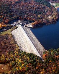
Surry Mountain Lake Beach
Surry
27.4 miles SA free Army Corps of Engineers beach on Surry Mountain Lake, six miles north of Keene, with a long sandy swim area, no lifeguards, and weekly water testing that sometimes brings summer bacteria advisories.
Canoe, Hike, Kayak, Swim
Union Village Dam Recreation Area
Thetford Center
33.2 miles NSandy Beach is a free river beach on the Ompompanoosuc inside the Army Corps' Union Village Dam Recreation Area, half a mile down Buzzell Bridge Road from Thetford Center. No lifeguards, no pets on the beach.
Hike, Swim
St. Catherine State Park
Poultney, Vermont
35.9 miles WA Vermont state park on Lake St. Catherine with shoreline fishing, swimming, boat rentals, camping, a playground, and a seasonal 'Let's Go Fishing' workshop each June.
Camp, Canoe, Swim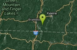
Pisgah State Park
Hinsdale, New Hampshire
39.3 miles SA clothing-optional swimming area at Kilburn Pond inside Pisgah State Park — separate from the park's Pisgah Reservoir, so be sure to head to the right body of water.
Swim
Sculptured Rocks
Hebron, New Hampshire
39.5 miles NESwim near Hebron, New Hampshire
Swim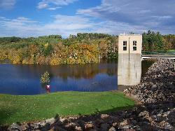
Edward MacDowell Lake
Peterborough
42.3 miles SEA free, Army Corps-run day-use park on a 165-acre flood-control lake in Peterborough, with a small sand swim beach (no lifeguards), picnic shelters, a car-top boat launch and wooded trails.
Canoe, Hike, Kayak, Swim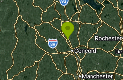
Riverland Beach
Canterbury
46.1 miles EFree Town of Canterbury river beach on a Merrimack River sand bar, a quarter-mile walk from the Lois Lane lot. Open 7 am to 8 pm, May 15 to November 1, with no lifeguards and a sharp drop-off.
Hike, Swim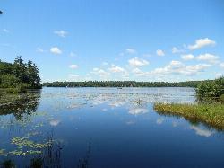
Contoocook Beach
Jaffrey
47.3 miles SEContoocook Beach is the Town of Jaffrey's sand beach on 344-acre Contoocook Lake, with a buoyed swim area, a bathhouse and concession stand, and Mount Monadnock filling the skyline across the water. Swimming is free for everyone, but the parking lot is re
Canoe, Hike, Kayak, Swim
Royalston Falls
Royalston, Massachusetts
47.6 miles SSwim near Royalston, Massachusetts
Swim
Old Wilton Reservoir
Concord, New Hampshire
48.1 miles ESwim near Concord, New Hampshire
Swim
Merrimack River
Concord, New Hampshire
48.1 miles ESwim near Concord, New Hampshire
Swim


