


Riverland Beach
Canterbury
Hike and Swim
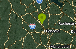
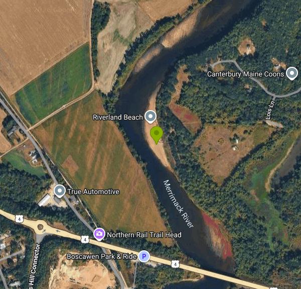
Riverland Beach is the Town of Canterbury's beach on the Merrimack River, set inside the Riverland Conservation Area, a town-owned lot of about 68.7 acres at the southwest corner of Canterbury. The swim spot is a sand bar on the inside of a river bend on the east bank, a short distance upstream of the US Route 4 bridge and about a mile north of Penacook village in Concord, with Boscawen across the water. The Canterbury Conservation Commission looks after the land, and the Canterbury Police Department enforces the beach rules the Select Board adopted in June 2024.
Access is from Oxbow Pond Road over a town right-of-way. From May 15 through October 31 you drive in to the parking lot at the end of Lois Lane and walk the rest of the way, roughly a quarter mile on foot to the sand. The beach and lot are open from 7:00 am to 8:00 pm daily between May 15 and November 1. Cars left in the lot after hours, or parked along Oxbow Pond Road during the season, are towed at the owner's expense. From November 1 to May 14 the lot is closed and parking is allowed only in the marked spot on Oxbow Pond Road across from the gate, and the conservation area stays open to people on foot all year. There is no entry or parking fee.
The beach itself is open sand that slopes into the river. The water at the edge is shallow and slow, but a few steps out the bottom drops off into a deeper channel with a steady current, which is the main danger here. There are no lifeguards. Canterbury posted signs at its river beaches in 2020 telling swimmers to use extreme caution, with an illustration of the drop-off and the beach's location details for 911 calls, and added life rings with throw ropes in 2021 after three people drowned in the river the summer before. The Merrimack stays cool into early summer, and its level and speed rise after heavy rain upstream.
The 2024 regulations require children under 12 to be supervised by an adult in their party at all times. Fires need a permit from both the Canterbury Fire Department and the Select Board, camping needs written permission from the Select Board, and no motor vehicles are allowed on the beach. Damaging trees or plants, littering and disorderly conduct are violations, with fines of $100, $250 and $500 for first, second and third offenses, and repeat offenders can be barred from the property. The town closes the entrance now and then for mowing and maintenance, so check the town's news page before a long drive. No routine water-quality sampling for this beach is posted online, so skipping a swim for a day or two after heavy rain is a sensible precaution.
Away from the water, the conservation area takes in open floodplain fields, woods and a walking path out to the beach, and the town has been working on new signage, a kiosk and a trail map. Paddlers on the Forest Society's Muchyedo Banks route, which starts at a boat launch in Penacook and heads upstream, pass Riverland as the first sand bar on the trip, with quieter sand bars and the tall sand cliffs of Muchyedo Banks farther up the river. Bank swallows nest in those cliffs in summer, and spotted sandpipers are common along the shore.
More Information
After drownings last year, rescuers hope signs and life rings prevent repeat - Concord Monitor
At the sandy edge of the Merrimack River, the still, shallow water is deceitful. Swimmers wading out further from shore to cool off from the heat quickly discover, the bank drops off into deeper, faster-moving water. Three people lost their lives last...
https://www.concordmonitor.com/2021/06/30/canterbury-rivers-41194757/After fatalities, new signs along the Merrimack River caution swimmers - Concord Monitor
The dirt road leading to the Merrimack River cuts through a spacious field before narrowing along the tree line. The drive appears easy at first, but the wide road quickly shrinks to the width of a walking path with tree branches and shrubbery on...
https://www.concordmonitor.com/2020/08/01/pebble-beach-canterbury-nh-new-safety-signs-merrimack-river-35460132/Policies and Ordinances | Town of Canterbury NH
The Town of Canterbury has a wide variety of policies and ordinances across the different departments. Policies are internal guidance about how the municipality operates and are created by the […]
https://www.canterburynh.gov/departments/administration/policies-and-ordinances/Riverland Conservation Area Closed July 20th, 2026 | Town of Canterbury NH
The Riverland Conservation Area main entrance and parking lot will be closed from 5 pm on Sunday July19th through 7am on Tuesday July 21st for mowing on Monday the 20th.
https://www.canterburynh.gov/2026/07/16/riverland-conservation-closed-july-20th-2026/Visiting Canterbury | Town of Canterbury NH
Discover the beauty and hospitality of Canterbury, NH. Plan your visit and explore our rich history and scenic landscapes.
https://www.canterburynh.gov/community/visiting-canterbury/Be courteous, informed, and prepared. Read trailhead guidelines, stay on the trail, and don't feed the wildlife.
Read More
- Plan Ahead and Prepare
- Travel & camp on durable surfaces
- Dispose of waste properly
- Leave what you find
- Minimize campfire impacts
- Respect wildlife
- Be considerate of other visitors
Directions
- Get directions on Google Maps
Other Swimming Holes and Hiking Trails Nearby
Old Wilton Reservoir
Concord, New Hampshire
3.0 miles SESwim near Concord, New Hampshire
Swim
Merrimack River
Concord, New Hampshire
3.0 miles SESwim near Concord, New Hampshire
Swim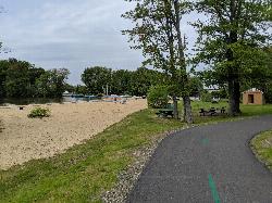
Bartlett Beach
Laconia
16.7 miles NFree city beach on the north shore of Lake Winnisquam in Laconia, with a sandy swim area, free parking, a playground and the WOW Trail running through. No lifeguards, so swim at your own risk.
Swim
Waukewan Beach
Meredith
24.7 miles NMeredith's free town beach on Lake Waukewan, with about 20 parking spots and no resident sticker required, unlike Leavitt Beach across town. Because the lake is Meredith's drinking water supply, swimming is fine but flotation devices, pets in the water an
Canoe, Kayak, Swim
Brewster Beach
Wolfeboro
27.4 miles NEA free, town-run sand beach on Lake Winnipesaukee's Wolfeboro Bay, a short walk south of downtown Wolfeboro. Unlike the town's other beaches, parking here needs no resident sticker or beach pass.
Swim 2.1 mi
Wildcat Falls
Merrimack, New Hampshire
30.1 miles SCLOSED. THIS location has been closed until further notice. Effective June 26th, 2020 due to illegal activities and trail damage. An 87-acre conservation area along the Souhegan River featuring Wildcat Falls, pine and hardwood forest, a Heritage Trail extension, blueberry picking, and great bird watching in a cleared meadow.
Cross-country Ski, Dive, Hike, Mountain Bike, Snowshoe, Swim
Sculptured Rocks
Hebron, New Hampshire
31.5 miles NWSwim near Hebron, New Hampshire
Swim
Edward MacDowell Lake
Peterborough
34.0 miles SWA free, Army Corps-run day-use park on a 165-acre flood-control lake in Peterborough, with a small sand swim beach (no lifeguards), picnic shelters, a car-top boat launch and wooded trails.
Canoe, Hike, Kayak, Swim
Packers Falls
Durham, New Hampshire
34.8 miles ESwim near Durham, New Hampshire
Swim
Pinkham Notch Area
Durham, New Hampshire
34.8 miles ESwim near Durham, New Hampshire
Swim
Leigh's Mill Pond
South Berwick, Maine
39.6 miles ECLOSED. Private property off Vine Street, heavily posted against trespassing, and closed to the public since 2020. Multiple drownings have occurred here. Please stay out. Leigh's Mill Pond in South Berwick, Maine, is a former swimming spot on the Great Works River — now private, posted, and closed to the public.
Swim
Long Dam
South Berwick, Maine
39.6 miles ESwim near South Berwick, Maine
Swim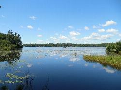
Contoocook Beach
Jaffrey
40.3 miles SWContoocook Beach is the Town of Jaffrey's sand beach on 344-acre Contoocook Lake, with a buoyed swim area, a bathhouse and concession stand, and Mount Monadnock filling the skyline across the water. Swimming is free for everyone, but the parking lot is re
Canoe, Hike, Kayak, Swim
Surry Mountain Lake Beach
Surry
41.8 miles SWA free Army Corps of Engineers beach on Surry Mountain Lake, six miles north of Keene, with a long sandy swim area, no lifeguards, and weekly water testing that sometimes brings summer bacteria advisories.
Canoe, Hike, Kayak, Swim
Lake Gardner Beach
Amesbury
44.6 miles SEFree city beach at the south end of Lake Gardner in Amesbury, with a shallow roped swim area, seasonal restrooms, a car-top boat launch and trails into the Powow River Conservation Area.
Canoe, Hike, Kayak, Swim
Stoughton Pond Recreation Area
Perkinsville
46.1 miles WA small Army Corps of Engineers day-use beach on Stoughton Pond near Perkinsville, Vermont, with a sandy swim area, picnic sites and no listed day-use fee in summer.
Canoe, Hike, Kayak, Swim
Freeman Lake Beach
North Chelmsford
46.6 miles SFree town beach on Freeman Lake at Varney Playground in North Chelmsford, open dawn to dusk to everyone. No lifeguards, weekly E. coli testing in summer, and hand-launched small boats welcome.
Canoe, Kayak, Swim
Union Village Dam Recreation Area
Thetford Center
49.2 miles NWSandy Beach is a free river beach on the Ompompanoosuc inside the Army Corps' Union Village Dam Recreation Area, half a mile down Buzzell Bridge Road from Thetford Center. No lifeguards, no pets on the beach.
Hike, Swim


