


224 Things to do near Buckhorn Campground Nature Trail
first prev 1 2 3 4 5 6 7 8 9 10 next lastShowing results within 50 miles Distance miles of Buckhorn Campground Nature Trail near Apache Junction, Arizona City, Zip, or Address
Tom's Thumb to Bell Pass
Scottsdale, Arizona
18.3 miles NWHike and Mountain Bike near Scottsdale, Arizona
Hike, Mountain Bike
Tom's Thumb Trail South
Scottsdale, Arizona
18.3 miles NWHike near Scottsdale, Arizona
Hike
Gateway and Tom's Thumb Loop Trail
Scottsdale, Arizona
18.3 miles NWA roughly 10.5-mile loop linking Gateway, Bell Pass, and Windgate trails in Scottsdale — featuring a steep Bell Pass climb with views described simply as amazing.
Hike, Horseback, Mountain Bike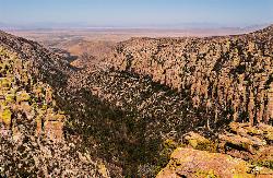
Inspiration Point
Scottsdale, Arizona
18.3 miles NWA wooded canyon with mixed trail and campground options — take it as a loop or a top-to-bottom shuttle mountain bike ride through beautiful scenery near Logan, Utah.
Hike, Mountain Bike
Gatewa-Prospector-Thompson Peak Road Trail
Scottsdale, Arizona
18.3 miles NWHike near Scottsdale, Arizona
Hike
Horseshoe Loop Hike
Scottsdale, Arizona
18.4 miles NWThe Horseshoe Loop is one of the easiest and most rewarding walks in Scottsdale's McDowell Sonoran Preserve, a gentle 1.7-mile circuit from the Gateway Trailhead that delivers proper Sonoran Desert...
Hike
Saguaro Loop and Nature Trail
Scottsdale, Arizona
18.4 miles NWThe Saguaro Loop and Nature Trail is one of the friendliest introductions to the Sonoran Desert anywhere in the Phoenix area, an easy loop in Scottsdale's McDowell Sonoran Preserve that packs classic...
Hike
Crosscut Canal Trail
Tempe, Arizona
18.4 miles WA two-mile concrete multi-use trail linking Tempe Town Lake to Papago Park, with canal views, desert buttes, a reservoir hidden in the Papago Buttes, and panoramic city views from the high point.
Hike
Gateway Loop
Scottsdale, Arizona
18.4 miles NWA steep, rocky ascent from a well-equipped trailhead with water and bathrooms, linking to Tom's Thumb, Wingate Pass, and Bell Pass trails in the McDowell Mountains.
Mountain Bike
Phoenix Mcdowell / Wingate Pass / Bell Pass
Scottsdale, Arizona
18.4 miles NWA challenging Scottsdale mountain bike trail with a steep rocky ascent from a well-equipped trailhead and flowing singletrack descents, with links to Tom's Thumb, Dixie Mine, and the McDowell Loop.
Mountain Bike 0.6 mi
Horseshoe Trail
Scottsdale, Arizona
18.4 miles NWA short, fun singletrack full of quick turns shaped by washes and rocks — javelinas, deer, and the occasional bobcat add wildlife thrills near Scottsdale.
Hike, Horseback, Mountain Bike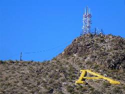
'A' Mountain at Hayden Butte
Tempe, Arizona
18.4 miles WA short, slightly steep hike through Arizona State University's backyard with Hohokam petroglyphs and panoramic views of downtown Tempe at the top — a quick urban escape.
Hike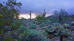
Tom's Thumb, Feldspar, and Marcus Landslide Loop
Scottsdale, Arizona
18.5 miles NWThis loop links three of the finest trails in the McDowell Sonoran Preserve, the enormous protected desert on the northeast edge of Scottsdale, and centers on Tom's Thumb, one of the most iconic rock...
Hike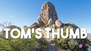
Tom's Thumb Trail
Scottsdale, Arizona
18.5 miles NWA 4.7-mile out-and-back hike in Scottsdale's McDowell Sonoran Preserve with 1,200 feet of elevation gain to a unique thumb-shaped granite rock formation — pet friendly, but no water on trail.
Hike, Mountain Bike, Rock Climb 2.2 mi
Marcus Landslide Trail
Scottsdale, Arizona
18.5 miles NWNamed for geographer Melvin Marcus, this trail winds through an ancient McDowell Mountain landslide with sweeping Superstition and Mazatzal mountain views and boulder-filled formations.
Hike, Horseback, Mountain Bike, Rock Climb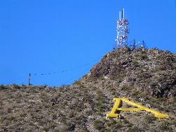
Hayden Butte And Tempe Town Lake Trail
Tempe, Arizona
18.7 miles WHayden Butte, better known to generations of locals as "A" Mountain for the giant gold letter "A" near its top, is the landmark volcanic butte rising right in the heart of downtown Tempe beside...
Hike 2.0 mi
Loma and Canal Trails
Tempe, Arizona
18.8 miles WMountain biking and hiking trails through Papago Park in Tempe — the Loma Trail winds through hills to a small lake and playground, while the Canal Trail hugs the shady south canal.
Hike, Mountain Bike 4.9 mi
Tempe Town Lake Trail
Tempe, Arizona
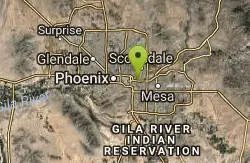
18.8 miles WA lakeside paved trail at Tempe Town Lake connecting ASU, Tempe Beach Park, Tempe Marketplace, and extending east to Riverview Park in Mesa — with a water-level marina connection on the north side.
Hike
Moeur Park
Phoenix ( Tempe), Arizona
19.0 miles WA hot, dusty, challenging disc golf course next to a dry desert wash in Phoenix/Tempe — discs take a beating on the rough terrain, and water comes into play when the wash runs.
Disc Golf
Papago Park Area
Phoenix, Arizona
19.3 miles WFive beginner-to-intermediate mountain bike loops and a dirt jump area spread across Papago Park's loose dirt and rolling hills — short, steep climbs and fast, loose descents in the heart of Phoenix.
Mountain Bike


