


255 Things to do near Conant Creek Pegram Truss Railroad Bridge
first prev 4 5 6 7 8 9 10 11 12 13 next lastShowing results within 50 miles Distance miles of 3968 E 1000 N, Ashton, ID 83420, USA City, Zip, or Address

Wolf Flats Recreation Area
Ririe, Idaho
32.0 miles SWolf Flats is a completely free, dispersed, undeveloped camping area with 25 locations to camp. Some areas are large enough to accommodate groups of 50 people.
Camp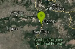
Coffee Pot Rapids Trail
Island Park, Idaho
32.0 miles NHiker and fisherman parking is available at the campground entrance. Coffee Pot Rapids trail is 2.2 miles in length, is a non-motorized trail that follows the Henry's Fork of the Snake...
Mountain Bike 2.7 mi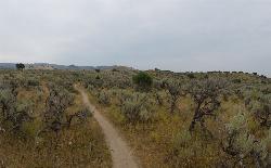
Sidewinder Trail
Ririe, Idaho
32.1 miles SWSidewinder's claim to fame is that it's on a South facing hill just above the Snake River. That means that when all the other trails in the Kelly Canyon Trail network are covered with snow...
Mountain Bike 3.8 mi
Stinking Springs
Ririe, Idaho
32.1 miles SWStinking Springs is a great early to late season trail. Being at the edge of the Big Hole range, it gets spring earlier and winter later than other trails in the range. It's closed from December...
Hike, Mountain Bike
Upper Coffee Pot Campground
Island Park, Idaho
32.1 miles NUpper Coffeepot Campground stretches along a floatable section of Henry's Fork of the Snake River. A mixed growth lodgepole pine forest provides partial shade and summer wildflowers are...
Camp, Canoe 1.0-1.3 mi
Lorenzo Bridge
Rexburg, Idaho
32.1 miles SWThis is the old site of the Lorenzo Boat Launch, which has moved to the other side of the river a little further downstream. This spot sees very little traffic. There are beautiful, yet...
Airsoft, Hike, Paintball
Mt. Moran
Alta, Wyoming
32.4 miles SEMount Moran (12,610 feet (3,840 m)) is a mountain in Grand Teton National Park of western Wyoming, USA. The mountain is named for Thomas Moran, an American western frontier landscape artist....
Hike
Victor Bike Park
Victor, Idaho
32.4 miles SEThe Victor Bike Park is home to a progressive jump line, pumptrack, and more stunts.
Mountain Bike
Pine Creek Campground
Victor, Idaho
32.4 miles SThe Pine Creek Campground has 10 single units and has restrooms.
Camp
Lorenzo Boat Ramp
Rigby, Idaho
32.5 miles SWHike and Kayak near Rigby, Idaho
Hike, Kayak 0.3 mi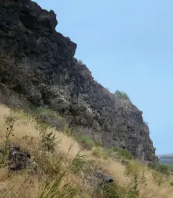
Pointless Crag
Ririe, Idaho
32.5 miles SWNO MORE BOLTING as of 5/2012 requested by the Bureau of Land Management. The BLM has asked us NOT to park on the road below the cliff. Please use the obvious parking area next to the river...
Rock Climb
West Pine Creek Trail
Ririe, Idaho
32.5 miles SNon-motorized use. source: fs.usda.gov
Mountain Bike
Trail Canyon Trail
Ririe, Idaho
32.6 miles SThe Trail Canyon trail begins at Trail Canyon Parklot, T8s R43e Sec28 and ends at Intersect Trail 5251,t8s R43e Sec28. source: fs.usda.gov
Mountain Bike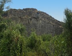
South Park
Ririe, Idaho
32.6 miles SWRock Climb near Ririe, Idaho
Rock Climb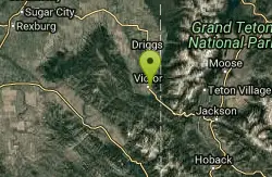
Pioneer Park Nordic Trail
Victor, Idaho
32.7 miles SEDistance: 3 miles (4.5km) Trail Map: Pioneer_Park_2015.pdf Grooming Report: http://tvtap.org/nordic-grooming
Cross-country Ski, Snowshoe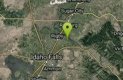
Rigby Wave-45th Wave
Rigby, Idaho
32.8 miles SWKayak near Rigby, Idaho
Kayak
Big Springs
Island Park, Idaho
33.0 miles NThere's also a great little walking trail along the river with placards that tell about the ecosystem and history of the area. There's about a 1/2 mile that's paved and then a 1/2 mile...
Camp, Hike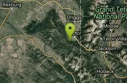
Allen Canyon-Pole Canyon Trail (014)
Victor, Idaho
33.3 miles SThis trail is locally known as the Pole Canyon Trail. Just South of Victor, ID, the Allen Canyon-Pole Canyon Trail (014) is a popular destination for local motorbikers, horseback...
Mountain Bike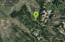
Teton Springs Trail
Victor, Idaho
34.0 miles SCLOSED. This trail is no longer accessible to the public. There is a new company which owns the resort and the loop land. Teton Springs Loop is a loop for cross-country skiing and snowshoeing. The...
Cross-country Ski, Snowshoe

South Fork Snake River Trail
Ririe, Idaho
34.8 miles SGo left at the trail head. It heads down about a mile and a half on double track. Then you'll come to a creek crossing. After the crossing the trail heads across a gate. Head left...
Mountain Bike


