


43 Things to do near Dixie National Forest
first prev 1 2 3 next lastShowing results within 50 miles Distance miles of Dixie National Forest near Cedar City, Utah City, Zip, or Address
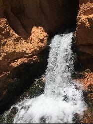
Cascade Falls
Cedar City, Utah
12.1 miles SA 1.2-mile family-friendly round-trip hike through sandstone stairs and red-cliff scenery to a waterfall fed by underground tubes from Navajo Lake — with sweeping views of Cedar Valley and Zion.
Hike 
Thunder Mountain Trail
Panguitch, Utah
19.6 miles EA dry creek run with big berms and flowing terrain in Red Canyon near Panguitch, Utah — a fun ride through striking red-rock scenery.
Mountain Bike 
C trail
Cedar City, Utah
21.7 miles WA popular mountain bike trail in Cedar City that climbs to the C letter on Cedar Mountain — bermed switchbacks make the descent manageable, but watch for hikers on the way down.
Mountain Bike 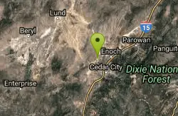
Three Peaks Disc Golf Course
Cedar City, Utah
25.7 miles WHigh-desert disc golf through junipers, rock outcroppings, and washes, with baskets mounted into rocks and six holes over 650 feet — one of two courses on site.
Disc Golf 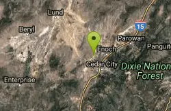
Ironside Disc Golf Course
Cedar City, Utah
25.7 miles WA thrilling disc golf course at Three Peaks Recreation Area in Cedar City with majestic vistas, elevated tees, unique natural obstacles, and amazing pin locations — one of two courses on site.
Disc Golf 4.1 mi
Swamp Canyon Overlook and Trail
Bryce, Utah
25.8 miles EA lesser-explored loop trail through Bryce Canyon's pink and red cliffs and forested Ponderosa Pines, descending and ascending 800 feet in a peaceful counter-clockwise circuit.
Hike 8.2 mi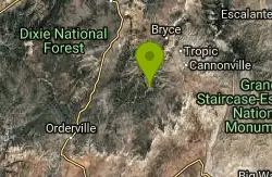
Riggs Spring Loop Trail
Kanab, Utah
27.2 miles SEOne of Bryce Canyon's least-traveled trails — an 8-mile loop descending 2,248 feet through ponderosa pines and Pink Cliffs views near Rainbow Point, strenuous but serenely off the beaten path.
Hike 1.0 mi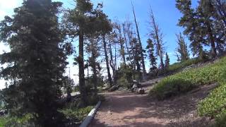
Bristlecone Loop
Kanab, Utah
27.2 miles SEA 1-mile loop from Rainbow Point — the highest spot in Bryce Canyon — past 1,800-year-old Bristlecone pines, cliff-top views, and wildlife including woodpeckers, owls, and chipmunks.
Hike 
Sunset Campground
Bryce, Utah
27.6 miles EA spacious first-come, first-served campground inside Bryce Canyon with 101 sites across three loops, fire grates, drinking water, and flushing restrooms — no hookups.
Camp 

North Campground
Bryce, Utah
27.9 miles EOne of Bryce Canyon's main campgrounds, with 99 RV and tent sites, restrooms with flush toilets, picnic tables, fire grates, and a nearby summer General Store with showers and laundry.
Camp 1.8 mi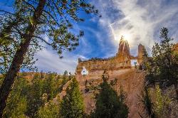
Tower Bridge
Bryce, Utah
27.9 miles EA moderately difficult 3-mile round trip from Sunrise Point past classic Bryce Canyon hoodoos to a dramatic rock formation resembling London Bridge — less crowded the further you go.
Hike 1.2 mi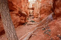
Navajo Trail
Bryce, Utah
28.0 miles EA short but winding 1.5-mile loop descending into Bryce Canyon's amphitheater, where towering hoodoos, Thor's Hammer, Twin Bridges, Wall Street, and 750-year-old Douglas Firs surround you.
Hike 2.3 mi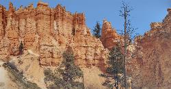
Queens Garden Trail
Bryce, Utah
28.1 miles EA descent through hoodoos and tunnels in Bryce Canyon's main amphitheater starting at Sunrise Point — well-kept dirt trail with benches, detour to a Queen Victoria rock formation, and a forest ecosystem below.
Hike 0.5-5.4 mi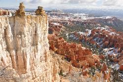
Rim Trail
Bryce, Utah
28.1 miles EA 5.5-mile Bryce Canyon rim hike connecting every major viewpoint above the Hoodoos, from Fairyland Point to Bryce Point — partially paved and wheelchair accessible at the midpoint.
Hike 3.1 mi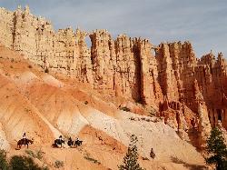
Peek-a-boo Loop
Bryce, Utah
28.6 miles EA strenuous 5-mile hike through quiet canyon trails with up-close hoodoo views, a shaded respite at the loop's bottom, and sweeping views of the Bryce Amphitheater.
Hike 1.6 mi
Hat Shop
Bryce, Utah
28.7 miles EA moderately difficult 4-mile out-and-back hike to Bryce Canyon's Hat Shop — balancing gray boulders on slender red stilts, plus Pink Cliffs and far-off mountain views.
Hike 3.6 mi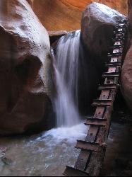
Kanarraville Falls
Kanarraville, Utah
28.9 miles WA slot canyon hike through ankle-to-knee-deep water to twin waterfalls, with a natural sandstone slide into a refreshing swimming hole halfway through the route.
Hike, Swim 7.6 mi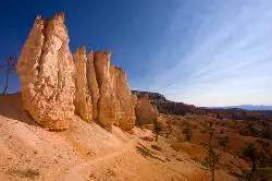
Fairyland Loop Trail
Bryce, Utah
28.9 miles EAn 8-mile loop descending 900 feet into Bryce Canyon's red and white hoodoos, connecting back along Rim Trail at Sunrise Point — with a 200-yard detour to the Tower Bridge rock formation.
Hike 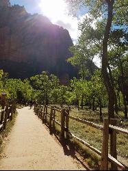
Riverside Walk
Springdale, Utah
29.9 miles SWA flat, paved riverside walk through Zion's desert swamp oasis, with hanging gardens on the cliffs and the option to continue into The Narrows — check flood conditions first.
Hike 
Echo Canyon
Springdale, Utah
30.1 miles SWA technical canyoneering route through Zion's Echo Canyon with eight miles of trail, 2,148 feet of elevation to Observation Point, and a short detour to the 'weeping' Weeping Rock formation.
Canyoneer


