


128 Things to do near Flat Laurel Creek
first prev 1 2 3 4 5 6 7 next lastShowing results within 50 miles Distance miles of Flat Laurel Creek, North Carolina 28716, USA City, Zip, or Address

Sunburst
Canton, North Carolina
3.4 miles NWSwim near Canton, North Carolina
Swim 0.2-2.8 mi
Graveyard Fields
Brevard, North Carolina
3.5 miles ETwo cascading waterfalls — a swimmable Lower Falls just 1/3 mile from the road, and a more challenging Upper Falls on a 3.5-mile wildflower loop — make this a must-see hike.
Hike, Swim

Courthouse Falls
4.0 miles S
A gorgeous 45-foot waterfall streams into a stunning blue-green pool in a greenery-covered cliff cove — just a 3/4-mile easy hike from the parking lot, open year-round.
Hike, Swim
Skinny Dip Falls
Brevard, North Carolina
4.3 miles EA cascading waterfall with multiple clear pools for wading and swimming, a 6-foot jumping spot, and an easy 3/4-mile forested walk from the Blue Ridge Parkway — swimmers should mind fast water and slippery rocks.
Hike, Swim 2.3 mi
Cove Creek
Canton, North Carolina
5.3 miles EA fast, fun descent on Cove Creek Trail near Canton after a gravel forest road climb — cool rock sections at the top and rustic log bridges midway down.
Mountain Bike 7.1 mi
Daniel Ridge Loop
Canton, North Carolina
5.4 miles SEA classic short Pisgah loop with moderate technical riding, a rocky downhill roller coaster, two waterfalls, and multiple route options to tailor the adventure.
Hike, Mountain Bike 3.1-4.3 mi
Farlow Gap
Canton, North Carolina
5.4 miles SEOne of Pisgah's most technical downhills — a minefield of boulders dropping 2,000 feet in 3 miles, best ridden as part of the Fish Hatchery loop.
Hike, Mountain Bike
Big East Fork
Canton, North Carolina
5.8 miles NEHeavy forest, multiple waterfalls, and a river that shifts from white rapids to calm swimming holes along Big East Fork in Pisgah National Forest — great for kayaking, camping, and swimming year-round.
Backpack, Hike, Kayak, Swim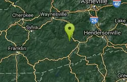
Cove Creek Tubs
Brevard, North Carolina
5.9 miles SEThree perfectly rounded pot holes — the Pisgah Forest's finest — stack up to 12 feet deep in sun-drenched pools that are best described as nature's own jacuzzi collection.
Swim
Whaleback Swimming Hole
Asheville, North Carolina
6.1 miles SEA horseshoe of massive bedrock around a deep, green swimming hole where Cove Creek meets the Davidson River — locals' quiet answer to crowded Sliding Rock.
Swim 0.8 mi
Daniel Ridge Falls
Brevard, North Carolina
7.2 miles SEAn easy half-mile hike in Pisgah National Forest near Brevard to a 150-foot waterfall known by three names — most impressive after rain, modest in dry spells, with an optional 4-mile loop to the top.
Hike, Mountain Bike, Swim 13.5 mi
Horse Cove Gap Loop / FS 475C
Brevard, North Carolina
7.3 miles SEA 12-mile round-trip mountain bike ride near Brevard on forest road and singletrack through Horse Cove Gap, with views of Looking Glass Rock, Pilot Rock, and the Blue Ridge Parkway.
Mountain Bike
Butter Gap / Trail #123
Brevard, North Carolina
7.3 miles SEButter Gap Trail in Pisgah Forest climbs about 1,000 feet and connects to FS 471D — the western fork is open to mountain bikes, with seasonal bike access on part of the route.
Hike, Mountain Bike
Pilot Cove Loop Trail
Pisgah Forest, North Carolina
7.6 miles EA short 1.8-mile singletrack loop in Pisgah Forest with steep, tight turns and one of the best ridge views in Pisgah National Forest.
Hike, Mountain Bike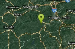
Coontree
Brevard, North Carolina
8.1 miles SEA gnarly 3.7-mile one-way trail near Brevard — a steep hike-a-bike one direction and a steep, technical descent the other; prepare to get your legs worked.
Mountain Bike
Looking Glass Falls
Brevard, North Carolina
8.2 miles EA cascading 60-foot waterfall over mossy stone with a wading pool below — just a short, beautiful walk from Pisgah Highway in Brevard, stunning in any season.
Hike, Swim 0.1 mi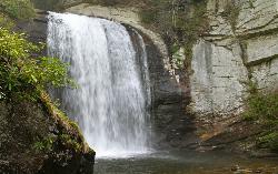
Looking Glass Falls
Brevard, North Carolina
8.2 miles EOne of North Carolina's most popular and accessible waterfalls — the 60-foot Looking Glass Falls drops roadside along the Forest Heritage Scenic Byway in Pisgah National Forest, with easy viewing from the parking area or a short walk.
Swim
Big Creek Area
Tuckasegee, North Carolina
8.3 miles SWSeveral remote swimming holes near the TN-NC border in the Big Creek Recreation Area of the Great Smoky Mountains — very secluded, and dogs are not allowed on the trail.
Swim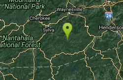
Bear Creek Area
Tuckasegee, North Carolina
8.3 miles SWSeveral remote swimming holes in lakes along Route 281 southeast of Sylva and Cullowhee — bathing suits optional at most spots, given how far off the beaten path they are.
Swim
Coontree Recreation Area
Brevard, North Carolina
8.5 miles EA scenic picnic area on the Davidson River with direct access to calm, deep water for swimming and fishing — plus the 3.7-mile Coontree Loop Trail through Pisgah National Forest.
Hike, Mountain Bike, Swim


