


Graveyard Fields
Brevard, North Carolina

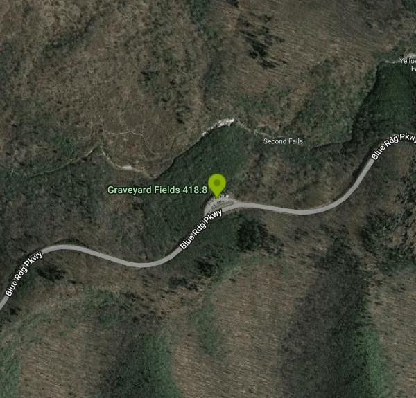
| Address: | Graveyard Fields 418.8, Graveyard Fields, Canton, NC 28716, USA |
| GPS: |
35°19'13.1"N 82°50'50.0"W Maps | Directions |
| State: | North Carolina |
| Trails/Routes: | 0.2-2.8 mi |
Restrooms
Hike and Swim
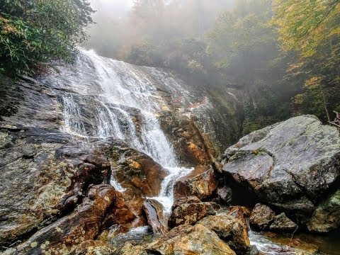
Graveyard Fields is a beautiful hike known for it's forests, wild flowers and two beautiful waterfalls. The Blue Ridge Mountains surround this area creating stunning views throughout the trail.
The trail begins at the easily accessible roadside parking area just off of Blue Ridge Parkway and goes first to the Lower Falls. The Lower Falls cascade over a beautiful rock formation and pool at the bottom. The pool is deep enough to wade and swim in. The Lower Falls is a short 1/3 a mile hike from the parking lot. The accessibility and swimming available here make this a popular destination for visitors.
Hikers wishing for fewer crowds and more of a challenge can continue to the Upper Falls. The hike to the Upper Falls takes a 3.5 mile loop and offers stunning riverside views. The trail goes through a beautiful field of wildflowers and returns through a lush forest.
More Information
Graveyard Fields Hike & Waterfall, North Carolina
Hike Graveyard Fields on the Blue Ridge Parkway in North Carolina, see photos of this popular hiking spot near Asheville with waterfalls and mountain views.
https://www.romanticasheville.com/graveyard.htmGraveyard Fields: Don’t Let the Name of This Awesome Swimming Hole Scare You Off
Graveyard Fields might be an odd name for a swimming hole, but its fabulous on a hot day. Visit the swimming hole off the Blue Ridge Parkway.
https://kiddingaroundgreenville.com/graveyard-fields-swimming-holeLower Falls Graveyard Fields
Lower Falls Graveyard Fields on the Blue Ridge Parkway, is an exceptionally gorgeous waterfall. See our photos, directions, video, information and more.
https://blueridgemountainlife.com/lower-falls-graveyard-fields/Be courteous, informed, and prepared. Read trailhead guidelines, stay on the trail, and don't feed the wildlife.
Read More
- Plan Ahead and Prepare
- Travel & camp on durable surfaces
- Dispose of waste properly
- Leave what you find
- Minimize campfire impacts
- Respect wildlife
- Be considerate of other visitors
Directions
From Brevard, North Carolina
- Head northeast on US-64 E/
S Broad St toward E Main St Continue to follow US-64 E(2.9 mi) - At the traffic circle, continue straight onto US-276 N/
US-64 E Pass by Waffle House (on the right in 0.3 mi)(0.5 mi) - Turn left onto US-276 N (15.1 mi)
- Turn right (0.2 mi)
- Turn left onto Blue Rdg Pkwy (7.0 mi)
- Turn right onto Graveyard Fields OverlookDestination will be on the left(207 ft)

Other Swimming Holes and Hiking Trails Nearby

Skinny Dip Falls
Brevard, North Carolina
0.8 miles EA cascading waterfall with multiple clear pools for wading and swimming, a 6-foot jumping spot, and an easy 3/4-mile forested walk from the Blue Ridge Parkway — swimmers should mind fast water and slippery rocks.
Hike, Swim 7.1 mi
Daniel Ridge Loop
Canton, North Carolina
2.6 miles SA classic short Pisgah loop with moderate technical riding, a rocky downhill roller coaster, two waterfalls, and multiple route options to tailor the adventure.
Hike, Mountain Bike 3.1-4.3 mi
Farlow Gap
Canton, North Carolina
2.7 miles SEOne of Pisgah's most technical downhills — a minefield of boulders dropping 2,000 feet in 3 miles, best ridden as part of the Fish Hatchery loop.
Hike, Mountain Bike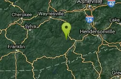
Cove Creek Tubs
Brevard, North Carolina
2.9 miles SEThree perfectly rounded pot holes — the Pisgah Forest's finest — stack up to 12 feet deep in sun-drenched pools that are best described as nature's own jacuzzi collection.
Swim
Whaleback Swimming Hole
Asheville, North Carolina
3.2 miles SEA horseshoe of massive bedrock around a deep, green swimming hole where Cove Creek meets the Davidson River — locals' quiet answer to crowded Sliding Rock.
Swim
Big East Fork
Canton, North Carolina
3.5 miles NEHeavy forest, multiple waterfalls, and a river that shifts from white rapids to calm swimming holes along Big East Fork in Pisgah National Forest — great for kayaking, camping, and swimming year-round.
Backpack, Hike, Kayak, Swim 1.8 mi
Flat Laurel Creek
3.5 miles W
A 3.18-mile multi-use trail following Flat Laurel Creek through colorful rock formations and forest, with distant views of Sam Knob and a small waterfall — open year round.
Hike, Horseback, Mountain Bike, Swim 0.8 mi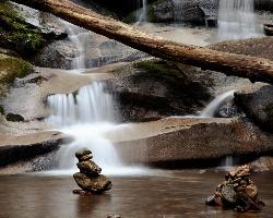
Daniel Ridge Falls
Brevard, North Carolina
4.0 miles SEAn easy half-mile hike in Pisgah National Forest near Brevard to a 150-foot waterfall known by three names — most impressive after rain, modest in dry spells, with an optional 4-mile loop to the top.
Hike, Mountain Bike, Swim
Butter Gap / Trail #123
Brevard, North Carolina
4.0 miles SEButter Gap Trail in Pisgah Forest climbs about 1,000 feet and connects to FS 471D — the western fork is open to mountain bikes, with seasonal bike access on part of the route.
Hike, Mountain Bike
Courthouse Falls
4.3 miles SW
A gorgeous 45-foot waterfall streams into a stunning blue-green pool in a greenery-covered cliff cove — just a 3/4-mile easy hike from the parking lot, open year-round.
Hike, Swim
Pilot Cove Loop Trail
Pisgah Forest, North Carolina
4.5 miles NEA short 1.8-mile singletrack loop in Pisgah Forest with steep, tight turns and one of the best ridge views in Pisgah National Forest.
Hike, Mountain Bike
Looking Glass Falls
Brevard, North Carolina
4.7 miles EA cascading 60-foot waterfall over mossy stone with a wading pool below — just a short, beautiful walk from Pisgah Highway in Brevard, stunning in any season.
Hike, Swim 0.1 mi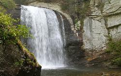
Looking Glass Falls
Brevard, North Carolina
4.7 miles EOne of North Carolina's most popular and accessible waterfalls — the 60-foot Looking Glass Falls drops roadside along the Forest Heritage Scenic Byway in Pisgah National Forest, with easy viewing from the parking area or a short walk.
Swim
Coontree Recreation Area
Brevard, North Carolina
5.1 miles SEA scenic picnic area on the Davidson River with direct access to calm, deep water for swimming and fishing — plus the 3.7-mile Coontree Loop Trail through Pisgah National Forest.
Hike, Mountain Bike, Swim
Sunburst
Canton, North Carolina
6.3 miles NWSunburst is a refreshing mountain getaway along the West Fork of the Pigeon River in North Carolina's Pisgah National Forest, tucked into the high, forested country south of Canton and...
Swim
South Mills River Trail
Canton, North Carolina
7.2 miles NEAn easy out-and-back following the South Fork Mills River with several swinging bridge crossings leading to the historic Cantrell Lodge site — with a steep, technical river-access option.
Hike, Mountain Bike
Avery Creek / 327
Brevard, North Carolina
7.3 miles EClassic Pisgah-style singletrack: 3.2 miles of rutted, technical descent from a four-way junction with stream crossings, muck, and hidden flowy sections under a massive tree canopy.
Hike, Mountain Bike
Thrift Cove
Brevard, North Carolina
7.4 miles EAbout 750 feet of elevation, red-blazed trail through Thrift Cove, and five back-to-back jump whoops that are among the best you'll find anywhere — worth lapping repeatedly.
Hike, Mountain Bike
North Slope
Pisgah Forest, North Carolina
7.5 miles EA seasonal mountain bike trail near Pisgah Forest open only October 15 to April 15, with impossible climbs, river sections, great mountain views, and tricky roots and bridges on the descent.
Hike, Mountain Bike
Davidson River Campground
Pisgah Forest, North Carolina
7.5 miles EA year-round campground in Pisgah National Forest just four miles from Brevard and less than an hour from Asheville, with shaded loops, hiking trails, waterfalls, and fishing spots nearby.
Camp, Hike, SwimNearby Campsites
Davidson River Campground
Pisgah Forest, North Carolina
7.5 miles EA year-round campground in Pisgah National Forest just four miles from Brevard and less than an hour from Asheville, with shaded loops, hiking trails, waterfalls, and fishing spots nearby.
Camp, Hike, Swim
Mt. LeConte Lodge
Sylva, North Carolina
23.8 miles WThe highest guest lodge in the eastern United States at 6,400 feet, with spectacular Smokies views from an open glade just below the Mt. LeConte summit in Great Smoky Mountains NP.
Camp, Hike, Horseback, Rock Climb
Cosby Campground
Cosby, Tennessee
36.3 miles NWCamp and Swim near Cosby, Tennessee
Camp, Swim
Rocky Bluff
Hot Springs, North Carolina
37.5 miles NRocky Bluff is a tranquil mountain getaway in the Pisgah National Forest near Hot Springs, North Carolina, where a wooded campground sits beside the lovely Spring Creek just a few miles south of...
Camp, Hike, Swim
War Woman Dell Wildlife Management Area
Clayton, Georgia
41.6 miles SWA short 0.8-mile out-and-back hike near Clayton, Georgia through a nature trail to a waterfall — good for all skill levels and accessible year-round.
Camp, Hike, Horseback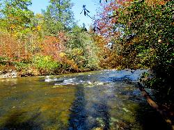
Carolina Hemlock
Burnsville, North Carolina
49.2 miles NEA family swimming area on the South Toe River near Mount Mitchell in the Pisgah National Forest campgrounds — note that the site is closed seasonally and fees apply.
Camp, Swim


