


135 Things to do near Grand Prismatic Spring Overlook Trail
first prev 1 2 3 4 5 6 7 next lastShowing results within 50 miles Distance miles of 85PFG589+22 City, Zip, or Address

Beaver Ponds Trail
Mammoth, Yellowstone National Park
32.3 miles NBeaver Ponds Trail is a wonderful short hike accessible from Mammoth Hot Springs. The trail forms a loop between the two trailheads available at Mammoth Hot Springs. The loop is just over 5 miles...
Hike 8.1 mi
Sepulcher Mountain Trail
Mammoth Hot Springs, Yellowstone National Park
32.3 miles NSepulcher Mountain Trail is an 11 mile loop trail from Mammoth Hot Springs to the peak of Sepulcher Mountain. This is a challenging hike with a 3,500 foot ascent to the 9,652 foot peak. The...
Hike 0.1-5.2 mi
Mammoth Hot Springs
Mammoth, Yellowstone National Park
32.3 miles NMammoth Hot Springs is a unique sight in Yellowstone National Park. The soft limestone in this area allowed the water to form colorful terraces. The extremely hot running water is clear and smooth,...
Camp, Hike 4.0 mi
Lava Creek Trail
Mammoth Hot Springs, Yellowstone National Park
32.5 miles NLava Creek Trail is a 4.2 mile hike where hikers can enjoy walking along the scenic Lava Creek. The trail passes Undine Falls and the Gardner River. Undine Falls is a beautiful 60 foot...
Hike
Mammoth Hot Springs Campground
Mammoth Hot Springs, Yellowstone National Park
32.6 miles NMammoth Hot Springs Campground is the only campground in Yellowstone that is open to campers year-round. Campsites cannot be reserved and are available on a first come first served basis. It is...
Camp
Mammoth/Gardiner Back Road
Mammoth Hot Springs, Yellowstone National Park
32.6 miles NThe only road open in Yellowstone National Park is Highway 89 at Gardiner, Montana to park Headquarters at Mammoth Hot Springs and from Mammoth Hot Springs to Silver Gate and Cooke City, Montana.
Hike, Mountain Bike 7.4 mi
Blacktail Deer Creek to Yellowstone River Trail
Mammoth Hot Springs, Yellowstone National Park
32.6 miles NBlacktail Deer Creek Trail is a 7 mile out and back trail that leads to the Yellowstone River. Hikers on this trail will enjoy seeing green open fields, boulder formations and waterfalls at the...
Hike
Sheep Falls on Fall River
Ashton, Idaho
32.7 miles SWThe lesser known Sheep Falls on Fall River is a local treasure off of Cave Falls road. There are primitive campsites and beautiful views for a great picnic spot. The water splits and comes down in...
Camp
Forces of the Northern Range
Mammoth, Yellowstone National Park
33.3 miles NEThis short 1/2 mile boardwalk located on the Blacktail Deer Plateau between Mammoth Village and Tower Junction will open your eyes and educate you about forces of nature that have sculpted the land...
Hike
Mesa Falls
Ashton, Idaho
33.3 miles SWUpper Mesa Falls, aka Big Falls, is an absolutely awesome waterfall on the Henrys Fork of the Snake River. The falls drop 114 ft. and measure 300 ft. across. To get to the falls from the parking lot...
Cross-country Ski, Hike, Kayak
Divide Road
Island Park, Idaho
33.5 miles NWDivide Road criss-crosses the Continental Divide between Montana and Idaho. I have ridden it three times and didn't see a soul each time. I saw lots of deer and elk. There are bears...
Mountain Bike
The Pit
Ashton, Idaho
33.5 miles SWThis location is great because there is no one around only locals know of this area and you can shoot anything out there. Watch out for target shooters there! Also stay away from the main road.
Airsoft, Paintball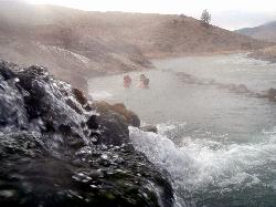
Boiling River
North Entrance, Yellowstone National Park
33.7 miles NThe Boiling River is created where a large hot spring enters the Gardner River, allowing the hot and cool waters to mix into a temperature comfortable enough to bathe in. The natural hot tub makes a...
Hot Springs, Swim 0.3-0.6 mi
Bear Gulch
Ashton, Idaho
33.8 miles SWBear Gulch is an abandoned ski hill out of operation since 1969. While the vegetation is beginning to take over, there's still some great sledding to be had. It's just far enough into the...
Camp, Cross-country Ski, Hike, Sled 0.6-4.7 mi
Harriman State Park
Island Park, Idaho
33.8 miles SWHarriman State Park is found 38 miles from Yellowstone along Henry's Fork. This 11,000-acre wildlife refuge is open year round for most activities. In addition to having beautiful scenery and...
Cross-country Ski, Hike, Horseback, Mountain Bike, Snowshoe
Tower Falls
Tower Junction, Yellowstone National Park
33.9 miles NETower Fall is a waterfall on Tower Creek in the northeastern region of Yellowstone National Park, in the U.S. state of Wyoming. Approximately 1,000 yards (910 m) upstream from the creek's...
Camp, Hike 3.3 mi
Avalanche Peak Trail
Cody, Wyoming
34.0 miles EAvalanche Peak Trail is a 4 mile trail to the peak of Avalanche Mountain. This is considered difficult because hikers will climb 2,100 feet in 2 miles. It is recommended that hikers bring...
Hike 2.4 mi
Lost Lake Trail
Tower Junction, Yellowstone National Park
34.1 miles NELost Lake Trail is a 2.8 mile hike that can be completed in less than two hours. This is an easy hike with very little elevation change. Hikers can enjoy forests, meadows and a view of Lost Lake...
Hike 8.2 mi
Garnet Hill Trail
Tower Junction, Yellowstone National Park
34.4 miles NEGarnet Hill Trail is a 7.6 mile loop that follows an old, dirt stagecoach road. This trail passes through large meadows, dusty areas with sagebrush, forests and beside the Yellowstone River. This...
Hike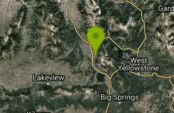
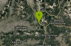
Mile Creek Trail
34.7 miles NW
It is important to note that Mile Creek Trail is part of the Continental Divide Trail system, so it connects to other trails of various difficulties. Mile Creek Trail itself is a great...
Mountain Bike


