165 Things to do near James Simpson Skatepark
first prev 1 2 3 4 5 6 7 8 9 next lastShowing results within 50 miles Distance miles of 274 S Hanson Ave, Shelley, ID 83274, USA City, Zip, or Address

Falls Campground
Victor, Idaho
38.9 miles EFalls Campground is located next to the Snake River near beautiful Swan Valley, only 45 miles east of Idaho Falls, Idaho. Mixed growth cottonwood trees provide partial shade, and grassy meadows...
Camp
South Fork Bear Creek Trail
Wayan, Idaho
39.1 miles EOHV trail. source: fs.usda.gov
Mountain Bike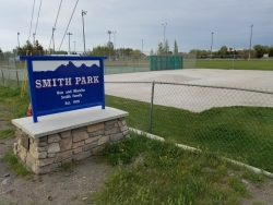
Smith Park
Sugar City, Idaho
39.1 miles NESugar Hill is a smaller sledding hill in Sugar City's Smith Park. It's great for younger kids or just some quick runs. You can often get a good run on every side.
Skateboard, Sled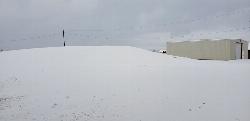
Park on Center St
Sugar City, Idaho
39.4 miles NESled near Sugar City, Idaho
Sled
Ross Park
Pocatello, Idaho
39.4 miles SOn grass with elevation and large trees that force a variety of throws. Alt. pins throughout the seasons. Public (No Fee)
Disc Golf
Upper Ross Park
Pocatello, Idaho
39.4 miles SOn grass with elevation and large trees that force a variety of throws. Alt. pins throughout the seasons. Public (No Fee)
Disc Golf
Shady Side Cliffs at Ross Park
Pocatello, Idaho
39.4 miles SThe routes on the Shady Side can be identified by a number on top of the cliff as well as on the face at the bottom of the climbs. The number is close to where the rope should hang for a given...
Rock Climb 0.2-9.7 mi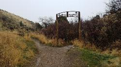
City Creek
Pocatello, Idaho
39.4 miles SWThe City Creek Management Area (CCMA) Trail System is a vast network of trails maintained by the City of Pocatello. There are trails to go up and others to come down. Most trails come back to the...
Hike, Horseback, Mountain Bike
Moody Meadows
Driggs, Idaho
39.6 miles NEGood place for kids, they can ride bikes in the meadow, play in the stream, and camping is off of the road. Hiking, motorbiking, and horseback riding trails are abundant in the area.
Camp
Sunnyside Cliffs at Ross Park
Pocatello, Idaho
39.8 miles SThe routes on the Sunny Side can be identified by a number at the bottom of the climbs. The number is close to where the rope should hang for a given climb. These numbers were put up years ago and...
Rock Climb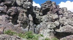
Basalt Bluff / Steve's Rock
Teton, Idaho
40.3 miles NEDon't go anywhere marked No Trespassing and Beware of the Attack Bees at the top of the cliffs and the Stinging Nettle at the bottom. About a mile north of Loon Lake/Wentworth Springs Road...
Rock Climb
Long Gulch/Indian Trail
Swan Valley, Idaho
40.7 miles EOff Highway Vehicles (OHV) less than or equal to 50 inches wide, Mountain Biking, Horse Riding, hiking. source: fs.usda.gov
Mountain Bike
Red Ridge Trail
Swan Valley, Idaho
40.7 miles EOHV trail. source: fs.usda.gov
Mountain Bike
Flat Iron Trail
Swan Valley, Idaho
40.9 miles EOHV trail. source: fs.usda.gov
Mountain Bike
Thousand Springs Trail
Driggs, Idaho
41.0 miles NEThe Thousand Springs trail begins at Moody Swamp trailhead and ends at Jct Prospect Peak Trail. source: fs.usda.gov Courtesy of Singletracks.com
Mountain Bike
Sucky Courtney's
Saint Anthony, Idaho
42.1 miles NEKayaker playing in Marshall's Wave near Rexburg, Idaho. The wave is located on the North Fork of the Teton River and is best at flows above 600 cfs. The wave is good for beginners. It has a...
Kayak
Slate Mountain/Gibson Jack Trail
Pocatello, Idaho
42.9 miles SThe Gibson Jack trail offers great views of Southeastern Idaho and a favorite trail among moutain bikers. This trail is a continuation of the West Fork Mink Creek trail and takes travelers further...
Hike, Horseback, Mountain Bike
Marshall's
Saint Anthony, Idaho
43.0 miles NEMarshall's Wave is located on the North Fork of the Teton River, where the Teton River splits into the north and south forks. The wave is created by a headgate and is best at flows above 600...
Kayak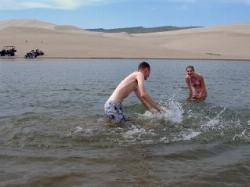
Egin Lakes
Saint Anthony, Idaho
43.0 miles NEgin Lakes is one of the favorite gateways to the St. Anthony Sand Dunes. The lakes themselves are unusually shallow and where you'll actually find a lake depends greatly on what time of the...
Sled, Swim
Driveway Canyon Trail
Inkom, Idaho
43.4 miles SMotorcycle traili. source: fs.usda.gov
Mountain Bike


