


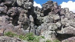
Basalt Bluff / Steve's Rock
Teton, Idaho
| Address: | ~1412-1440 N 6000 E, Teton, ID 83451, USA |
| GPS: |
43°50'47.6"N 111°39'32.8"W Maps | Directions |
| State: | Idaho |
Rock Climb
Don't go anywhere marked No Trespassing and Beware of the Attack Bees at the top of the cliffs and the Stinging Nettle at the bottom.
About a mile north of Loon Lake/Wentworth Springs Road junction, going towards Loon Lake, look up to the left to see this formation. Park on the road (narrow) and hike up to the the east face where all the climbs are. Can rappel off (2 ropes) or walk off to the north. Most routes are high quality with good rock. At last count there were 11 established routes here.
| Route | Difficulty | Ascents |
|---|---|---|
| 5.8 Hand Crack | 5.8 | 1 |
| Aoxomoxoa | 5.10b | 1 |
| Brown Shoes | 5.10c | 1 |
| Hangdogs Beget Eurodogs | 5.10a | 2 |
| Movin to Montana | 5.10c | 1 |
| Punk Titans Unchained | 5.10a | 1 |
| Three Ekka | 5.11a | 1 |
courtesy of RockClimbing.com
More Information
Add Resource- Plan Ahead and Prepare
- Travel & camp on durable surfaces
- Dispose of waste properly
- Leave what you find
- Minimize campfire impacts
- Respect wildlife
- Be considerate of other visitors
Directions
From Teton, Idaho
- Head east on E Main St toward N 3rd W (289 ft)
- Turn right onto N 3rd W (39 ft)
- Turn left at the 1st cross street onto ID-33 E/W Main StContinue to follow ID-33 E(0.9 mi)
- Turn right onto N 2500 E (0.1 mi)
- Continue onto E Teton Rd (2.0 mi)
- Continue onto N 6000 E/Archery RdDestination will be on the right(0.6 mi)
Park at the top of the hill on the North side where there is a little more of a pull-off spot. The rocks with all the routes are West of there. You can walk right to the top anchors, then rappel down from there.
jared
8/23/21 8:14 am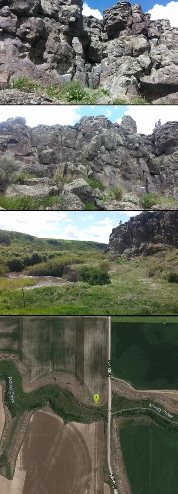


Other Rock Climbing Walls Nearby


Paramount Wall / Blanche Rock
Ririe, Idaho
14.4 miles SA sport climbing wall above the road near Ririe with great exposure, afternoon shade, and well-loved 5.9–5.10 lines — most routes work with a 50-meter rope, established by Chuck Oddette and crew.
Camp, Horseback, Rock Climb
Heise Rock (AKA Elephant Rock)
Ririe, Idaho
14.6 miles SCLOSED. Rock climbing is no longer permitted. A volcanic plug sport climbing crag near Heise Hot Springs with lines developed since the late 1980s — great potential across the south side, with routes across all skill levels.
Rock Climb 0.3 mi
Pointless Crag
Ririe, Idaho
17.0 miles SA BLM sport climbing crag in the South Fork area near Ririe — short routes with suspect rock, fixed anchor biners for lowering (not yours to take), and a dedicated parking area 2.7 miles up South Fork Road.
Rock Climb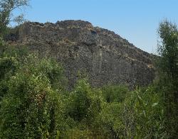
South Park
Ririe, Idaho
17.4 miles SRock Climb near Ririe, Idaho
Rock Climb
The Arcane
Ririe, Idaho
18.1 miles SEThe Arcane is a rugged rock-climbing crag in the canyon country of eastern Idaho, up the South Fork Snake River drainage past Heise and the Kelly Canyon area, roughly 23 miles from Idaho Falls. A...
Rock Climb
Blacktail Day Use Area
Ririe, Idaho
18.8 miles SCliff jumping from almost nothing up to 80 feet, plus rock climbing routes, on the north end of Ririe Reservoir — $3–$5 daily fee applies.
Dive, Rock Climb, Swim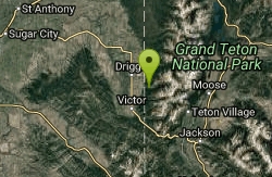
Darby Canyon Cliffs
Alta, Wyoming
33.9 miles EA popular west-slope hike near Alta, Wyoming to an ancient Wind Cave snaking through 350-million-year-old dolomite, with waterfalls and wildflowers cascading down the canyon rim along the way.
Rock Climb 6.2 mi
Darby Wind Cave
Driggs, Idaho
36.2 miles EWaterfalls, wildflowers, creek crossings, and a wind cave high on the canyon wall — Darby's switchback trail rewards hikers with views found nowhere else in the Tetons.
Backpack, Cave, Hike, Rock Climb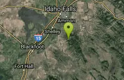
RPM Wall
Firth, Idaho
41.7 miles SWolverine Canyon is full of limestone. The RPM wall being the currently developed wall and has some decent routes.
Rock Climb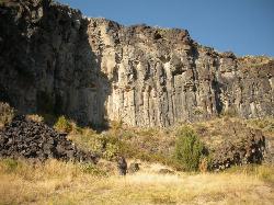
The Playground
Shelley, Idaho
44.8 miles SWA moderate-to-hard basalt sport climbing wall east of Idaho Falls with nine routes from 70 to 80 feet — including classics like 'Tied to the Whipping Post' and 'Anchored to the Sky,' best April through September.
Rock Climb 3.9-14.4 mi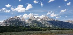
Grand Teton
Jackson Hole, Wyoming
46.5 miles EAt 13,770 feet, the Grand Teton towers over Western Wyoming — all popular routes require rock climbing gear and are for skilled climbers only, with 3,000 feet of exposure where a fall is fatal.
Backpack, Hike, Rock Climb 13.8 mi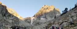
Middle Teton
Jackson Hole, Wyoming
46.5 miles EThe 12,804-ft Middle Teton rewards serious alpinists with glacier bouldering through the Southwest Couloir and panoramic views of the Grand, South, and surrounding Tetons.
Backpack, Hike, Rock ClimbNearby Campsites

Eagle Park
Rexburg, Idaho
6.9 miles WA cottonwood forest park inside Rexburg city limits with campsites, fishing, a dog park, mountain biking on easy and moderate loops, and rock-throwing by the river.
Camp, Hike, Mountain Bike, Sled 0.8-1.3 mi
Warm Slough Campground
Rexburg, Idaho
10.5 miles WA popular river campground with two boat ramps and an easy, slow-moving inner tube float — the take-out is 1,000 feet from the put-in, making multiple runs a breeze.
Airsoft, Camp, Canoe 0.5-3.5 mi
Webster's Dam
Ririe, Idaho
10.8 miles SAn abandoned dam in Moody Creek canyon where sediment split the stream into two beautiful 15-foot waterfalls — stunning in spring runoff and blazing with fall colors.
Camp, Hike, Mountain Bike
Big Hole Dispersed Campsites
Ririe, Idaho
12.3 miles SA network of dispersed campsites with fire rings in the Big Hole mountains above Kelly Canyon — first come, first served, no reservations, and Leave No Trace principles are essential.
Camp
Beaver Dick Park
Rexburg, Idaho
12.4 miles WA 9.5-acre Snake River park near Rexburg with fire pits, pavilions, fishing, boating, swimming, and a rich history tied to legendary frontiersman Beaver Dick Leigh.
Camp, Canoe, Disc Golf, Swim
Twin Bridges Park
Rexburg, Idaho
13.1 miles SWA 27-acre Snake River park between two bridges near Rexburg with shaded campsites, fire pits, pavilions, a playground, and BLM ground for hiking and hunting on three sides.
Camp, Canoe
Paramount Wall / Blanche Rock
Ririe, Idaho
14.4 miles SA sport climbing wall above the road near Ririe with great exposure, afternoon shade, and well-loved 5.9–5.10 lines — most routes work with a 50-meter rope, established by Chuck Oddette and crew.
Camp, Horseback, Rock Climb
Moody Meadows
Driggs, Idaho
15.0 miles SEGood place for kids, they can ride bikes in the meadow, play in the stream, and camping is off of the road. Hiking, motorbiking, and horseback riding trails are abundant in the area.
Camp
Table Rock Campground
Ririe, Idaho
15.3 miles SA campground in Caribou-Targhee National Forest — part of a 3-million-acre stretch from Montana to the Utah and Wyoming borders — with access to the Curlew National Grassland.
Camp
Kelly Island Campground
Ririe, Idaho
15.4 miles SA BLM campground with 14 family sites and 1 group site for RVs or tents, open May through September — vault toilets, pets welcome, and rates from $5–$20 per night.
Camp
Jefferson County Lake (AKA Rigby Lake)
Rigby, Idaho
15.8 miles SWSandy beaches, two floating docks with a slide, volleyball, playgrounds, and a safe swim zone — Jefferson County Lake is eastern Idaho's go-to summer swimming spot.
Camp, Canoe, Dive, Kayak, Sled, Swim 0.6-2.0 mi
North Menan Butte ('R' Mountain)
Menan, Idaho
17.0 miles WA volcanic butte locals call R Mountain, with a paved trailhead, chain handrails near the top, informational signs at the rim, and views of Rexburg and the Snake River.
Camp, Cave, Hike
Wolf Flats Recreation Area
Ririe, Idaho
17.3 miles SWolf Flats is a completely free, dispersed, undeveloped camping area with 25 locations to camp. Some areas are large enough to accommodate groups of 50 people.
Camp
Warm River Campground
Ashton, Idaho
25.7 miles NESlow-moving warm water and willow-lined banks make this campground a perfect spot for tubing, trout fishing, and peaceful mountain biking at 5,200 ft elevation.
Camp
Porcupine Creek
Ashton, Idaho
27.4 miles NEA backcountry hunting, fishing, camping, and swimming spot in Targhee National Forest, surrounded by forests, meadows, a creek, and unmarked trails — bear country, so pack and store food carefully.
Camp, Swim 0.3-0.6 mi
Bear Gulch
Ashton, Idaho
28.0 miles NEAn abandoned ski hill from 1969 with overgrown runs that still deliver great sledding — the lower run is fast and winding all the way down to the old ski lift.
Camp, Cross-country Ski, Hike, Sled
Pine Creek Campground
Victor, Idaho
29.5 miles SEThe Pine Creek Campground has 10 single units and has restrooms.
Camp
Pine Butte / The Caldera
St. Anthony, Idaho
29.9 miles NAn old volcano in the Idaho desert that feels like stepping into a mountain forest — pine-covered hillsides, a meadow ringed by aspen and boulders, and a quarter-mile easy trail to the caldera floor.
Camp, Hike, Horseback
Fall Creek Falls
Swan Valley, Idaho
31.4 miles SEA shaded Snake River campground near Swan Valley with abundant wildlife, great trout fishing, and Fall Creek Falls a quarter-mile away.
Camp, Cave, Hike, Kayak, Swim
Falls Campground
Victor, Idaho
32.3 miles SEA Snake River campground near Swan Valley with cottonwood shade, abundant wildlife — eagles, osprey, moose, and deer — and Fall Creek Falls just a quarter mile away; Palisades Reservoir is 20 miles out.
Camp


