


Moody Meadows
Driggs, Idaho
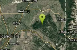
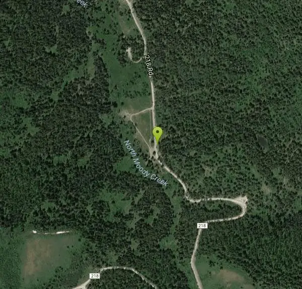
Camp
Good place for kids, they can ride bikes in the meadow, play in the stream, and camping is off of the road. Hiking, motorbiking, and horseback riding trails are abundant in the area.
More Information
Walla Walla District Recreation
The official public website of the Walla Walla District, U.S. Army Corps of Engineers. For website corrections, write to cenww-pa@usace.army.mil
https://www.nww.usace.army.mil/Missions/Recreation/Dworshak-Dam-and-Reservoir/Three-Meadows-Group-Camp/
- Plan Ahead and Prepare
- Travel & camp on durable surfaces
- Dispose of waste properly
- Leave what you find
- Minimize campfire impacts
- Respect wildlife
- Be considerate of other visitors
Directions
From Driggs, Idaho
- Head east on W Bates Rd toward N Main St (69 ft)
- Turn left at the 1st cross street onto ID-33 W/N Main StContinue to follow ID-33 W(25.1 mi)
- Turn left onto Canyon Creek Rd (0.8 mi)
- Merge onto N Canyon Creek Rd (7.8 mi)
- Turn right onto Canyon Creek Rd (1.2 mi)
- Turn left (0.3 mi)
- Sharp left (1.4 mi)
- Turn left (148 ft)
- Keep right (0.5 mi)
- Turn left onto 218 Rd/Long Hollow Rd (3.0 mi)
27 miles west of Orofino, Idaho, on Highway 7 through Cavendish and the Freeman Creek Campground. 3.5 miles past Freeman Creek. Access road is steep, narrow, and one lane with turnouts. Portions of the road are gravel.
Other Arenas Nearby

Thousand Springs Trail
Driggs, Idaho
2.2 miles EA singletrack trail beginning at Moody Swamp trailhead and ending at the Prospect Peak Trail junction in Idaho's Teton-area national forest.
Mountain Bike 0.6-2.2 mi
Fish Creek Area
Ririe, Idaho
5.2 miles WThe Big Hole Mountains' Fish Creek trail network serves up singletrack climbs, floater jumps, rock gardens, and fast Fishbone descents accessed from Ririe or Rexburg.
Hike, Mountain Bike
Burns Canyon
Ririe, Idaho
5.2 miles SHike and Mountain Bike near Ririe, Idaho
Hike, Mountain Bike 0.6-5.5 mi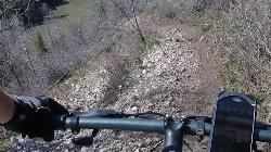
Old Ranger
Ririe, Idaho
5.3 miles SA diverse, challenging singletrack on a southern-exposure ridge above the Snake River — great for early or late season riding when other trails are still snow-covered or muddy.
Mountain Bike
The Arcane
Ririe, Idaho
5.7 miles SWThe Arcane is a rugged rock-climbing crag in the canyon country of eastern Idaho, up the South Fork Snake River drainage past Heise and the Kelly Canyon area, roughly 23 miles from Idaho Falls. A...
Rock Climb
Wolverine Creek Trail
Ririe, Idaho
5.9 miles SWWolverine Creek Trail is an easygoing doubletrack ride in the Kelly Canyon network above the South Fork of the Snake near Ririe, Idaho.
Mountain Bike
Blacks Canyon Trail
Ririe, Idaho
6.4 miles SA Forest Service singletrack from Black Can Road to the Fleming Canyon Trail junction in Ririe, Idaho — open to motorcycles and OHVs up to 50 inches wide.
Mountain Bike
South Fork Rim Trail
Ririe, Idaho
6.4 miles SA motorcycle-designated trail along the South Fork Rim near Ririe, Idaho — check local regulations before bringing other bike types.
Mountain Bike
Kelly Canyon Loops
Ririe, Idaho
6.5 miles WA mountain bike network near Kelly Canyon Ski Area in Ririe, Idaho with panoramic summit views and multiple trail options including the Waterfall Loop, Fish Creek Loop, and alpine cow-path routes.
Mountain Bike 11.9 mi
Waterfall Loop
Ririe, Idaho
6.7 miles WA mix of singletrack, forest road, and doubletrack near Kelly Canyon Ski Area in Idaho with about 1,400 feet of elevation change — GPS or a printed map is essential since signage is sparse.
Mountain Bike 0.5-3.5 mi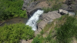
Webster's Dam
Ririe, Idaho
6.8 miles WAn abandoned dam in Moody Creek canyon where sediment split the stream into two beautiful 15-foot waterfalls — stunning in spring runoff and blazing with fall colors.
Camp, Hike, Mountain Bike
Bighole Mountains / Moody
Ririe, Idaho
6.8 miles WWooded fields divided by two merging roads and a natural elevation change create a versatile unofficial airsoft and paintball area in the Big Hole Mountains.
Airsoft, Paintball 1.1 mi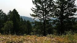
Hidden Vista / Pine Loop
Ririe, Idaho
7.0 miles WA short singletrack trail to a canyon overlook with Snake River views — then a detour east for fun climbs, turns, rocks, and jumps on the way back to the Buckskin Morgan parking lot.
Hike, Mountain Bike 5.7-8.1 mi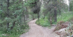
Space Cruz
Ririe, Idaho
7.0 miles WFlowy singletrack connecting to ATV trails with great berms, small jumps, and a thistle patch best attacked at speed — just watch out for cows at the junctions.
Cross-country Ski, Mountain Bike 1.7 mi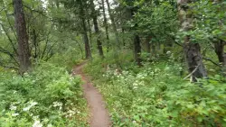
Buckskin Morgan Ridge
Ririe, Idaho
7.0 miles WA punchy climb to Buckskin Morgan Ridge pays off with twisty singletrack descents through roots, loose rock, and rolling hills above the Snake River Plain.
Hike, Mountain Bike 4.3 mi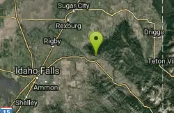
Leaning Fir #169
Ririe, Idaho
7.1 miles SWMountain Bike near Ririe, Idaho
Mountain Bike
Lower Hawley Gulch Trail
Ririe, Idaho
7.1 miles SWA mostly flat intermediate singletrack through forest and fields in Ririe, Idaho — expect fallen logs, small ponds, rocky stretches, and creek crossings before connecting to a shared ATV doubletrack.
Mountain Bike
Big Hole Dispersed Campsites
Ririe, Idaho
7.1 miles WA network of dispersed campsites with fire rings in the Big Hole mountains above Kelly Canyon — first come, first served, no reservations, and Leave No Trace principles are essential.
Camp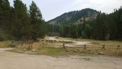
Table Rock Campground
Ririe, Idaho
7.1 miles SWA campground in Caribou-Targhee National Forest — part of a 3-million-acre stretch from Montana to the Utah and Wyoming borders — with access to the Curlew National Grassland.
Camp
Kelly Canyon/Table Rock
Ririe, Idaho
7.2 miles SWTwisty, root-and-rock singletrack near Ririe with enough challenge on the climb and enough air on the descent to keep things interesting.
Mountain Bike
Nearby Campsites
Webster's Dam
Ririe, Idaho
6.8 miles WAn abandoned dam in Moody Creek canyon where sediment split the stream into two beautiful 15-foot waterfalls — stunning in spring runoff and blazing with fall colors.
Camp, Hike, Mountain Bike
Big Hole Dispersed Campsites
Ririe, Idaho
7.1 miles WA network of dispersed campsites with fire rings in the Big Hole mountains above Kelly Canyon — first come, first served, no reservations, and Leave No Trace principles are essential.
Camp
Table Rock Campground
Ririe, Idaho
7.1 miles SWA campground in Caribou-Targhee National Forest — part of a 3-million-acre stretch from Montana to the Utah and Wyoming borders — with access to the Curlew National Grassland.
Camp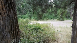
Wolf Flats Recreation Area
Ririe, Idaho
9.3 miles SWWolf Flats Recreation Area is a free, undeveloped camping area strung along the South Fork of the Snake River in the canyon country east of Idaho Falls, and it's a longtime favorite of eastern Idaho...
Camp
Paramount Wall / Blanche Rock
Ririe, Idaho
9.9 miles WA sport climbing wall above the road near Ririe with great exposure, afternoon shade, and well-loved 5.9–5.10 lines — most routes work with a 50-meter rope, established by Chuck Oddette and crew.
Camp, Horseback, Rock Climb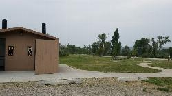
Kelly Island Campground
Ririe, Idaho
10.7 miles WA BLM campground with 14 family sites and 1 group site for RVs or tents, open May through September — vault toilets, pets welcome, and rates from $5–$20 per night.
Camp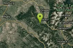
Pine Creek Campground
Victor, Idaho
14.9 miles SEThe Pine Creek Campground has 10 single units and has restrooms.
Camp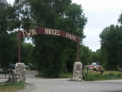
Twin Bridges Park
Rexburg, Idaho
15.1 miles WA 27-acre Snake River park between two bridges near Rexburg with shaded campsites, fire pits, pavilions, a playground, and BLM ground for hiking and hunting on three sides.
Camp, Canoe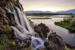
Fall Creek Falls
Swan Valley, Idaho
17.1 miles SA shaded Snake River campground near Swan Valley with abundant wildlife, great trout fishing, and Fall Creek Falls a quarter-mile away.
Camp, Cave, Hike, Kayak, Swim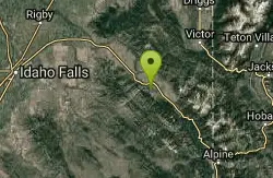
Falls Campground
Victor, Idaho
17.9 miles SA Snake River campground near Swan Valley with cottonwood shade, abundant wildlife — eagles, osprey, moose, and deer — and Fall Creek Falls just a quarter mile away; Palisades Reservoir is 20 miles out.
Camp 0.2-0.5 mi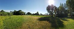
Eagle Park
Rexburg, Idaho
19.7 miles NWA cottonwood forest park inside Rexburg city limits with campsites, fishing, a dog park, mountain biking on easy and moderate loops, and rock-throwing by the river.
Camp, Hike, Mountain Bike, Sled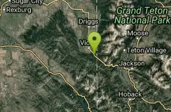
Mike Harris Campground
Victor, Idaho
21.6 miles SEA scenic mountain campground at 6,200 feet along Teton Pass just 5 miles from Victor, Idaho — a peaceful base for fishing, trail exploring, and sightseeing in the Teton region.
Camp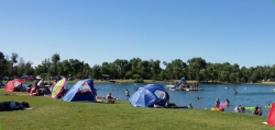
Jefferson County Lake (AKA Rigby Lake)
Rigby, Idaho
21.9 miles WSandy beaches, two floating docks with a slide, volleyball, playgrounds, and a safe swim zone — Jefferson County Lake is eastern Idaho's go-to summer swimming spot.
Camp, Canoe, Dive, Kayak, Sled, Swim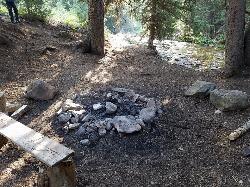
Darby Canyon Camping
Alta, Wyoming
22.2 miles EDispersed campsites with fire lays in scenic Darby Canyon — no official campground, just established spots in Wyoming wilderness. Leave No Trace and use existing rings only.
Camp 2.8-4.1 mi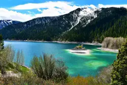
Palisades Creek Trail / Lakes and Waterfall Canyon
Irwin, Idaho
23.3 miles SESpectacular mountain views, two landslide-formed alpine lakes, and mountain goat sightings — all within a 4-to-6-mile hike in the Swan Valley wilderness.
Backpack, Camp, Hike, Horseback, Mountain Bike 0.8-1.3 mi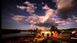
Warm Slough Campground
Rexburg, Idaho
24.0 miles NWA popular river campground with two boat ramps and an easy, slow-moving inner tube float — the take-out is 1,000 feet from the put-in, making multiple runs a breeze.
Airsoft, Camp, Canoe
Beaver Dick Park
Rexburg, Idaho
24.2 miles NWA 9.5-acre Snake River park near Rexburg with fire pits, pavilions, fishing, boating, swimming, and a rich history tied to legendary frontiersman Beaver Dick Leigh.
Camp, Canoe, Disc Golf, Swim
Reunion Flat Campground
Alta, Wyoming
26.1 miles ECamp near Alta, Wyoming
Camp 0.6-2.0 mi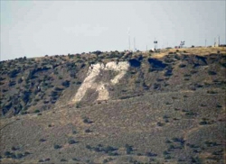
North Menan Butte ('R' Mountain)
Menan, Idaho
27.2 miles WA volcanic butte locals call R Mountain, with a paved trailhead, chain handrails near the top, informational signs at the rim, and views of Rexburg and the Snake River.
Camp, Cave, Hike
Calamity Campground
Irwin, Idaho
27.5 miles SEA wooded Palisades Reservoir campground 55 miles east of Idaho Falls with clean blue water for swimming, boating, water skiing, and fishing — plus miles of ATV routes.
Camp, Canoe, Hike, Kayak, Mountain Bike, Swim


