


146 Things to do near Mystic Falls
first prev 1 2 3 4 5 6 7 8 next lastShowing results within 50 miles Distance miles of 85PFF4PW+2X City, Zip, or Address
Howard Creek Trail
Island Park, Idaho
40.7 miles WThe Howard Creek trail follows Howard Creek upstream to the old Taylor Creek Road. The old Taylor Creek Road connects the Howard Creek trail to the Continental Divide Trail. Howard...
Mountain Bike 0.8 mi
Conant Creek Pegram Truss Railroad Bridge
Ashton, Idaho
40.7 miles SWAs part of the Rails to Trails project, this old railroad bridge has been transformed into a very safe little viewing experience for the whole family. You can drive right up to the bridge where there...
Hike
Daly Creek
Gallatin Gateway, Montana
41.4 miles NDaly Creek Trail is a 5.2 mile out and back trail located near Gallatin Gateway, Montana and is good for all skill levels. The trail is primarily used for hiking and is accessible from May until...
Hike 8.5 mi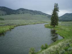
Slough Creek Trail
Tower Junction, Yellowstone National Park
41.4 miles NESlough Creek Trail is a 3.4 mile out and back trail that follows a historic wagon trail through several meadows. This trail is a fairly easy hike that has beautiful views of Slough Creek. The...
Hike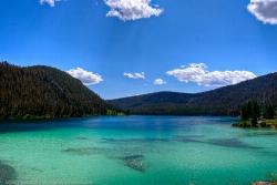
Wade Lake
Cameron, Montana
41.5 miles NWCamp, Canoe, Kayak, and Swim near Cameron, Montana
Camp, Canoe, Kayak, Swim
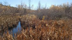
Slough Creek Campground
Tower Junction, Yellowstone National Park
41.7 miles NESlough Creek campground is a small but very popular campground on the Northeast Entrance Road. Most of the campsites are situated right on the banks of Slough Creek where fishing is a favorite...
Camp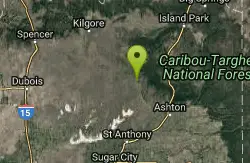
Sand Creek Frenzy
Ashton, Idaho
43.0 miles SWThere are some woods back there and it is secluded. There are many places you can play just watch out for campers.
Paintball
River Rush
Ashton, Idaho
43.4 miles SWPaintball near Ashton, Idaho
Paintball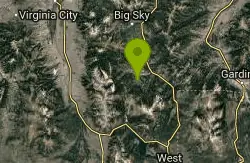
Little Wapiti
Gallatin Gateway, Montana
43.7 miles NWThe climb is partially double track. The descent is narrow, at times rocky, singletrack. Gorgeous views. At 9,000 plus feet...wolf tracks, too.
Mountain Bike
Mt. Moran
Alta, Wyoming
45.1 miles SMount Moran (12,610 feet (3,840 m)) is a mountain in Grand Teton National Park of western Wyoming, USA. The mountain is named for Thomas Moran, an American western frontier landscape artist....
Hike
Badger Creek
Tetonia, Idaho
45.5 miles SBadger Creek is a stream located just 13.6 miles from Ashton, in Teton County, in the state of Idaho, United States, near France, ID. Whether you’re spinning, baitcasting or fly fishing your...
Camp, Cross-country Ski, Hike, Mountain Bike, Rock Climb 0.6-1.5 mi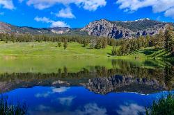
Trout Lake and Buck Lake
Tower Junction, Yellowstone National Park
45.8 miles NEThe Trout Lake trail is a steep 1/2-mile trail through a Douglas fir forest which leads to the lake. Trout Lake is also known to be called Fish Lake and Soda Butte Lake .The most difficult...
Hike
Pebble Creek Campground
Northeast Entrance, Yellowstone National Park
46.9 miles NEPebble Creek is a popular campground for fishermen and those seeking a more quiet and smaller campground in Yellowstone National Park. The campsites can fill very early, so get there before 11 AM...
Camp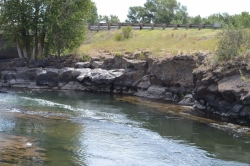
Fall River Bridge
Ashton, Idaho
47.7 miles SWRight off Highway 20, there's a great spot to swim, swing, and dive. There's pullouts for parking right next to the bridge. There's a rope swing under the railroad bridge and a little...
Dive, Swim 1.7 mi
Rick's Basin
Driggs, Idaho
47.9 miles SMountain Bike near Driggs, Idaho
Mountain Bike
Twin Bridges
St. Anthony, Idaho
48.1 miles SWThere's an old abandoned bridge next to the one currently in use. The water is pretty deep underneath and offers two distinct levels to jump from. There's a little rope swing under the bridge...
Dive, Swim 0.6-4.0 mi
Grand Targhee XC Park
Moose, Wyoming
48.4 miles SMountain Bike 1.1 mi
More Cowbell
Moose, Wyoming
48.4 miles SThis singletrack trail winds through aspens, high alpine meadows and old growth conifers.
Mountain Bike 1.9 mi
Perm-a-grin
Moose, Wyoming
48.4 miles SPerma Grin is guaranteed to fix a smile on your face indefinitely! This swooping, flowing, smooth singletrack descends the hillside above Rick's Basin.
Mountain Bike 2.1 mi
Buffalo Soldier
Moose, Wyoming
48.5 miles STrail is a nice loop, all singletrack, with about 300' of elevation gain. Trail is about 1.8 miles one way. You can also use it as a connector to Mill Creek or lightning loop. Buffalo...
Mountain Bike


