


233 Things to do near Piestewa Peak Summit Trail #300
first prev 3 4 5 6 7 8 9 10 11 12 next lastShowing results within 50 miles Distance miles of Piestewa Peak Summit Trail, Phoenix, AZ 85016, USA City, Zip, or Address

Rainbow Valley to Toothaker Loop Trail
Goodyear, Arizona
23.3 miles SWEstrella Mountain Regional Park has many trails within it, a great beginner to intermediate friendly trail is the Rainbow Valley to Toothaker Loop Trail. This 6.6 mile hike is mostly flat with a few...
Hike, Horseback, Mountain Bike 1.0 mi
Quail Trail
Goodyear, Arizona
23.3 miles SWQuail Trail is the access trail from the Nature Center to the main trail system. It is a pretty steep climb, but smooth and steady. Quail Trail is a spur trail in the Estrella Mountain...
Hike, Horseback, Mountain Bike
Pass Mountain
Mesa, Arizona
23.6 miles EMultiple loop options and trails with various degrees of difficulty. Beginners/novices will enjoy Moonrock and Blevins trails while experts will enjoy Pass Mt and the Cat Peaks loops. I...
Mountain Bike
Buckhorn Campground Nature Trail
Apache Junction, Arizona
23.7 miles ECamp and Hike near Apache Junction, Arizona
Camp, Hike 1.5 mi
Moon Rock Loop
Apache Junction, Arizona
24.1 miles ELocated within the larger Usery Mountain Regional Park, the Moon Rock loop is a fast and smooth trail that adds 1.3 miles to the more famous Blevins Trail. Although the Moon Rock loop is not known as...
Hike, Horseback, Mountain Bike 1.7 mi
Levee Trail
Mesa, Arizona
24.1 miles ELocated within the Usery Mountain Regional Park, the Levee trail is named so because it mostly follows the top of levee, running parallel to a large section of the channel trail and a Phoenix...
Hike, Horseback, Mountain Bike
Usery Mountain Regional Park
Mesa, Arizona
24.2 miles EThere are many miles of two-way single-track trails in the park at several levels of difficulty. The Pass Mountain Trail should challenge intermediate to advanced riders. The Cat Peaks...
Mountain Bike
Crismon Wash Trail
Mesa, Arizona
24.3 miles EThe Crismon Wash Trail is 1.8 mile trail that is accessible from the south at the Crismon road trailhead. It is also accessible from the Blevins train to the north. There are several...
Hike, Horseback, Mountain Bike
Cat Peaks - Blevin - Moonrock
Apache Junction, Arizona
24.5 miles EFollow Blevins trail 0.6 miles, the entrance to the Moonrock loop will be on your right, marked by a brown sign and arrow. Take this loop (around 1.4 miles) until it returns to Blevin's...
Mountain Bike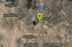
Emery Henderson
Phoenix, Arizona
25.2 miles NBct(Black Canyon Trail) trail head features paved parking and restrooms. From here you can head south on relatively flat ground, or North, working into the desert hills, on multiuse...
Mountain Bike
Pebble Beach
Mesa, Arizona
25.9 miles EPebble Beach is a popular place to go tubing and swimming with designated picnic areas. It's located along the Salt River in Cibola National Forest. The reason the Salt River is so salty is...
Swim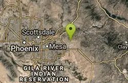
Blevins Via Meridian
Apache Junction, Arizona
26.1 miles EThe ride East down Meridian trail is a one mile intermediate to beginner ride. However if you can stay on the pedals through the several dry wash crossings you are definitely not a...
Mountain Bike
Cat Peaks Via Ruidoso
Apache Junction, Arizona
26.3 miles EThe Ruidoso trail is a beginner ride with a few tricky dry wash crossings that will challenge you to try and stay on the pedals. This trail ends at the Spillway trail after 1.2 miles....
Mountain Bike
Quartz Peak Trail
26.7 miles SW
Hike near
Hike
Marbella Vineyards
Gilbert, Arizona
27.1 miles SEShort straight shots over grass with few trees to baskets surrounding a subdivision neighborhood park. Undefined tees. Reverse to make 18. Private (No Fee)
Disc Golf
Black jack
Goodyear, Arizona
27.2 miles SWExtreme terrain, advance riders only.
Mountain Bike

Wildlife Trail
Waddell, Arizona
27.6 miles WA short trail which terminates at a small pond.
Hike, Horseback
Mule Deer Trail (Maricopa Trail)
Waddell, Arizona
27.6 miles WMule Deer trail is a 3.5 mile out-and-back trail that it part of the Maricopa Trail within White Tank Mountain Regional Park. This is a beginner to moderate friendly trail for both hikers and...
Hike, Horseback, Mountain Bike
South, Bajada, Mule Deer Loop Trail
Waddell, Arizona
27.7 miles WSouth - Bajada - Mule Deer Loop is a 4.1 mile loop trail located near Waddell, Arizona that offers the chance to see wildlife. The trail is rated as moderate and is accessible from...
Hike, Horseback, Mountain Bike
Black Rock Loop Trail
Waddell, Arizona
27.7 miles WBlack Rock Trail is a 1.3 mile loop trail located near Waddell, Arizona and is good for all skill levels. The trail is primarily used for hiking and is accessible year round. Black...
Hike


