


229 Things to do near Quakie Ridge
first prev 1 2 3 4 5 6 7 8 9 10 next lastShowing results within 50 miles Distance miles of 3300 E Alta Ski Hill Rd, Moose, WY 83012, USA City, Zip, or Address

Terraced Falls
Grant Village, Yellowstone National Park
24.3 miles N3.6 mile easy out and back trail. 430 ft Elevation gain. The trailhead is off Ashton-Flagg Ranch Road along Yellowstone's South border. Ashton-Flagg Ranch Road is closed during the winter.
Hike
Thousand Springs Trail
Driggs, Idaho
24.5 miles WThe Thousand Springs trail begins at Moody Swamp trailhead and ends at Jct Prospect Peak Trail. source: fs.usda.gov Courtesy of Singletracks.com
Mountain Bike
Porcupine Creek
Ashton, Idaho
24.5 miles NWPorcupine Creek is a hunting, fishing, camping, and swimming spot near Ashton, Idaho in Fremont County within Targhee National Forest. It's surrounded by forests, meadows, and a creek...
Camp, Swim
Cave Falls of Yellowstone
Ashton, Idaho
24.7 miles NThis campgrond is situated on the banks of Fall River in Wyoming along the south border of Yellowstone National Park. Cave Falls Campground has 23 single site units and a terrific area for...
Camp, Hike 14.8-30.2 mi
Mr. Bubbles Hot Spring
Old Faithful, Yellowstone National Park
25.4 miles NMr. Bubbles is one of the few places you can actually soak in the thermal waters of Yellowstone National Park. The Bechler area of Yellowstone is one of the best kept secrets of the otherwise densely...
Hike, Hot Springs
North/South Rainey Creek Trails
Irwin, Idaho
25.9 miles SWMotorcycle trail. source: fs.usda.gov
Mountain Bike 0.8 mi
Conant Creek Pegram Truss Railroad Bridge
Ashton, Idaho
26.2 miles NWAs part of the Rails to Trails project, this old railroad bridge has been transformed into a very safe little viewing experience for the whole family. You can drive right up to the bridge where there...
Hike
Moody Meadows
Driggs, Idaho
26.3 miles WGood place for kids, they can ride bikes in the meadow, play in the stream, and camping is off of the road. Hiking, motorbiking, and horseback riding trails are abundant in the area.
Camp
Horseshoe Lake
Ashton, Idaho
26.8 miles NHorseshoe Lake is hidden back in the Targhee National Forest. It's a beautiful lake with plenty of lily pads. The road to get there is well maintained and there are many options for pull-outs...
Camp, Canoe, Dive, Swim
Blue Miner Lake
Jackson, Wyoming
27.2 miles SEBackpack and Hike near Jackson, Wyoming
Backpack, Hike
Cache Creek Trial
Jackson, Wyoming
28.0 miles SEHilly terrain with an elevation gain/loss of 850’. Groomed 4.6 miles to Noker Mine Draw on Monday, Wednesday and Friday, generally in the morning. Snowmobiles are allowed on the Cache Creek...
Hike
South Fork Rim Trail
Ririe, Idaho
28.4 miles SWMotorcycle trail. source: fs.usda.gov Courtesy of Singletracks.com
Mountain Bike
Blacks Canyon Trail
Ririe, Idaho
28.4 miles SWThe Blacks Canyon trail begins at Black Can Road and ends at Junction Fleming Canyon Trail. The trail is open for the following uses: Motorcycle Trail Riding, Off Highway Vehicles (OHV)...
Mountain Bike
Burns Canyon
Ririe, Idaho
28.4 miles SWHike and Mountain Bike near Ririe, Idaho
Hike, Mountain Bike 0.6-5.5 mi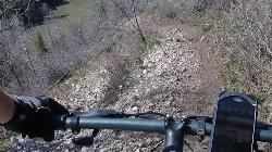
Old Ranger
Ririe, Idaho
28.6 miles SWOn the South end of the Big Hole mountains just above the Snake River is a grueling yet diverse section of single-track on Forest Service Trail 287 called Old Ranger. Because of the...
Mountain Bike
Warm River Campground
Ashton, Idaho
28.9 miles NWWarm River Campground is located nine miles northeast of Ashton, Idaho, along the slow-moving Warm River at an elevation of 5,200 feet. Willows line the riverbanks and pine trees offer partial...
Camp 3.2-47.0 mi
Yellowstone Branch Line Trail
Ashton, Idaho
28.9 miles NWYellowstone branch line trail runs from Warm River to the Montana border totaling 39 miles. There are a few places to jump on and off the trail as well as a few smaller trails that branch off of this...
Backpack, Cross-country Ski, Hike, Horseback, Mountain Bike
South Fork Snake River Trail
Ririe, Idaho
29.0 miles SWGo left at the trail head. It heads down about a mile and a half on double track. Then you'll come to a creek crossing. After the crossing the trail heads across a gate. Head left...
Mountain Bike
Crystal Creek Campground
Jackson, Wyoming
29.1 miles SECrystal Creek Campground is located along the Gros Ventre River and Crystal Creek, both designated Wild and Scenic Rivers for the spectacular surrounding scenery and excellent fishing opportunities....
Camp 5.6-8.3 mi
Palisades Creek Trail / Lakes and Waterfall Canyon
Irwin, Idaho
29.7 miles SWPalisades Creek Trail is located about 50 miles southeast of Idaho Falls and about 60 miles west of Jackson Hole WY in Swan Valley Idaho. The four mile hike up to lower Palisades Lake or the 6.2 mile...
Backpack, Camp, Hike, Horseback, Mountain Bike


