


262 Things to do near Rob's Trail
first prev 1 2 3 4 5 6 7 8 9 10 next lastShowing results within 50 miles Distance miles of 2505 Bear Hollow Dr, Park City, UT 84098, USA City, Zip, or Address
Corvair
Park City, Utah
6.5 miles SECorvair is another high-alpine Park City trail that starts near the beginning of TG and crosses and intersects with TG several times. It's narrow, steep, and rocky up high....
Mountain Bike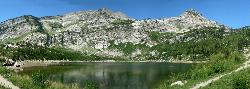
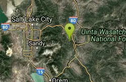
Silver Lake (Big Cottonwood)
Brighton, Utah
6.6 miles SThis hike has everything. The trail passes by three bodies of water and winds through beautiful woodland areas. Wildlife is in abundance. Everything from chipmunks to moose can be observed along...
Hike, Mountain Bike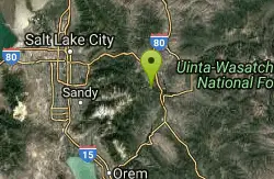
Deer Valley Resort Bike Park
Park City, Utah
6.9 miles SEThe Deer Valley area encompasses all of the trails in the Deer Valley ski resort, butting up against PCMR near Empire Lodge, and running all the way North to Jordanelle and Deer Valley...
Mountain Bike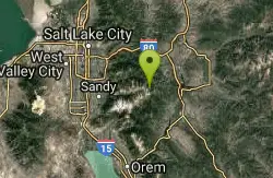
Brighton Lakes Loop
Salt Lake City, Utah
6.9 miles SThe Brighton Lakes loop is a never ending challenge, from the time you start to climb, to the wild and hair raising descent down the Lake Mary trail! The ride takes you past 4...
Mountain Bike
Payroll
Park City, Utah
6.9 miles SEPayroll is less than a mile long, but it is a rowdy .67 miles! Payroll features some massive berms, swoops, plenty of rocks, kickers, doubles, a few sizeable drops, and another scoop of...
Mountain Bike
TG
Park City, Utah
7.0 miles SETG is an advanced singletrack trail with one section of doubletrack thrown in that has some rocks, drops, and sharp switchbacks. It's located high up on the side of the mountain....
Mountain Bike
Spin Cycle
Park City, Utah
7.5 miles SEFamous Park City trail. Natural half pipe (the actual Spin Cycle portion) that is tons of fun (and makes it pretty much a one-way, downhill only trail). Don't forget to take a picture...
Mountain Bike
Mill Creek Pipeline
Salt Lake City, Utah
7.6 miles Wthere are quite a few hiking trails that connect into this trail coming up the mountain from your left you will go about 6.5 miles and then a sign post will mark the Rattlesnake down...
Mountain Bike
Mill Creek Canyon
Salt Lake City, Utah
7.6 miles WMill Creek is an out and back with over 1000 ft of elevation gain. The lower section of the ski trail gets a lot of foot traffic, but the upper section (above Elbow Fork) is generally very quiet....
Camp, Cross-country Ski, Snowshoe
Mountain Dell Golf Course
Salt Lake City, Utah
7.8 miles NWDuring the winter, the hill behind the clubhouse makes a great sledding hill which the golf course permits free of charge.
Sled
Mormon Flats
Salt Lake City, Utah
8.4 miles NWPersonal favorite, this trail has a little bit of everything that i consider Wasatch riding. Start by crossing a bridge and heading up into a historic pioneer trail that turns a hair northshore a...
Mountain Bike
Lake Blanche
Salt Lake City, Utah
9.1 miles SWLake Blanche is a fun and popular hike. Lake Blanche, Lake Florence and Lake Lillian are all located next to each other in the upper reaches of the South Fork of Mill B. The trail to Lake Blanche...
Hike
Hidden Falls
Salt Lake City, Utah
9.2 miles SWHidden Falls is a popular road side attraction for anyone cruising Big Cottonwood Canyon on a sunny afternoon. The falls are within strolling distance of the parking lot and only require about 15...
Hike
Cecret (Secret) Lake
Alta, Utah
9.2 miles SCecret (pronounced "Secret") Lake is a beautiful lake located among alpine meadows in Little Cottonwood Canyons Albion Basin. Some folks spell Secret Lake as Cecret Lake, but the USGS...
Hike
Sugarloaf Peak
Alta, Utah
9.6 miles SSugarloaf Peak is an easily reached 11,000 ft. summit which overlooks Albion Basin, Secret Lake, and much of Utah's Alta ski resort. The easy terrain and relatively high trailhead elevation...
Hike 2.6 mi
Salt Lake Valley Scenic Overlook
Salt Lake City, Utah
9.7 miles WThe Salt Lake Valley Scenic overlook starts on the Desolation trail in Millcreek Canyon near Salt Lake City, Utah and offers hikers a wide variety of destinations to stop at along the trail,...
Hike
Grandeur Peak
Salt Lake City, Utah
10.0 miles WGrandeur Peak is the most easily accessible of the major peaks that form the Salt Lake City skyline. For many valley residents Grandeur Peak was there first major summit. The peak offers great...
Hike
Pfeiferhorn Peak
Provo, Utah
10.3 miles SWThe Pfeifferhorn is a majestic peak, which is located east of Salt Lake City, Utah in the Wasatch mountain range. It's easy access, proximity to alpine lakes and short trail make it a popular...
Backpack, Hike
Storm Mountain
Salt Lake City, Utah
10.5 miles SWStorm Mountain is on of the smaller peaks included in the Wasatch Range. Storm Mountain is located in Cottonwood Canyon. Storm Mountain Day Use Area is just 3 miles up Big Cottonwood Canyon,...
Hike, Mountain Bike, Rock Climb
Rockport State Park
Peoa, Utah
10.9 miles NERockport State Park has several trails for a variety of experience levels. The park is located right next to Rockport Reservoir, near Peoa Utah. One of the easiest and longest trails in the...
Mountain Bike


