


254 Things to do near Rocky Mouth Trail/Waterfalls
first prev 1 2 3 4 5 6 7 8 9 10 next lastShowing results within 50 miles Distance miles of 11254 Eagle View Dr, Sandy, UT 84092, USA City, Zip, or Address

Hidden Valley Park trail
Sandy, Utah
0.6 miles SWHidden Valley Trail has different levels and gradual uphill fun and makes for a good adventure trail. It's a wide, shallow valley that is hidden from view; hence the name. The valley’s...
Hike, Mountain Bike 1.1-4.7 mi
Bells Canyon
Sandy, Utah
1.3 miles NBells Canyon is a moderate, 4.5 mile hike that begins in a residential area and ends at a waterfall in the enter of the canyon's forest. The first 1/2 mile of the hike is relatively...
Backpack, Hike, Mountain Bike, Snowshoe 0.2 mi
Orson Smith trail
Draper, Utah
1.9 miles SWOrson Smith Trail is located north of the Corner Canyon Gate. It leads up to the suspension bridge and has become a popular spot for hiking and bike routes since the suspension...
Hike, Mountain Bike 0.8 mi
Bear Canyon Suspension Bridge
Draper, Utah
2.3 miles SWThe Bear Canyon Suspension Bridge is a 185ft bridge that connects the Bear Canyon to the Bonneville Shoreline Trail. The bridge was built and completed in 2015 thanks to donations from residents and...
Hike, Mountain Bike
Scruffy Band Little Cottonwood Canyon
Sandy, Utah
2.4 miles NERock Climb near Sandy, Utah
Rock Climb 3.2 mi
Little Cottonwood Pipeline Trail
Sandy, Utah
2.4 miles NELocated in Sandy, UT, Little Cottonwood Pipeline trail starts at the mouth of Little Cottonwood Canyon and is a single-track trail with some rocky situations on the trail. The first portion of the...
Mountain Bike 0.5 mi

Draper City Park
Draper, Utah
3.0 miles SWDraper City Park is located in the center of the Draper Town Center and the park is near the Porter Rockwell Trail and Willow Creek Trail so visitors can walk or jog around. There are trail heads for...
Hike 0.6 mi
Bst To Equestrian Center Loop
Draper, Utah
3.6 miles SWAn intermediate trail with a length of 10 miles that's located in Draper, UT. It's a single track look trail that has an elevation of 417 ft. Start at the Equestrian Center and follow the...
Hike, Mountain Bike 1.6 mi
Corner Canyon Trail
Draper, Utah
3.6 miles SWCorner Canyon is the "Go To" riding area in South Salt Lake and for many riders it is worth the drive (or ride) from Utah County. It is a good mix of everything from beginner training...
Backpack, Hike, Mountain Bike 1.2 mi
Ghost Falls Trail
Sandy, Utah
3.7 miles SGhost Falls is located in the corner canyon riding area of Draper, Utah and one of the first mountain bike routes in the canyon. It's a family-friendly hike, named for the...
Hike, Mountain Bike, Snowshoe 0.2-1.8 mi
Lone Peak
Draper, Utah
3.7 miles SEstablished in 1978 and located southeast of Salt Lake, Lone Peak is one of the taller peaks in the Wasatch range along the Wasatch Front. It has 5 main trailheads: Jacobs Ladder via Corner Canyon...
Hike, Mountain Bike, Rock Climb 1.7 mi
Jacob's Ladder Trail
Sandy, Utah
3.7 miles SJacobs Ladder trail has an elevation trail of 5,700 ft. and the most popular trailhead out of the five trails in Lone Peak. It's located near a large area on the right side of the road...
Hike, Mountain Bike 0.7 mi
Great White Icicle
Sandy, Utah
3.7 miles NEThe Great White Icicle is located in Little Cottonwood Canyon just outside of Salt Lake City, Utah. It is a climbing area that is a frozen waterfall in the winter and a cascading waterfall...
Hike, Rock Climb
Sandy Skatepark
Sandy, Utah
3.8 miles WSkateboard near Sandy, Utah
Skateboard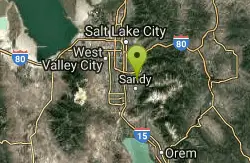
Willow Creek Park
Sandy, Utah
3.9 miles NThese are pretty short slopes for sledding. One is steeper than the other.
Sled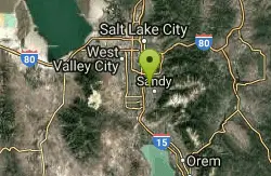
Union Skate Park
Sandy, Utah
4.0 miles NWOpen From 10 AM to 10 PM Mon-Sat. 10 Am to 6 PM Sunday. $5.00 for 3 hours
Skateboard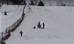
Flat Iron Mesa Park
Sandy, Utah
4.0 miles NWSled near Sandy, Utah
Sled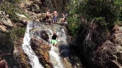
Alpine Rock Water Slide
Alpine, Utah
4.3 miles SCLOSED. The land has been sold and the new owner has closed off the waterslide to the public. The Alpine Waterslide is a natural waterslide that surprisingly does not hurt your backside. However,...
Swim
Ferguson Canyon
Cottonwood Heights, Utah
4.5 miles NFerguson canyon is small canyon between Big and Little Cottonwood Canyons. This canyon has gained popularity over the last few year and is a popular destination for rock climbers. This is one hike...
Hike, Mountain Bike, Rock Climb
Lisa Falls
Sandy, Utah
4.5 miles NELisa Falls is a great place to climb Spring through Fall, any time of day. The base is well shaded by trees and offers many flat places to belay, or just hang out and relax. The roaring waterfall...
Hike, Rock Climb


